Jan Wesner Childs
Winds and tornadoes knocked down trees, damaged buildings and left tens of thousands of homes and businesses without power across parts of the upper Midwest Wednesday night and into Thursday morning.
The weather is being blamed in the death of a man who was killed after his car crashed into a fallen tree and a power line on a highway near the town of Ripon, Wisconsin, about 22 miles southwest of Oshkosh, the Wisconsin State Journal reported, citing the state patrol.
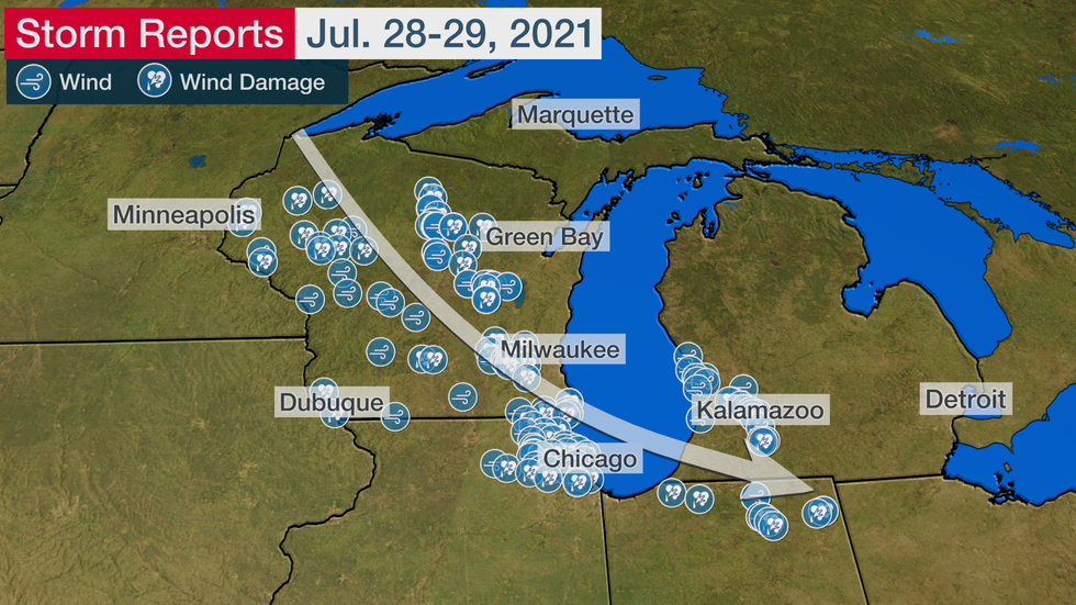
Impacts from the storms stretched from Wisconsin to northeast Illinois, southwest Michigan and northern Indiana, including the metropolitan Milwaukee and Chicago areas.
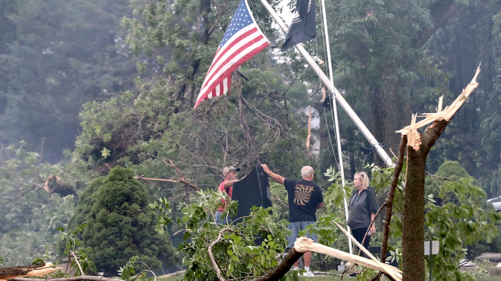
 Jefferson County residents inspect damage at Dahnert Park, Thursday, July 29, 2021 in Concord, Wis., following an overnight storm.
Wisconsin Gov. Tony Evers declared a state of emergency as damage assessments came in Thursday morning.
“Last night's storms affected communities from the Mississippi River to Lake Michigan, leaving many regions with widespread damage,” Evers said in a news release.
There were reports of multiple homes and buildings damaged near Concord, Wisconsin, in Jefferson County, about 37 miles west of Milwaukee. A preliminary report from the National Weather Service indicated that an EF1 tornado moved through the area at about 1:15 a.m.
Photos from the Milwaukee Journal-Sentinel showed several large trees snapped in half, debris littering a roadway, a tree on a vehicle and a building with its roof torn off.
Emergency management officials in Milwaukee County told weather.com there was no major damage there.
In the Chicago metro area, wind gusts topped 60 mph early Thursday and numerous trees were reportedly downed.
(MORE: Severe Thunderstorms to Rake Upper Midwest Into Early Thursday)
More than 130,000 homes and businesses were without power in Wisconsin and Illinois at 4:30 a.m. CDT Thursday, according to poweroutage.us. That number had dropped to about 65,000 by 10:30 a.m.
The National Weather Service in Chicago warned of hazardous conditions along the shores of Lake Michigan in Illinois and Indiana on Thursday.
Ahead of the storms, the threat of severe weather forced a nighttime airshow at the Experimental Aircraft Association's EAA AirVenture Oshkosh to be postponed until Thursday, and most activities at the event shut down earlier than planned on Wednesday.
The Red Cross opened a shelter for attendees, many of whom were camping onsite.
The event bills itself as the world's largest fly-in. The decision to cancel the airshow, unique because it happens after dark, was based on advice from the National Weather Service, EAA spokesman Dick Knapinski told weather.com in a phone call Wednesday evening.
Knapinski said the EAA works closely with both the NWS and NOAA.
“There are 1,000 contingency plans that go into an event like this and weather is certainly one of them," he said.
“Fortunately, pilots are probably some of the most weather-aware people out there, short of meteorologists. Everyone is very attuned to the weather, which is fortunate. It’s very easy to get the word out.”
Kapinski estimated attendance Wednesday afternoon at roughly 50,000 people.
Among the aircraft on-site were some 1,400 vintage airplanes.
Knapinski said pilots were checking their aircraft tie-downs ahead of the storms, while others had left. The airport planned to be open from 5 p.m. to 8 p.m., or as long as weather conditions allowed, so that anyone else who wanted to fly out could do so.
A screenshot from Flightradar 24 showed what it said were hundreds of planes leaving the event at about 3:30 p.m. EDT. Another screenshot showed a similar scene on radar at about 7 p.m.
Earlier in the day, Michigan State Police advised residents to double-check their storm supplies, especially since severe weather had already hit some parts of the state in recent days.
"I know we are all tired of the rain and storms. However, we need to be ready for the possibility that we will get it again tonight into tomorrow morning," the agency said in a tweet. "Make sure you have restocked your emergency kits from the last few storms. Secure the outside furniture, trash cans and toys."
The area of wind damage reports from this cluster of storms is more than 250 miles long, which should satisfy the criteria for a low-end derecho event, according to a 2005 study.
Last August, one extreme derecho raced 770 miles in 14 hours from South Dakota to Ohio, producing wind gusts over 100 mph in large swaths of central and eastern Iowa and spawning tornadoes in the Chicago area. Homes and businesses were damaged and millions of acres of corn and soybean fields were flattened in what was estimated by NOAA as an $11.5 billion disaster.

The Weather Company’s primary journalistic mission is to report on breaking weather news, the environment and the importance of science to our lives. This story does not necessarily represent the position of our parent company, IBM.
The Weather Company’s primary journalistic mission is to report on breaking weather news, the environment and the importance of science to our lives. This story does not necessarily represent the position of our parent company, IBM.

No comments:
Post a Comment