Jonathan Erdman
 Number of progressive derecho events from May through August 1996-2013 passing through a 100 kilometer by 100 kilometer grid box.
Widespread, destructive convective windstorms, known as derechos, have a very pronounced summer corridor, according to a recent study.
A swath from the Upper Mississippi Valley through the Ohio Valley is most susceptible to these summer complexes of thunderstorms, which can produce large swaths of straight-line winds that cause downed trees, power outages and structural damage.
(MORE: What is a Derecho?)
"Northeastern Illinois is ground zero for warm-season progressive derechos," said Dr. Lance Bosart from the University at Albany/SUNY, a co-author of the April 2016 study with Corey Guastini of the National Weather Service Environmental Modeling Center.
Guastini and Bosart examined 18 years of progressive derechos, a total of 256 events, May through August from 1996 to 2013.
 The Weather Channel meteorologist Mike Seidel stands next to the roots of a large tree downed from a derecho on June 29, 2012 in the northwest District of Columbia.
Progressive derechos are those thunderstorm clusters typically forced in the warmer months of the year not by a strong cold front, per se, but rather near a stationary or warm front separating hot, humid air to the south from less hot, still humid air to the north.
These clusters ingest dry air, helping to produce a collection of damaging downburst winds which race forward over a large area.
Parts of Minnesota, Wisconsin, Iowa, Illinois, Indiana, southern Michigan, Ohio, Kentucky and the Appalachians averaged one to two progressive derechos each May-August over that 18-year period, consistent with three prior studies.
A somewhat lower-frequency was analyzed in Kansas and Oklahoma, though Guastini and Bosart caution this may be due more to the particular period of study rather than suggesting the threat in those areas isn't still significant.
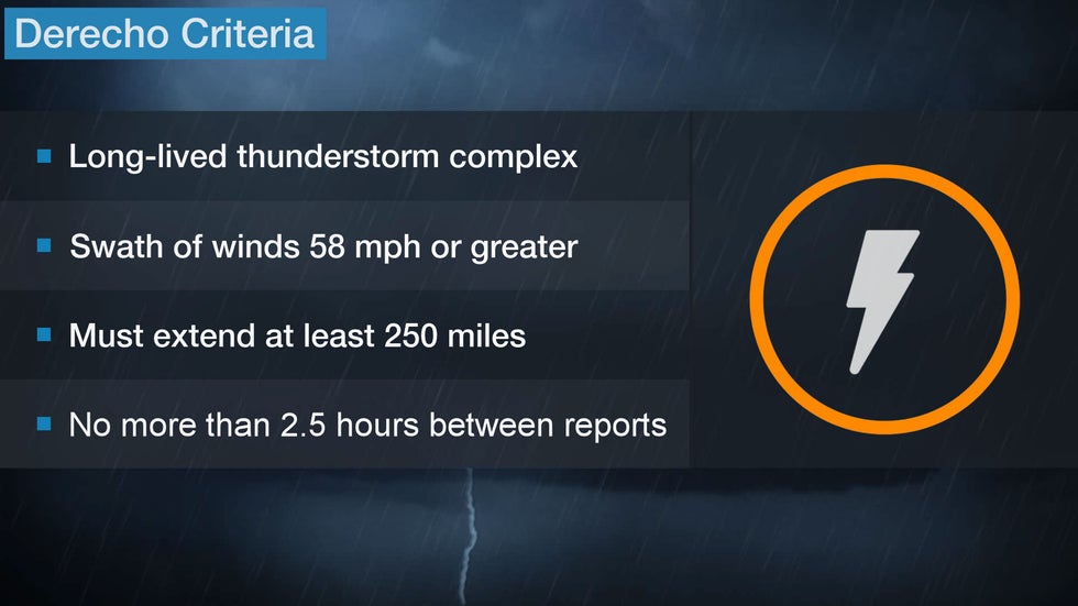
We've written about derechos before. For a thunderstorm cluster to be dubbed a derecho, it must meet the following criteria:

(Footnote: A June 2016 paper proposed to change the criteria to split off warm-season, progressive events from squall lines associated with cold fronts in other times of the year.)
Progressive derechos are not frequent, but when they occur, they can be very damaging.
When wind gusts exceed 75 mph, numerous trees may be downed, often toppling on power lines and cutting power to hundreds of thousands, often in the heart of a sweltering summer.
(MORE: Why You Shouldn't Ignore Severe T-Storm Warnings)
Since this can happen at night, victims may claim their home was hit by a tornado, which can sometimes occur at the leading edge of the derecho.
One such derecho traveled roughly 800 miles from near Chicago to the Mid-Atlantic seaboard on June 29, 2012, with an average forward speed of 65 mph.
Above: Satellite history of the June 29, 2012 Midwest-East derecho (Credit: NASA). Radar history compiled by digital meteorologist Ari Sarsalari.
Over 4 million customers were without power and over 600 reports of high winds or wind damage were attributed to this derecho.
The Weather Company’s primary journalistic mission is to report on breaking weather news, the environment and the importance of science to our lives. This story does not necessarily represent the position of our parent company, IBM.
The Weather Company’s primary journalistic mission is to report on breaking weather news, the environment and the importance of science to our lives. This story does not necessarily represent the position of our parent company, IBM.

No comments:
Post a Comment