Published: July 30, 2021
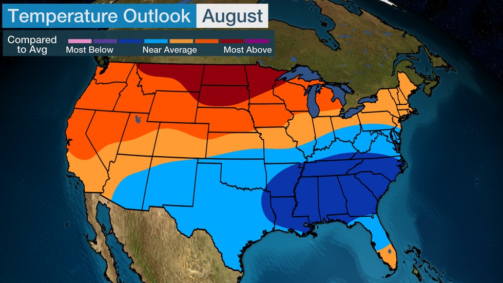
August's forecast temperature pattern is one that has become familiar for the United States since summer began, with a split between hotter-than-average conditions in parts of the western and northern U.S., and the South escaping the worst of the searing heat.
Hotter-than-average temperatures are most likely to encompass an area from the Northwest to the upper Midwest in August, according to the latest outlook from The Weather Company, an IBM Business. Portions of the Northern Plains could have the hottest temperatures when compared to August's average.
Save up to $100 on the Dyson Pure Cool Link Fan (SPONSORED)
Areas from the lower Mississippi Valley into the Southeast might have below-average temperatures overall in the new month. But since it's still summer, the South's typical humidity will still make temperatures feel uncomfortable at times.

This general weather pattern expected in August is similar to what the U.S. has experienced since summer began in June.
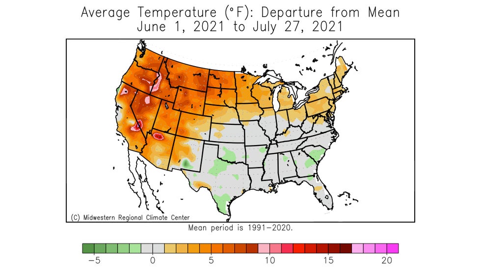
You can see this summer's topsy-turvy temperature pattern in the analysis below from the Midwest Regional Climate Center. Orange areas had above-average temperatures June 1 through July 27, while much of the South was near average or slightly cooler, as depicted in gray or green shadings, respectively.
 Orange shaded areas had warmer than average temperatures June 1-July 27, 2021. Locations shaded gray were near average and green depicts slightly below-average temperatures.
"This 'warm-over-cool' pattern is typical in summers with strong tropospheric polar vortex (TPV)," said Todd Crawford, Director of Meteorology at Atmospheric G2.
Essentially, areas surrounding the North Pole have seen a weather pattern where troughing in the middle portions of the atmosphere has dominated, which is having an impact on the weather experienced in the lower latitudes and results in the warm-over-cool pattern.
The strong TPV is expected to weaken to some extent soon, but the temperature pattern seen this summer is forecast to continue for now.
Another reason for the South's cooler-than-average forecast is due to the expectation that the month will begin with a southward plunge of the jet stream in the East. That will push away the intense heat dominating the region as July ends.
One wild card that could also impact the outcome of the expected temperature pattern during August is hurricane season. Tropical storms or hurricanes in the Atlantic can have an impact on the overall weather pattern where we live in the mid-latitudes, but it's too early to know if that will play out later in August.
Typical August Temperatures
Afternoon temperatures in the 80s and 90s are common across a large portion of the Lower 48 in August. The Desert Southwest remains the hot spot, with highs above the century mark. The northern tier cools into the 70s as cold fronts begin to pass through the borderlands again.
Average daily high temperatures in many cities also begin to trend downward in August. For example, the average high from the start of the month to the end drops from 85 degrees to 81 in New York City, and from 83 to 78 in Minneapolis.

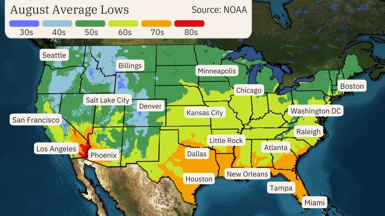
Overnight temperatures begin to drop as well. Slightly lower humidity allows lows to drop in much of the East into the 50s and 60s, while the Gulf Coast remains in the 70s with humidity still hanging tight.
Overnight temperatures remain in the 70s and even the 80s in the Desert Southwest.
The coolest air is typically found in the Pacific Northwest and northern Rockies, where temperatures drop off into the 40s and 50s.

The Weather Company’s primary journalistic mission is to report on breaking weather news, the environment and the importance of science to our lives. This story does not necessarily represent the position of our parent company, IBM.
The Weather Company’s primary journalistic mission is to report on breaking weather news, the environment and the importance of science to our lives. This story does not necessarily represent the position of our parent company, IBM.

No comments:
Post a Comment