Linda Lam
Eta will move forward with determination this weekend, but next week, it is expected to slow down and meander in the Gulf of Mexico due to a change in steering influences.
In the short term, Eta is expected to track toward Cuba, the Bahamas and Florida, likely as a tropical storm, this weekend into early next week.
This northeastward forward motion will increase and is due to a mid- to upper-level trough developing over the Gulf of Mexico.
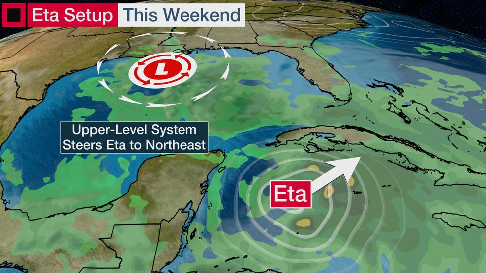 Eta will track northeastward for the first half of the weekend due to the influence of an upper-level trough over the Gulf of Mexico.
The trough is expected to become a closed low near the northern Gulf Coast, and Eta will interact with this low. A turn toward the west-northwest is anticipated due to this interaction, as well as the influence of high pressure over the western Atlantic.
During this time, it's also possible that Eta could take on at least some subtropical cyclone characteristics. In this case, Eta may become more lopsided with an expanded wind field.
(MORE: What Is a Subtropical Storm?)
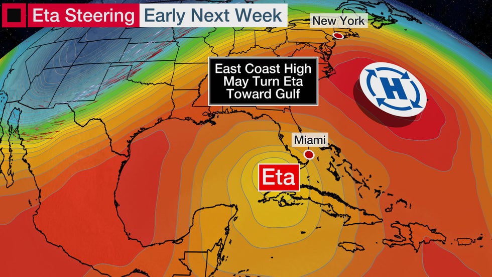 Eta will track northwestward into early next week.
At that point, the track of Eta will become more uncertain due to a change and lack of steering influences.
An amplified weather pattern will dominate the Lower 48 next week. Specifically, a northward bulge of the jet stream, or a ridge of high pressure, will be in place over the East and a southward dip of the jet stream, or trough, will be over the West.
The area of high pressure in the East will block Eta from escaping eastward and away from the U.S.; Rather, it will allow the storm to meander and linger in the Gulf of Mexico or near Florida.
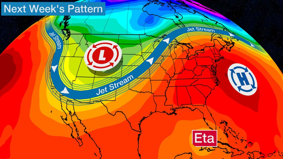 The pattern next week will feature a ridge of high pressure over the East.
This means Eta will likely move slowly and remain over the Gulf of Mexico through most of next week.
Eventually, a trough in the West will slowly push eastward and pull Eta northeastward, allowing the storm to finally make landfall along the U.S. Gulf Coast, likely late next week. How strong Eta will be at that time remains unclear.
This is a complicated setup and the details on where the turns take place will determine where the worst impacts will be, so check back frequently for updates in the days ahead.
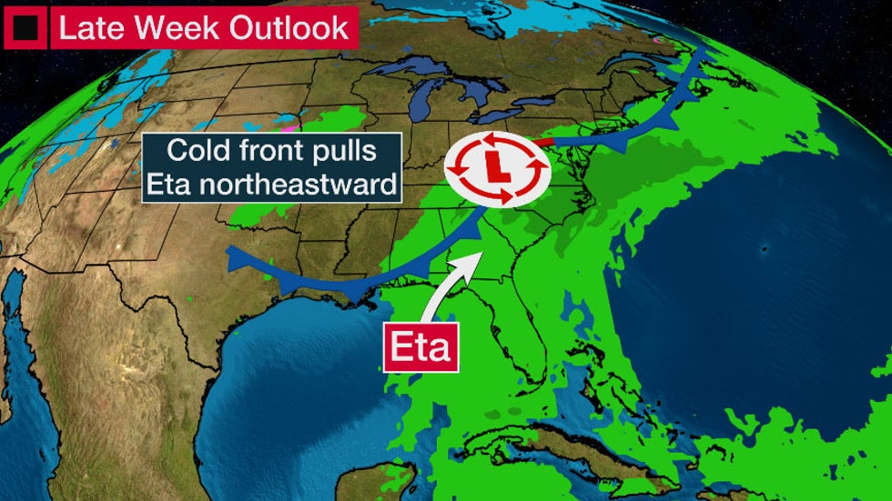 Eta may not exit the stage until late next week.
The Weather Company’s primary journalistic mission is to report on breaking weather news, the environment and the importance of science to our lives. This story does not necessarily represent the position of our parent company, IBM.
The Weather Company’s primary journalistic mission is to report on breaking weather news, the environment and the importance of science to our lives. This story does not necessarily represent the position of our parent company, IBM.


No comments:
Post a Comment