Jonathan Erdman
The twisty, curvy forecast path of Eta over the next several days is a reminder that hurricane paths often aren't relatively straight lines.
Some tropical cyclones follow very clear tracks – for example, a curve around the south and west sides of the Bermuda-Azores high in the Atlantic Basin, or just a straight buzzsaw through the Caribbean Sea.
In these cases, the atmosphere's steering flow is strong and persistent enough to keep the hurricane on a steady path. Those forecast tracks are relatively straightforward.
Some hurricanes and tropical storms, however, take stranger journeys.
The paths these storms trace out may resemble a child's first drawing, proudly displayed on the refrigerator.
These tended to fall into several categories. We have many examples of each in our slideshow atop this article.
Loopers
These tropical storms and hurricanes made at least one loop, crossing their previous path once or more. A few performed multiple loops, with paths resembling a helix.
Often in a looper case, a weak disturbance in the jet stream will brush to the north of the hurricane or tropical storm, pulling it northeast or east, but won't be strong enough to carry it away.
Behind that, higher pressure aloft will then curve the system back toward the south. Once that same high-pressure system aloft moves to the east, the hurricane or tropical storm will curl back toward the west, then northwest again.
In this way, you can get a loop, as occurred with Jeanne in 2004 before its eventual Florida landfall.
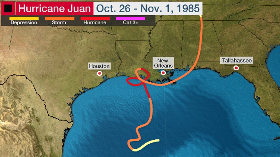
Hurricane Juan in 1985 did even better, looping twice near the Louisiana coast. Of course, that slow movement near land led to massive, widespread flooding in Louisiana, Mississippi, Alabama and Florida.
 Hurricane Juan did a double loop near or over the Louisiana coast in 1985.
Double-Backers
These reversed course and followed a similar segment of their path.
Double-backers occur when the steering flow in the upper atmosphere reverses from what it was previously.
Sometimes these tropical cyclones can weaken a bit if they track over a wake of cooler water churned up on their previous leg.
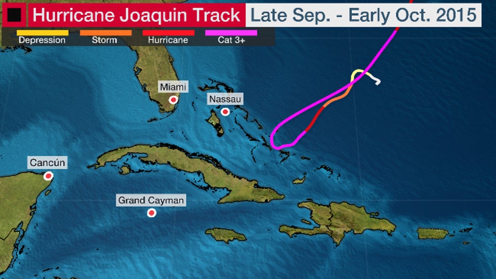
The best recent example of a double-backer was Hurricane Joaquin in 2015, which moved southwestward and then stalled and hammered the central Bahamas at peak intensity before moving northeast almost exactly on its previous path.
 The portion of Hurricane Joaquin's track where it virtually doubled back over its previous track after hammering the central Bahamas.
Scribblers
These take paths so chaotic that, again, a toddler might be the only one to draw it successfully.
The scribblers are the strangest of the bunch. These tend to occur when steering winds aloft are persistently erratic and weak.
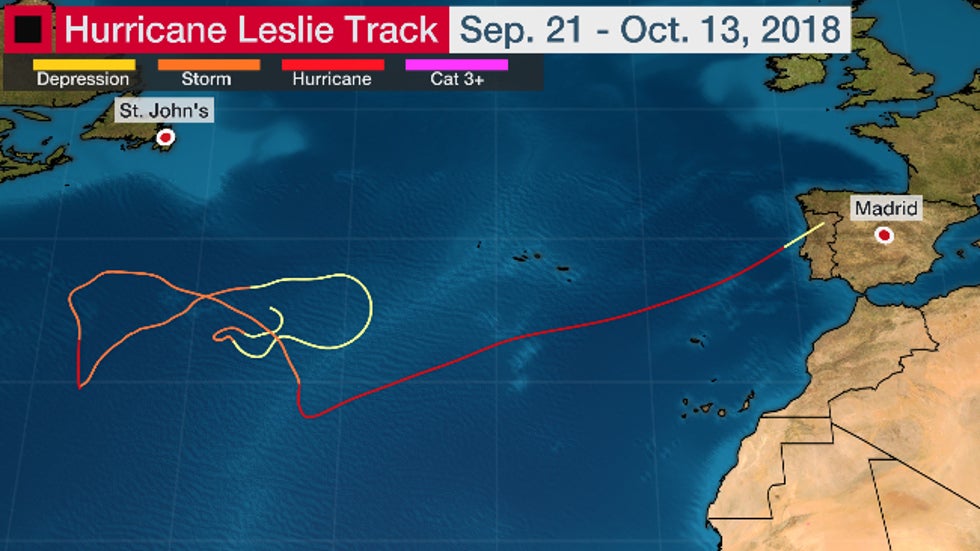
Perhaps the best recent example of this was Hurricane Leslie in 2018. Leslie meandered over the North Atlantic Ocean for more than two weeks before finally approaching the Iberian Peninsula, where it held on to hurricane strength until it was within 195 miles of Lisbon, Portugal.
 The bizarre track of Hurricane Leslie in 2018, including a rough bowtie, and nearly landfalling in Portugal as a hurricane.
No hurricane in the historical record had ever been observed in the eastern Atlantic Basin where Leslie was located west of Portugal. Leslie did not strike Portugal as a hurricane but did spread heavy rain and strong winds through the country as a post-tropical cyclone.
See if you can follow Leslie initially near the center of this satellite loop posted at the time by The Weather Channel senior meteorologist Stu Ostro.
Most importantly, these strange wanderers can be a big forecast challenge. Subtle changes in steering winds aloft can mean the difference between a hurricane drifting west toward land or drifting northeast, remaining out to sea.
The Weather Company’s primary journalistic mission is to report on breaking weather news, the environment and the importance of science to our lives. This story does not necessarily represent the position of our parent company, IBM.
The Weather Company’s primary journalistic mission is to report on breaking weather news, the environment and the importance of science to our lives. This story does not necessarily represent the position of our parent company, IBM.

No comments:
Post a Comment