Jonathan Erdman
Hurricane Ian made U.S. landfalls in similar locations in southwest Florida and South Carolina as Hurricane Charley in 2004, but despite the coincidence, these two storms had some key differences.
Ian's eye first came ashore on Sept. 28 near Cayo Costa, Florida, a barrier island about 23 miles west-northwest of downtown Fort Myers.
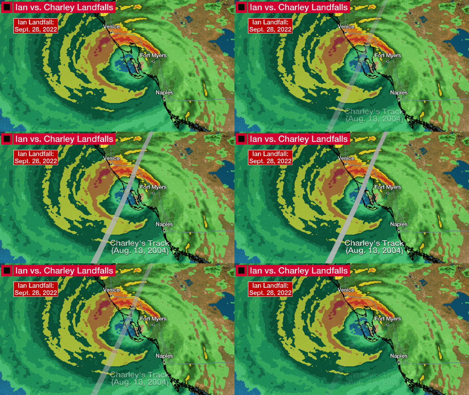
This was the exact same location of Hurricane Charley's landfall on Aug. 13, 2004.
 Radar image of Hurricane Ian when it made landfall at 3:05 p.m. EDT on Sept. 28, 2022. The gray track is that of the center of Hurricane Charley on Aug. 13, 2004.
If that wasn't weird enough, Ian's wind speed matched that of Charley's first landfall, and its central pressure was almost an exact match.
And Ian made landfall at roughly the same time of day (3:05 p.m. EDT) as Charley (3:45 p.m. EDT), according to the National Hurricane Center's final report on Charley.
Charley swept into Port Charlotte and Punta Gorda after taking a similar path as Ian from western Cuba into the southeast Gulf of Mexico and intensifying.
Charley then tore across the Peninsula with damaging winds before sweeping into South Carolina with its final landfall.
Charley caused $24.6 billion damage (adjusted to 2022 dollars). At the time it was the nation's second costliest hurricane behind only Andrew.
Two days later, Ian made its final landfall on Sept. 30 near Georgetown, South Carolina, as a Category 1 hurricane. That's only 25 miles from where Charley made its second U.S. landfall, near Cape Romain, on Aug. 14, 2004, also at Category 1 intensity. Charley would then make its final U.S. landfall at North Myrtle Beach a couple hours later after briefly hopping offshore.
All that said, Ian was a much different storm than Charley.
1. Ian Was Larger
Charley was a small hurricane, meaning the extent of its strong winds didn't cover much real estate initially at landfall. (We'll come back to the rest of Charley's wind damage swath later.)
Despite its southwest Florida landfall, peak wind gusts in the Tampa-St. Petersburg metro area were only on the order of 25 to 35 mph, according to NHC's final report.
That small size was one factor that limited the extent and height of Charley's storm surge, which, while still dangerous, remained at 7 feet or less in a small part of southwest Florida's coast.
Ian, however, was a more average-sized hurricane. That means both its hurricane and tropical-storm force winds were more widespread. Peak wind gusts in the Tampa-St. Pete metro were up to 77 mph.
This larger wind field also likely produced much higher storm surge in parts of the southwest Florida coast near and to the south and east of its landfall.
For example, surge inundation along the river in downtown Ft. Myers obliterated the previous high water record and was more than double the peak surge from Charley.
As NHC senior hurricane specialist Eric Blake alluded to Wednesday morning, "No one alive has seen 12 feet of storm surge in that area."
 Comparison of the maximum diameter of tropical storm-force winds between Charley and Ian each around the time of landfall.
2. Ian Moved Slower
Charley moved at a forward speed of 20 to 25 mph, unusually fast for a hurricane in Florida in mid-August. The center tore across the Peninsula like a buzzsaw in less than 9 hours, maintaining its hurricane status the entire way.
Its combination of small size and fast movement left a damage swath across the state more reminiscent of an oversized tornado track, rather than a hurricane.
Ian moved less than half that fast - only 8 to 9 mph - across the Florida Peninsula.
That meant Ian's impacts were more prolonged compared to the quick blast from Charley.
Hurricane and tropical storm-force winds lasted longer in the Peninsula during Ian and peak rainfall totals in Florida were more than double (up to 21 inches) those from Charley due to Ian's slower movement.
Flash flooding was more widespread, even record-breaking in spots, and river flooding was expected to linger much longer than after Charley.
(MORE: The Most Jarring Things Meteorologists Saw During Ian)
So while comparisons to Charley are inevitable with Ian, each and every hurricane is different.
Unfortunately, Ian was also a devastating hurricane in its own way, as Charley was.
The Weather Company’s primary journalistic mission is to report on breaking weather news, the environment and the importance of science to our lives. This story does not necessarily represent the position of our parent company, IBM.
The Weather Company’s primary journalistic mission is to report on breaking weather news, the environment and the importance of science to our lives. This story does not necessarily represent the position of our parent company, IBM.

No comments:
Post a Comment