The first full week of summer won't start as hot as you'd expect in the nation's midsection as a new pattern emerges across the Lower 48.
Here are a few things we're watching in the week ahead.
A New Storm Track
The jet stream will plunge southward over the Northern Plains and Great Lakes in contrast to dry, high pressure, which parked over this region recently.
Early in the week, thunderstorms will bubble up ahead of a cold front from the Plains to the Great Lakes and Ohio Valley.
By the middle of the week, that front should reach the East Coast but will stall in roughly east-west fashion from parts of the South westward into the Plains.
Near and ahead of that front is where thunderstorms will be most numerous. Occasionally stormy weather can be expected, with bouts of heavier rainfall and localized flooding, as is typical in the summer months.
However, showers and a few thundershowers may still persist in parts of the Great Lakes and Midwest behind that front.
Another frontal system later in the week will bring more thunderstorms to the Plains and Midwest.
 Pattern for the First Week of Summer
Heat in the East
While not as hot as the record-smashing heat we witnessed Friday, parts of the East will remain hotter than average early this week.
More 90-degree heat is expected in parts of central and upstate New York and New England through at least Tuesday.
While some heat relief is possible beyond Tuesday, temperatures should remain generally warmer than average for late June through the rest of this week from New England southward to the New York City tri-state, Philadelphia, Baltimore and Washington, D.C.
(MORE: The Weather Company's Summer Outlook)
 Early-Week High Temperatures
Less Hot in the Plains
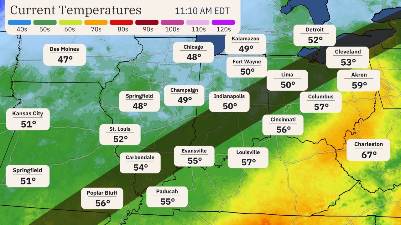
One part of the country that's been persistently hot so far this month will get a breather in the first full week of summer.
A cold front will slide down the Plains early this week and could make it as far south as Oklahoma and Arkansas. Even areas farther south than that should see temperatures dip a bit – if not from the cold front, then from an increased chance of thunderstorms.
Daily highs behind the front could hold in the 70s in parts of the Northern Plains and Great Lakes, and 80s from the Central and Southern Plains into the Ohio Valley. A few locations near the Canadian border and northern Great Lakes may not see highs rise out of the 60s.
The cooler air won't last long in most areas before temperatures climb to more familiar summertime levels later in the week ahead of the next frontal system.
 Midweek High Temperatures
Warm and Dry in the West
A ridge of high pressure will reassert control over much of the West this week.
This will keep most of the West rain-free, with the exception of some thunderstorms in the northern Rockies later in the week.
(MORE: Monsoon Season Won't Bring Relief Until Later This Summer)
Temperatures will soar over the century mark in California's Central Valley, and into the 80s or lower 90s at times as far north as Oregon's Willamette Valley, including Portland, Salem and Eugene.
Excessive heat watches and heat advisories have been posted by the National Weather Service for much of California's Central Valley and into southwestern Oregon due to the expected prolonged period of very hot and dangerous temperatures.
 Early-Week High Temperatures
"June Gloom" has shown up along portions of coastal Southern California, including Los Angeles, where temperatures will be 5 to 10 degrees below average due to the marine layer.
Some relief from the heat may come late in the week as a weak trough of low pressure could relax the heat by a few degrees in California.
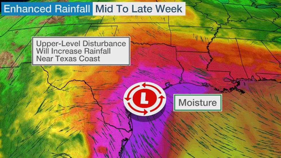
Late-Week Moisture Surge
An upper-level area of low pressure will develop near the Texas coast mid- to late week.
In addition, a persistent southeasterly flow of moisture from the Gulf of Mexico will stream northward toward the Texas coast.
This should enhance rainfall in parts of southern, central or eastern Texas later this week, though exactly where and when the heaviest rain may fall remains uncertain at this time.
The Weather Company’s primary journalistic mission is to report on breaking weather news, the environment and the importance of science to our lives. This story does not necessarily represent the position of our parent company, IBM.
The Weather Company’s primary journalistic mission is to report on breaking weather news, the environment and the importance of science to our lives. This story does not necessarily represent the position of our parent company, IBM.


No comments:
Post a Comment