Temperatures and humidity have risen this week in the Great Lakes and Northeast while excessive heat builds in parts of the West, serving as a reminder that summer is just around the corner.
The jet stream pattern has shifted, with a northward bulge developing over both the East and the West. In addition, an upper-level low will be cut off from the jet stream and linger over the Southern Plains, bringing days of rain and keeping temperatures relatively cool there.
Two upper-level areas of high pressure will be in place over portions of the East and West for the last week of May. This setup often correlates with warmer temperatures, which will be the case this week.

(MORE: Why Weather Moves Slower In The Late Spring, Summer)
Below, we take a closer look at what to expect, first in the Great Lakes and Northeast, followed by the West.
Hot and Humid in the Great Lakes, Northeast
Hot temperatures have developed in parts of the Great Lakes and interior Northeast due to a southerly wind flow. Dew points have risen into the 60s for most areas, making it feel humid as well.
Temperatures were 10 to 25 degrees above average on Memorial Day and Tuesday in much of the Midwest and interior Northeast, and the anomalous warmth is now spreading throughout the Northeast.
Buffalo, Rochester, Syracuse and Albany, New York, all recorded their first 90-degree day of the year on Tuesday.
Highs well above average will persist into late week, with most areas climbing well into the 80s, even in northern New England.
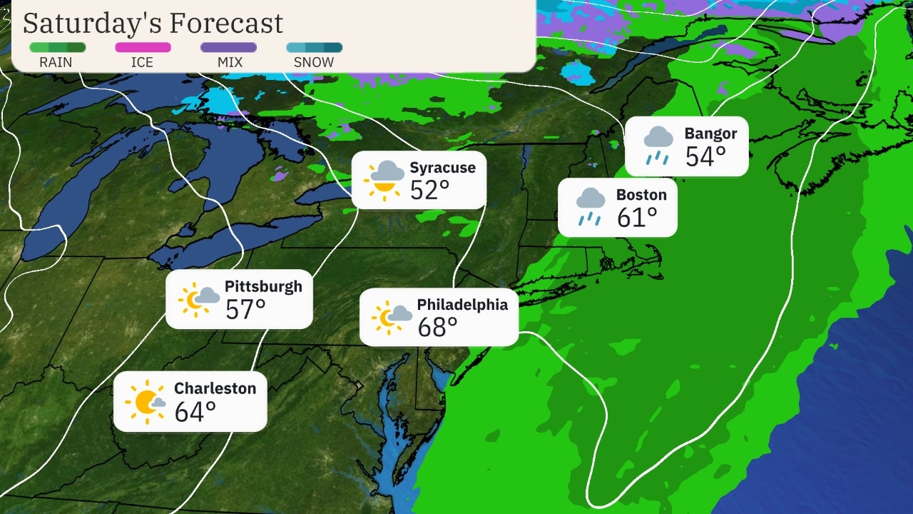
The warmer-than-average temperatures will be wiped away by a cold front later this week into the weekend. Highs will retreat to levels that are several degrees below average in the Great Lakes and Northeast on Saturday and Sunday, with many areas only rising into the 60s during the afternoon hours.
 Forecast Highs Compared to Average
Heat Builds in the West
Above-average temperatures have already begun to develop in California and southern Oregon, and the heat will spread across much of the West by midweek.
Temperatures will be 10 to 25 degrees above average in the West into late week.
Highs will soar into the triple digits from the Desert Southwest into Central California, including Sacramento.
 Forecast Highs
Daily record highs are likely, especially in California.
Sacramento; Fresno, California; and Reno, Nevada, could all set new daily records midweek.
 Potential Record Highs Wednesday
The heat will be widespread and may reach dangerous levels.
The National Weather Service office in Sacramento noted that the first significant heat wave of the season is expected, and highs over 100 degrees are possible in the area into late week.
Very hot temperatures, even by local standards, are expected for a prolonged period, with limited relief overnight. This can lead to heat-related illnesses.
Excessive heat warnings and heat advisories have been posted by the NWS for parts of the Southwest and California, including Phoenix, Las Vegas and San Francisco.
Avoid exercise outdoors, seek air-conditioned buildings, drink extra water and wear lightweight and light-colored clothing when excessive heat is anticipated. Never leave kids or pets unattended in cars.
For California, Oregon and Washington, cooler temperatures will arrive by this weekend as a southward plunge of the jet stream develops near the West Coast.
 Heat Alerts
The Weather Company’s primary journalistic mission is to report on breaking weather news, the environment and the importance of science to our lives. This story does not necessarily represent the position of our parent company, IBM.
The Weather Company’s primary journalistic mission is to report on breaking weather news, the environment and the importance of science to our lives. This story does not necessarily represent the position of our parent company, IBM

No comments:
Post a Comment