Linda Lam
Published: April 25, 2020
Thunderstorms, a few of which may be severe, will track across the South to start the weekend and another system will bring more rain and storms to the Midwest and South next week.
A disturbance will move across the South and will push off the Southeast coast by early Sunday with drier conditions developing. The break from active weather will not last long as another low pressure system will bring the chance for storms beginning early next week.
Below we take a closer look at what to expect into next week.
Late Week Disturbance
Severe thunderstorms from the first disturbance developed Friday evening from parts of the eastern Southern Plains into Arkansas, northwestern Louisiana and Missouri. Baseball size hail was reported near Red Chute, Louisiana.
This system will spread the chance for showers and thunderstorms eastward into parts of the Southeast on Saturday.
Scattered strong to severe thunderstorm are expected to develop from central Tennessee, southeastern Kentucky, northeastern Alabama into the Carolinas, as well as in parts of the southern Florida Peninsula on Saturday. Large hail, damaging winds and a tornado or two are possible with severe storms that form.
 Saturday - Saturday Night Severe Thunderstorm Forecast
Next Week
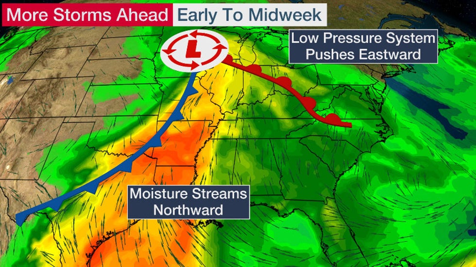
Early next week, another system will push into the central U.S. where it will become better organized. Moisture will stream northward from the Gulf of Mexico, which can help to fuel thunderstorms and increase rainfall.
 Early Week Setup
Rain and thunderstorms will develop in parts of the Plains and Midwest by Monday night.
The chance for showers and storms will slowly slide eastward Tuesday, stretching from the upper-Mississippi Valley to eastern Texas.
Strong to severe thunderstorms may develop and the greatest threat will likely stretch from parts of Missouri into eastern Oklahoma, northeastern Texas, Arkansas and northern Louisiana.
 Tuesday's Forecast
The low pressure system will track eastward Wednesday. Rain will continue in parts of the Midwest while showers and thunderstorms move across parts of the South. Another round of chilly rain will also move into the Northeast.
Showers and thunderstorms may linger into Thursday in parts of the Southeast, mainly toward the coast and in Florida. A few strong thunderstorms are possible.
 Wednesday's Forecast
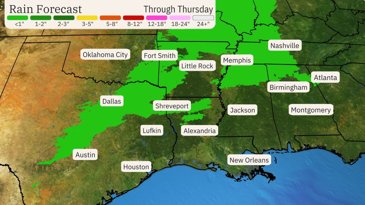
This system will have plenty of moisture which will enhance precipitation from the Mississippi Valley and Midwest into portions of the East Tuesday through Thursday.
Locally heavy rainfall is anticipated and the soil moisture remains above average, meaning the ground is saturated, especially from eastern Oklahoma into Georgia and parts of the Carolinas. This could result in flash flooding in parts of the region.
At least minor flooding continues for many river gauges along the Mississippi River, as well as in the South, and additional rainfall will add to river flooding concerns.
Some areas near the Gulf Coast are experiencing drought conditions and could benefit from some rain, but the heaviest rainfall through midweek will likely be farther north toward the Midwest.
 Rainfall Outlook
The Weather Company’s primary journalistic mission is to report on breaking weather news, the environment and the importance of science to our lives. This story does not necessarily represent the position of our parent company, IBM.
The Weather Company’s primary journalistic mission is to report on breaking weather news, the environment and the importance of science to our lives. This story does not necessarily represent the position of our parent company, IBM.

No comments:
Post a Comment