For the second weekend in a row, severe thunderstorms are bringing the risk of damaging winds and tornadoes to parts of the southern United States.
“The storms will be capable of bringing everything from frequent lightning strikes and brief strong wind gusts to flash flooding, large hail and even a tornado," AccuWeather Storm Warning Meteorologist Ali Davis said.
Into Saturday evening, severe thunderstorms are likely to extend from northeastern Texas to Kentucky.
The same system responsible for the severe thunderstorms will also unleash a blizzard across the north-central U.S.
Download the free AccuWeather app to be alerted when severe weather approaches.
RELATED:
The difference between tornado watches and warnings
Severe weather outbreak may spawn a couple of 'strong' tornadoes this weekend
'We saw things that you wouldn't believe:' President Trump and First Lady survey tornado damage in Alabama
The difference between tornado watches and warnings
Severe weather outbreak may spawn a couple of 'strong' tornadoes this weekend
'We saw things that you wouldn't believe:' President Trump and First Lady survey tornado damage in Alabama
7 p.m. CST Saturday:
A confirmed EF1 tornado was reported in the far southeast area of Pulaski County and into Lonoke County, Arkansas. The tornado was on the ground for about 6.4 miles and was 150 yards wide, according to preliminary results from the NWS.
5:30 p.m. CST Saturday:
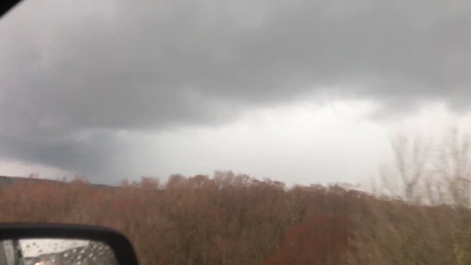
The strongest storms continue over northern Monroe and southern Itawamba counties moving rapidly into Alabama.
There is a severe storm northeast of Luka, Mississippi, which is shown below.
4 p.m. CST Saturday:
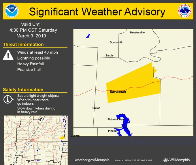
A Significant Weather Advisory was issued until 4:30 p.m. CST for central Hardin County in western Tennessee.
Watches and warnings are still ongoing through parts of the south-central United States. It is important to have weather notifications turned on in case of an emergency.
3 p.m. CST Saturday:
Two funnel clouds touched down in parts of Arkansas and Louisiana.
One twister hit Prairie Country, Arkansas, damaging a few homes in nearby Keo, Arkansas, while another struck Hosston, Louisiana.
According to a NWS report, two injuries are reported as well as a flipped house in Estes, Arkansas.
In Conway, Arkansas, the NWS reports three cars were crushed by a falling tree.
2:20 p.m. CST Saturday:
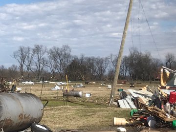
The Pulaski, Arkansas, Sheriff shared storm damage from Scott of damaged structures and downed trees.
1:45 p.m. CST Saturday:
There is a rotating storm along tracking toward the Corinth, Mississippi, area.
1 p.m. CST Saturday:
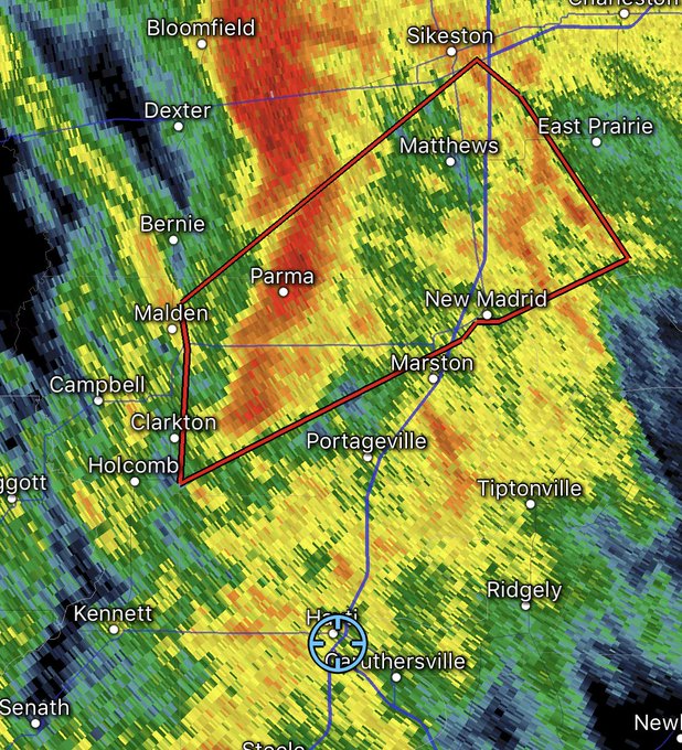
The National Weather Service (NWS) is reporting a rotation is east of Malden, Missouri, and very close to Parma and Risco, Missouri.
12 p.m. CST Saturday:
There is video confirmation of a tornado on the ground near Slovak, Arkansas.
Tornado-warned thunderstorms produced wind damage in Haynesville, Louisiana. Large trees were knocked down, according to law enforcement.
There are also reports of tornado damage west of Keo, Arkansas.
11 a.m. CST Saturday:
There have been several tornado warnings issued thus far for radar-indicated rotation in portions of Arkansas and northeastern Texas. Storms continue to strengthen from northeastern Texas to southern Indiana, central Kentucky and central Illinois.
10:35 a.m. CST Saturday:
A likely tornado was reported just north of Keo, Arkansas, and east of Little Rock heading toward Carlisle, Arkansas, as of 10:36 a.m. CST.
10:45 a.m. CST Saturday:
Hail about 1.5 inch in diameter was reported near Brownsboro, Texas, as of 9:46 a.m. CST. Hail larger than a quarter was spotted in Olive Branch, Mississippi.
10 a.m. CST Saturday:
The first tornado warning of the severe outbreak was issued for Little Rock, North Little Rock and Sherwood, Arkansas, until 10:30 a.m. CST.
7 a.m. CST Saturday:
There have been multiple reports of wind gusts between 55 and 60 mph in western Arkansas by emergency managers, law enforcement and official reporting stations.
Strong thunderstorm winds downed trees and tree limbs in Subiaco, Lamar and Knoxville, Arkansas.
Thunderstorm winds damaged a home in Mesquite, Texas.
4 a.m. CST Saturday:
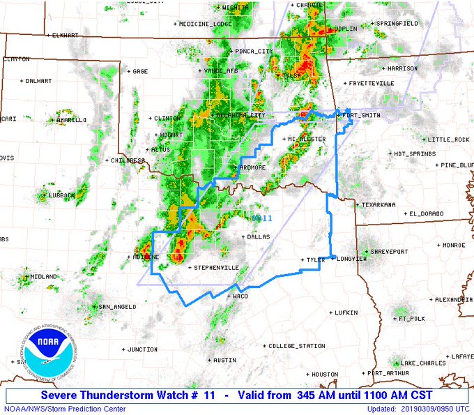
Another severe thunderstorm watch has been issued for southeast Oklahoma and northern Texas, including the Dallas-Fort Worth metro area.
Nickel-sized hail has been reported around Cisco, Texas.
2:45 a.m. CST Saturday:
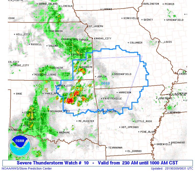
The first severe thunderstorm watch of the day has been issued for portions of southeast Kansas, northeast Oklahoma, northwest Arkansas and southwest Missouri.
Storms in this corridor can produce damaging wind gusts, large hail and torrential downpours.














Awesome Post Storm damage in Texas
ReplyDelete