Laredo, Texas: Where 99 degrees is a nice break in the heat.
Laredo, Texas: The city rain forgot.
Laredo, Texas: “Thank goodness we have air conditioning!”
Maybe the first two wouldn’t make great slogans for Laredo, but the third could work; it’s a quote from Laredo Mayor Pete Saenz, it’s catchy -- and it’s definitely true.
“California, the Great Basin, Desert Southwest and Intermountain West region will be hot and mainly dry into Labor Day weekend, with many area having temperatures as much as 4-14 degrees Fahrenheit above normal,” said AccuWeather Senior Meteorologist Jack Boston.
Laredo, however, has taken it to the extremes. The city has experienced 34 straight days -- and counting -- during which the high temperature has reached at least 100 degrees. That’s Laredo’s longest stretch since 2015 when it put together a 48-day streak of triple-digit temperatures. Last year, the city’s longest 100-degree streak was 14 days and it was 12 in 2017.
Through the first 29 days of August, daily temperatures in Laredo are 3.2 degrees above the 30-year normal temperatures. The last day the high temperature wasn’t at least 100 degrees was July 26, when it plummeted to 99. And the high temperature hasn’t been below 90 degrees since May 14, when there were still 39 days until the start of summer.
“We’re a semi-arid, semi-desert climate here, so the people who live in the Laredo region are somewhat accustomed to it,” said Saenz, a lifelong resident. “We’ve adapted. We’ve also recognized the dangers, so we take precautions. We stay hydrated, we stay in the shady areas -- thank goodness we have air conditioning. It’s a must.”
During the current 34-day streak, the high temperature reached 109 three times and from Aug. 8-18, the high temperature was at least 107 all 11 days.
Laredo residents can keep their umbrellas in storage this year. Since June 1, Laredo has had just 0.68 of an inch of rain, which is just 11% of the 30-year normal amount of rainfall. The city hasn’t recorded more than a trace of rain since June 26.
The cadence of life shifts in Laredo as people avoid outdoor daytime activities if possible and do outside projects and chores in the early morning or at night.
“But keep in mind,” Saenz said, “the evening at 9, you’re still talking about 90-degree weather.”
It’s so hot in Laredo during the day that people don’t even want to be outside to go swimming.
“We usually don’t see too many people swimming from when we open at 2 until 5,” said Enrique Gomez, event coordinator for Laredo Parks and Recreation Aquatics. “There are more people after 5. But people get super tired of the sun after a couple of weeks.”
The excessive, endless heat can take a toll on a person over a period of time, according to AccuWeather Founder and CEO Dr. Joel N. Myers.
“Clearly if a heat wave goes on for 10 days, 12 days or more … it can be devastating,” Myers said. “Your body has a certain amount of resiliency, but the longer the heat wave goes, the more it creates stress on your body and the more it takes out of you.”
Saenz says there have been no incidents of heatstroke or heat exhaustion this year, so clearly Laredo residents have a healthy respect for what the heat can do. Visitors, however, are taken aback.
“When we have dignitaries from Washington who come here, it’s the first thing they mention, especially on the hotter days,” Saenz said. “They say, ‘It’s like a wall of heat here.’ You step out of the plane and sure enough it just kind of hits you.”
There it is. Laredo, Texas: Welcome to our wall of heat!
Downpours are set to spread over much of north-central and western India next week as another monsoon low tracks across the country.
This monsoon low will provide an extra punch as it absorbs moisture from former Tropical Storm Podul as it spins over the Bay of Bengal this weekend. A slow westward track will bring the monsoon low near the coast of northeastern Andhra Pradesh and Odisha by Monday.
There is a small chance that this monsoon low organizes into a depression prior to reaching the east coast of India; however, impacts from the storm would vary little as the depression would quickly move onshore and weaken.
Downpours will inundate locations from northeastern Andhra Pradesh, Odisha to Chhattisgarh and eastern parts of Maharashtra and Madhya Pradesh on Monday before slowly expanding northward and westward as the week progresses.
By midweek, downpours will stretch from northern Chhattisgarh, western Madhya Pradesh, eastern Gujarat and southeastern Rajasthan.
Downpours will continue in similar areas on Friday with weekly rainfall total of 75-150 (3-6 inches) from eastern Gujarat to coastal Odisha. An AccuWeather Local StormMax™ of 300 m (12 inches) is possible.
These daily downpours will bring the risk of localized flooding and travel disruptions. There will also be a risk of mudslides in areas of rugged terrain. Aside from the risk of flooding, thunderstorms will also produce frequent lightning endangering anyone caught outdoors.
While the monsoon low tracks across north-central India, a surge of moisture from the Arabian Sea will enhance rainfall along India's western coastline.
Locations from western Maharashtra southward to northern Kerala will be at greatest risk for flooding downpours next week.
Travel may disrupted in Mumbai, Ratnagiri, Panaji, Mangalore and Kozhikode on any given day as downpours can quickly begin and produce more than 50 mm (2 inches) in a few hours.
The total number of deaths related to the monsoon rainfall this year climbed above 1,000 earlier in August and may rise further due to next week's adverse weather.
Maharashtra has been one of the hardest hit states by monsoon rainfall this year. Around 250 people of died in flooding since the start of June, according to the Times of India.
&Brian Lada, AccuWeather meteorologist and staff writer
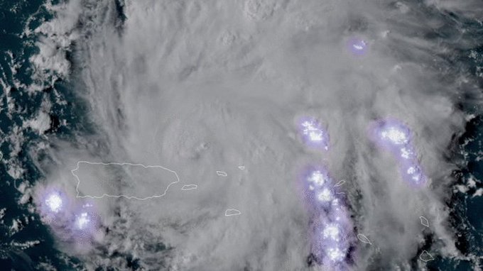
On Wednesday, NOAA's GOES-16 weather satellite captured the dramatic imagery of lightning striking in the eye of Hurricane Dorian.
While the imagery creates a stunning light show on satellite, lightning in the eye of the hurricane is a precursor for the rapid intensification of a hurricane, according to AccuWeather Hurricane Expert Dan Kottlowski.
"Lightning in the eye... means thunderstorms are really intense, and the more intense the thunderstorms are, that causes the eye to contract a little bit more," Kottlowski said. "It causes the pressures to fall as well, and that's a part of intensification."
The satellite imagery isn't picking up visual lightning from space in this video, but rather the "sferics," or the electrical discharge from the lightning.
"It's picked up by sensors on board the satellite so that we can see where lightning is occurring," Kottlowski said.
AM radio also catches these sferics, which make the sound of static when you tune the radio to the right side of the dial comes from them, Kottlowski explained.
Even more lightning was detected near Dorian's eye on Friday afternoon and evening as the storm experienced another burst of rapid intensification.
GOES-16 is a weather satellite that orbits the Earth over 22,000 miles from the planet's surface. Launched in 2016, the satellite is equipped with a Geostationary Lightning Mapper (GLM) that it uses to detect lightning in thunderstorms, or in this case, in the eye of a powerful hurricane.
According to NOAA, this instrument has the "ability to monitor the intensity change of tropical cyclones, which is often accompanied by increased lightning activity."
This sophisticated instrument is also on its twin, GOES-17, which is able to collect similar data from tropical systems across the eastern Pacific Ocean.
Hurricane Dorian became a major hurricane on Friday, as government officials and residents in the United States and Bahamas continued to prepare for the potentially devastating storm that is forecast to unleash a three-pronged assault of extreme winds, devastating storm surge and severe flooding.
Dorian will make a turn toward the west and continue to strengthen throughout the Labor Day weekend tracking along a path that will take it across the northern Bahamas Sunday and to the Florida coast, perhaps between West Palm Beach and Cape Canaveral, early next week.
More than 20 million Americans face the possibility of feeling impacts from Dorian, including about 3.7 million senior citizens, based on the current forecast.
As of 11 p.m. EDT Friday, the National Hurricane Center said the storm's maximum sustained winds were at 140 mph, which is a Category 4 storm. The storm was located about 545 miles to the east of West Palm Beach, Florida. As forecasters predicted, the storm has begun to slow its forward motion, with a current speed of 9 mph, down from 13 mph on Thursday night.
Dorian poses a serious threat to lives and property from the northern Bahamas, Florida and perhaps areas farther north in the southern United States in the coming days.
"Steering mechanisms will weaken while Dorian passes over very warm water with diminishing wind shear this weekend," according to AccuWeather Hurricane Expert Dan Kottlowski.
As a result, a decrease in the forward speed of Dorian but also significant strengthening are expected with the hurricane reaching Category 4 strength on the Saffir-Simpson Scale early Friday night.
A Category 4 hurricane has sustained winds ranging from 130-156 mph. Some fluctuation in strength is possible through the weekend.
"Given the potential for significant wind damage, flooding rainfall and a powerful storm surge, the AccuWeather RealImpact™ Scale for Hurricanes for Dorian is also 4 for the mainland U.S.," Kottlowski said.
The RealImpact can differ from the Saffir-Simpson category rating. The Saffir-Simpson rating is based on peak winds alone. AccuWeather's RealImpact Scale is based on risks to lives and property from storm surge flooding and inland flooding due to rainfall as well as wind strength.
It is possible that Dorian could pulse to Category 5 strength, which is the highest level of intensity for hurricanes. This is a concern as Dorian travels over deep, warm water of the Gulf Stream where cool, up welled water caused by hurricane wave action is rapidly replaced by more warm water.
Recall that Hurricane Andrew from August 1992 experienced rapid strengthening to a Category 5 over the Gulf Stream prior to making landfall in South Florida.
"Hurricanes often experience eye wall replacement cycles, which can cause the intensity of the core to weaken," according to Dan Kottlowski.
"These are usually brief, but generally unpredictable in advance. However, they do not affect the overall scope of the goings on outside of the eye wall, where tropical storm to major hurricane conditions continue. A decrease to a Category 2 hurricane at landfall can still have a RealImpact of a 4," Kottlowski said.
Satellite imagery Friday afternoon revealed the eye of Dorian becoming more defined and with a core temperature of minus-30 degrees Celsius or minus-22 degrees Fahrenheit. This cold at the top of the storm is a tell-tale sign of strengthening, Kottlowski said.
The strongest winds are in the eye wall with peak gusts to the right of the forward motion of the hurricane.
Winds of Category 4 strength or greater can produce catastrophic damage to poorly constructed homes and buildings. Some roofs can be removed and windows blown out. Widespread power outages occur during Category 4 hurricanes, even well away from the center.
Often spiral bands that extend well away from the center of the storm can produce hurricane-force wind gusts and significant damage.
The exact track, strength and forward speed of the storm will determine which areas are hit the hardest. However, damage and power outages are expected to extend well inland of the coast. This includes areas around Orlando and Tampa.
An overall increase in the size of the storm is expected to continue through landfall in the southeastern U.S. This means that tropical storm and hurricane conditions are likely to extend farther out from the center over time.
Now is the time to prepare your home or business for Dorian's arrival as tropical-storm-force winds will progress westward ahead of the storm. Installing plywood and storm shutters may be difficult and dangerous once strong wind gusts arrive.
Airline passengers should keep in mind that at some point, airports in the path of the storm will close and flights in and out of the area will stop. Motorists should expect traffic jams and difficulty finding areas without long lines at the gas pump and that some gas stations may run out of fuel. Where the storm hits, there may be no power to run the gast pumps in the wake of the storm for several days.
This image, taken during the afternoon on Friday, Aug. 30, 2019, shows Dorian and a well-defined eye north of Hispaniola and east of the Bahamas. (NOAA-GOES-East)
A hurricane watch has been issued for the northwestern Bahamas. Some of the islands are also under a hurricane warning.
"People on Grand Bahama and Abaco in the Bahamas can expect major damage, widespread power outages and a loss of most other utilities," Kottlowski said.
"Dangerous flash flooding, as well as storm surge flooding can cause low-lying areas and lower levels of some structures to be submerged for a number of hours," he added.
Since there is the potential for Dorian's forward speed to slow to a crawl, locations in its path including the Bahamas, Florida and other parts of the southeastern U.S. may face a prolonged period of storm surge, damaging winds and flooding rainfall.
The most dangerous aspect of a hurricane in terms of lives lost is storm surge.
A storm surge of 10 feet with locally higher levels is forecast near the eye of Dorian over the northern Bahamas and near and to the north of the eye along the Florida coast. Waves on exposed coastal areas will add to water levels and cause significant damage. A higher storm surge can occur in harbors, back bays, waterways or anyplace where water can get trapped.
People are urged to evacuate if and when such orders have been given. There will likely be a point when crews will not be able to rescue individuals who have decided to stay behind.
Dorian will unleash copious and potentially disastrous amounts of rain.
A general 8-16 inches of rain is forecast along the path of the storm with an AccuWeather Local StormMax™ of 24 inches. This is based on slow but steady forward motion. However, if Dorian were to crawl or stall, rainfall could be one and a half to two times these amounts.
Often, as hurricanes approach the coast, make landfall and move inland, waterspouts and tornadoes are spawned. This is a concern with Dorian.
Consequences of the most likely track
At this time, AccuWeather meteorologists believe the most likely track will take Dorian onshore between West Palm Beach and Cape Canaveral later Monday or Monday night.
A northward path over the interior of the Florida Peninsula would then spread bring tropical-storm- and hurricane-force wind gusts, torrential rain and fresh water flooding northward across the peninsula and later southeastern Georgia, South Carolina and central and eastern New Carolina into next week.
What if Dorian turns northward right along the Florida coast?
High pressure over the Atlantic, a storm in the upper atmosphere over the Caribbean and a non-tropical storm over the Midwest with the associated dip in the jet stream will ultimately guide Dorian's path through next week.
The strength and position of these features will change over time and affect the hurricane's exact track and forward speed.
During early October of 2016, Hurricane Matthew turned northward, prior to striking the Florida east coast and paralleled the southeastern coast of the Southeastern states.
Since the exact time of the northward turn with Dorian is uncertain, it is possible the eye may slowly bounce along the Florida east coast and perhaps the same along the coasts of Georgia and the Carolinas in a curved north to northeast path, similar to that of Matthew.
In such a scenario, hurricane conditions with dangerous coastal flooding, major beach erosion and damaging winds will spread northward next week along much of the southeast U.S. coast.
However, no two hurricanes and their track are ever exactly the same. Dorian and its track will have some degree of uniqueness about it.
What if Dorian fails to turn northward?
There is a remote chance that Dorian travels all the way across the Florida Peninsula and reaches the northeastern Gulf coast during the middle of next week.
In this case, some restrengthening could occur, depending on the amount of time spent over warm water. A new hurricane threat could then arise along the upper Gulf coast.
There is the potential for Dorian to stall over the Bahamas before reaching Florida or to stall over Florida. In these cases, Dorian's arrival in the U.S. could be delayed further or extreme rainfall may occur in Florida.
Download the free AccuWeather app to stay alert of tropical and severe weather advisories. Keep checking back for updates on AccuWeather.com and stay tuned to the AccuWeather Network on DirecTV, Frontier and Verizon Fios.