weather.com meteorologists
A slow-moving weather system will produce dual threats of severe thunderstorms and flooding rain from the Southern Plains into parts of the Midwest and interior Northeast into Thursday.
There were 10 reports of tornadoes from this storm system on Tuesday and Tuesday night in eastern Colorado, northwest Texas and southern Oklahoma. Trees and powerlines were downed by a possible tornado near Pauls Valley, Oklahoma, overnight.
Showers and thunderstorms are ongoing right now from northern Texas into the mid-Mississippi Valley.

A widespread area from Texas into parts of the mid-Mississippi and Ohio valleys and Northeast will see showers and thunderstorms from Wednesday into Thursday.
Severe thunderstorms are most likely on Wednesday from much of Oklahoma into northern and central Texas. Large hail, damaging winds and a few tornadoes are the main threats. A few severe storms could also develop from the mid-Mississippi Valley into the eastern Great Lakes. Damaging wind gusts and hail are the main concern from any storms that turn severe in this area.
 Wednesday-Wednesday Night Severe Thunderstorm Forecast
Showers and thunderstorms along this frontal system will continue to impact areas from Texas to the Ohio Valley and Northeast on Thursday. The threat of severe thunderstorms packing damaging winds and/or large hail should be isolated.
 Thursday's Forecast
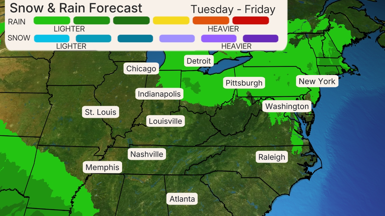
Regardless of the severe storm threat, a broad area from central Texas into the mid-Mississippi and Ohio valleys could pick up an inch or more of rainfall through Thursday.
Multi-inch rainfall totals are most likely from northern Texas into the Ozarks and mid-Mississippi Valley. Flash flooding is possible in spots throughout this corridor, especially Wednesday into Thursday.
Way Day Starts in 2 Days - Shop Early Access Here (SPONSORED)
The rainfall will be beneficial to alleviate dryness in parts of Texas and southern Oklahoma, but flooding could still occur if too much rain falls too quickly.
Flash flood watches have been issued by the National Weather Service from parts of Oklahoma into the Ohio Valley.
 Rainfall Forecast
Recap
Tuesday afternoon, a supercell thunderstorm developed east of Lubbock, Texas, then tracked toward the east-northeast for over an hour.
Up to 3-inch diameter hail smashed vehicle windshields south of Paducah, Texas. Multiple spotters reported a large, rain-wrapped tornado with this single thunderstorm.
Hail accumulated in several other locations, including up to 4 inches deep near the town of Hugo, Colorado.
The Weather Company’s primary journalistic mission is to report on breaking weather news, the environment and the importance of science to our lives. This story does not necessarily represent the position of our parent company, IBM.
The Weather Company’s primary journalistic mission is to report on breaking weather news, the environment and the importance of science to our lives. This story does not necessarily represent the position of our parent company, IBM.

No comments:
Post a Comment