Chris Dolce
Explosive eruptions at St. Vincent's La Soufrière volcano have provided some eye-popping views on satellite imagery since it began its major bursts of activity last Friday.
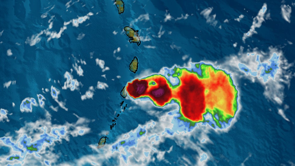
First is a colorized infrared satellite image of an eruption at La Soufrière from Saturday.
Meteorologists typically use this type of imagery to determine cloud top temperatures. Darker colors usually indicate colder (and higher) cloud tops.
You would typically see these darker colors associated with thunderstorms or even the core of a hurricane. However, in this case, we are seeing volcanic emissions rising high into the atmosphere.
 A colorized infrared satellite image of an eruption at La Soufrière from Saturday.
Stu Ostro, a senior meteorologist at The Weather Channel, produced this infrared satellite loop showing the series of eruptive bursts at La Soufrière Saturday morning into Sunday.
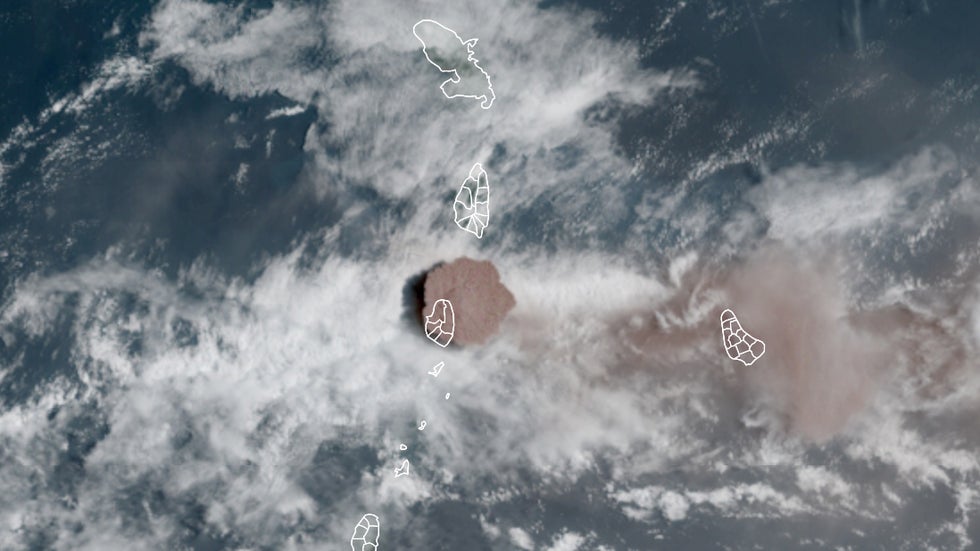
Visible satellite imagery captured this vivid plume of ash billowing from the volcano during an eruption on Sunday. The darker colored column of ash over St. Vincent stands out in contrast to the white clouds in the surrounding region.
This type of satellite imagery shows how the sky would generally appear if viewed by the naked eye from space.
Click the play button below to see an animated version of visible satellite imagery showing an eruption on Sunday at La Soufrière.
You can see a side view of one of the large vertical bursts of volcanic ash in this satellite loop from Saturday.
The emission of sulfur dioxide (SO2) from an eruption Monday morning is seen in the orange shading of this animation. This particular eruption has reportedly caused the dome of the volcano to collapse and sent pyroclastic flows down the volcano's south and southwest flanks.
Large volcanic eruptions like those at La Soufrière often produce lightning. More than 1,200 lightning events had been detected in the eruption during 72 hours ending Monday morning, according to Chris Vagasky, a meteorologist at Vaisala.
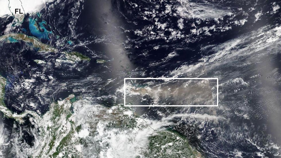
The extensive plume from this weekend's volcanic eruptions extended hundreds of miles eastward into the western Atlantic on Sunday, as highlighted by the white box in this NASA satellite image. You can compare the size of the plume in relation to the Florida Peninsula in the upper left.
A computer model forecast from Copernicus ECMWF shows that sulfur dioxide (SO2) generated by La Soufrière could reach as far east as northern Africa this week. You can see this in the red and orange shadings of this animation tweeted by Mark Parrington, a senior scientist at Copernicus Atmosphere Monitoring Service.
Photos: Eruption of La Soufrière
The Weather Company’s primary journalistic mission is to report on breaking weather news, the environment and the importance of science to our lives. This story does not necessarily represent the position of our parent company, IBM.
The Weather Company’s primary journalistic mission is to report on breaking weather news, the environment and the importance of science to our lives. This story does not necessarily represent the position of our parent company, IBM.


No comments:
Post a Comment