Jonathan Erdman
Chilly air, even some spring snow, may linger in the Rockies and central U.S. into next week, while parts of the West Coast could threaten mid-April record highs by the weekend.
After a warm start to April, it has turned markedly chillier in the nation's heartland this week.
Highs in the 30s and 40s have been common in parts of the northern Plains and Rockies, with snow from Minnesota to northern Montana to the Rockies.

Those in the Plains longing for the kind of spring warmth seen earlier this month will have to be patient – a couple reinforcing shots of chilly air are forecast to plunge out of Canada into the central U.S. through late this week, then again early next week.
This stubborn cold air could linger into much of next week, if not longer.
Some cooler air will also spread into parts of East and Southeast later this week, and could linger into next week. But it won't be nearly as chilly – relative to mid-April average – as parts of the Plains and Rockies.
(MAPS: 10-Day U.S. Forecast Highs and Lows)
 Extended Range Temperature Outlook
With this chilly air in place, wet snow is expected in parts of the Rockies, High Plains and Northern Plains, including Denver. Thursday night into early Friday is when Denver has its best shot at seeing some accumulating snow.
Shop Outdoor Patio Umbrellas On Sale Now (SPONSORED)
This won't be nearly the magnitude of mid-March's Winter Storm Xylia, which dumped feet of snow in the Front Range and High Plains of Wyoming and Colorado.
But some wet snow accumulations are possible each day through the weekend in parts of the Rockies and High Plains as far south as New Mexico.
More snow is possible with the second cold front early next week in some of the same areas.
(MAPS: 7-Day U.S. Rain/Snow Forecast)
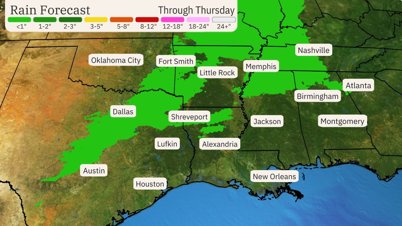 Snow and Rain Forecast
Conversely, the West Coast will heat up into the weekend.
Record highs in the low to mid-80s are possible this weekend in Portland, Oregon, which shivered through a freeze Sunday morning.
Seattle will enjoy several days of 70-degree-plus highs.
And parts of California could see record highs Sunday, including in Sacramento, where highs could reach 90 degrees.
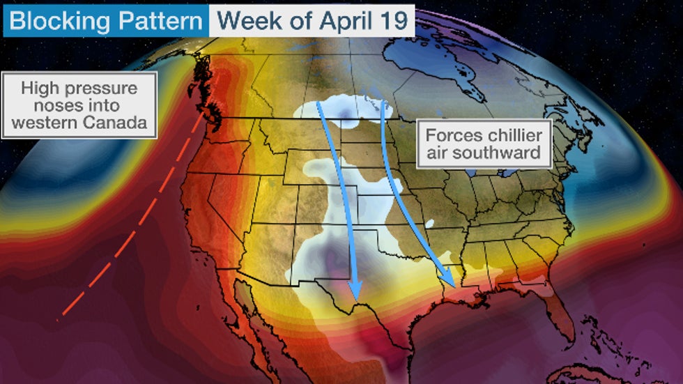
The Stubborn Pattern
The reason for the stubborn central chill and warming West Coast can be traced to the jet stream pattern.
A northward nose of high pressure from the West Coast into western Canada and Alaska will force the jet stream to dive southward out of central and eastern Canada, ushering in rounds of cooler air deep into the central U.S. and parts of the East.
This jet-stream pattern may hold into at least early next week. If it holds longer, so will the temperature pattern.
 General weather pattern expected early next week.
The Weather Company’s primary journalistic mission is to report on breaking weather news, the environment and the importance of science to our lives. This story does not necessarily represent the position of our parent company, IBM.
The Weather Company’s primary journalistic mission is to report on breaking weather news, the environment and the importance of science to our lives. This story does not necessarily represent the position of our parent company, IBM.


No comments:
Post a Comment