Jonathan Erdman
Winter Storm Orlena is pummeling parts of the Northeast and has delivered more snow in a matter of hours in New York City, Philadelphia and Washington D.C. than all of last season, one of the least snowy on record.
Orlena dumped over a foot of snow in parts of the New York City Tri-State Area with snowfall rates of up to 2 inches per hour Monday, accompanied by winds gusting over 30 mph, leading to near whiteout conditions at times.
(STORM LATEST: Forecast | News Impacts)
At New York City's Central Park, 8 inches of snow was measured in six hours Monday morning.
That was more snow in one morning than they measured all of last season.
SPONSORED: Epic winter clearance sale at Sierra Trading Post
Only 4.8 inches of snow fell from fall 2019 through spring 2020, NYC's fourth-least-snowy "season" on record and only 19% of average, according to data from the National Weather Service.
The combination of the current storm and mid-December's Winter Storm Gail – 10.5 inches – should push New York City above its seasonal average of 25.8 inches.
It's quite the contrast from January 2020, when Central Park flirted with 70 degrees two days in a row – a feat Boston accomplished easily.
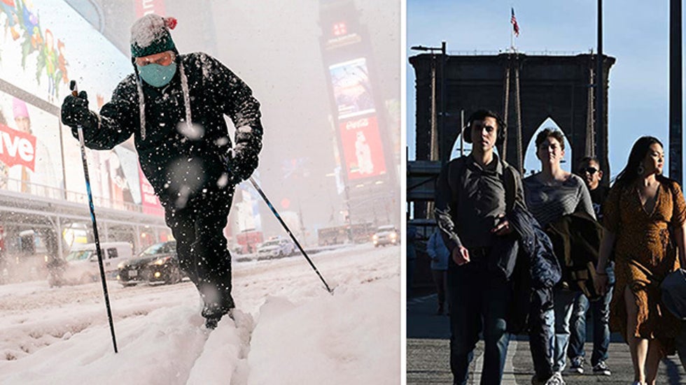
 A skier glides through Times Square in New York City on Feb. 1, 2021 (left); Holding their winter coats over their arms, pedestrians walk the Brooklyn Bridge during springlike temperatures nearing 70 degrees, in New York City on Jan. 12, 2020 (right).
Even areas with more modest snow from the storm managed to easily top last winter's totals.
Neither Philadelphia (0.3 inches) nor Washington D.C. (0.6 inches) could scrape up a measly inch of snow all last season. Each picked up at least 2 to 4 inches of snow from Winter Storm Orlena.
Last season was Philly's second least-snowy season and Washington's third-least-snowy season in records dating to the mid-1880s.
Orlena was the first time Reagan National Airport picked up a 2-inch snowfall since Feb. 20, 2019.
If a nor'easter did form last winter, it either was too far offshore and moved away quickly or lacked cold air.
Most often, low pressure tracked well inland instead of offshore, pumping warmer air into the East and taking snow off the table, particularly along the Interstate 95 urban corridor.
This winter, however, delivered a major Northeast snowstorm in mid-December, Winter Storm Gail, and the current Winter Storm Orlena.
Despite climate change, snowfall appears to be increasing along the Northeast Urban Corridor over time.
According to a February 2020 report from Climate Central, three of the top five cities that exhibited the largest gains in snowfall since 1970 – Atlantic City, New Jersey; New York City and Newark, New Jersey – were near the Northeast seaboard.
These I-95 corridor snowfall increases over the decades were most prevalent in winter and spring, rather than fall.
This may be due to a combination of factors, including warmer ocean water able to supply more moisture to winter storms, and more frequent blocking patterns in the upper atmosphere, such as the Greenland block, which ushers in cold air and can lead to slow-moving snowstorms in the East.
The Weather Company’s primary journalistic mission is to report on breaking weather news, the environment and the importance of science to our lives. This story does not necessarily represent the position of our parent company, IBM.
The Weather Company’s primary journalistic mission is to report on breaking weather news, the environment and the importance of science to our lives. This story does not necessarily represent the position of our parent company, IBM.

No comments:
Post a Comment