Jonathan Erdman
Flooding rain and severe thunderstorms are pouding parts of the Ohio Valley and South as February exits with a bang and the calendar turns to March.
Dangerous flash flooding has already occurred in parts of the Ohio Valley and Appalachians, particularly in parts of Kentucky and West Virginia.
Widespread flooding, including flooding of homes and businesses and major highways, was reported in Murray, Kentucky, near the Tennessee state line about 90 miles west-northwest of Nashville.
Flooding in Todd County, Kentucky, prompted evacuations of several homes in the town of Elkton, where water was reportedly up to and under some structures. A rare flash flood emergency issued by the National Weather Service for this area.
A section of road was washed out in Graves County. At least one vehicle was trapped on a flooded street in Hopkinsville. A high school softball field was flooded in Booneville.
In West Virginia, a reservoir near the town of Hurricane overflowed onto Highway 34, roughly halfway between Charleston and Huntington. One motorist was rescued after driving into a flooded road near the town.
Water entered several homes and some secondary roads began to wash out in Pennsboro, West Virginia. Roads were blocked by up to 3 feet of water in Mineral County. Deckers Creek in Morgantown flooded a road Sunday afternoon.
A swift water rescue was reported south of Huntington, West Virginia, and at least one street was flooded in the city of Huntington.
Numerous roads were closed due to high water in Switzerland County, Indiana, and Pike County, Ohio.
Over 100 reports of flash flooding were received by the National Weather Service Sunday from Kentucky to western Maryland.

Meanwhile, severe thunderstorms flared up late Sunday morning in parts of the South. Hail up to ping-pong ball size was reported in Grayson County, Texas.
The map below shows the current active flash flood warnings, severe thunderstorm and tornado watches and warnings.
 Current Radar, Severe Weather Watches and Warnings
Deep moisture ahead of an advancing cold front and jet-stream energy are all teaming up to produce this double threat of flooding and severe thunderstorms through early Monday morning.
(MORE: March Weather Has a Stormy Reputation)
Let's take a closer look at each threat.
Flood Threat
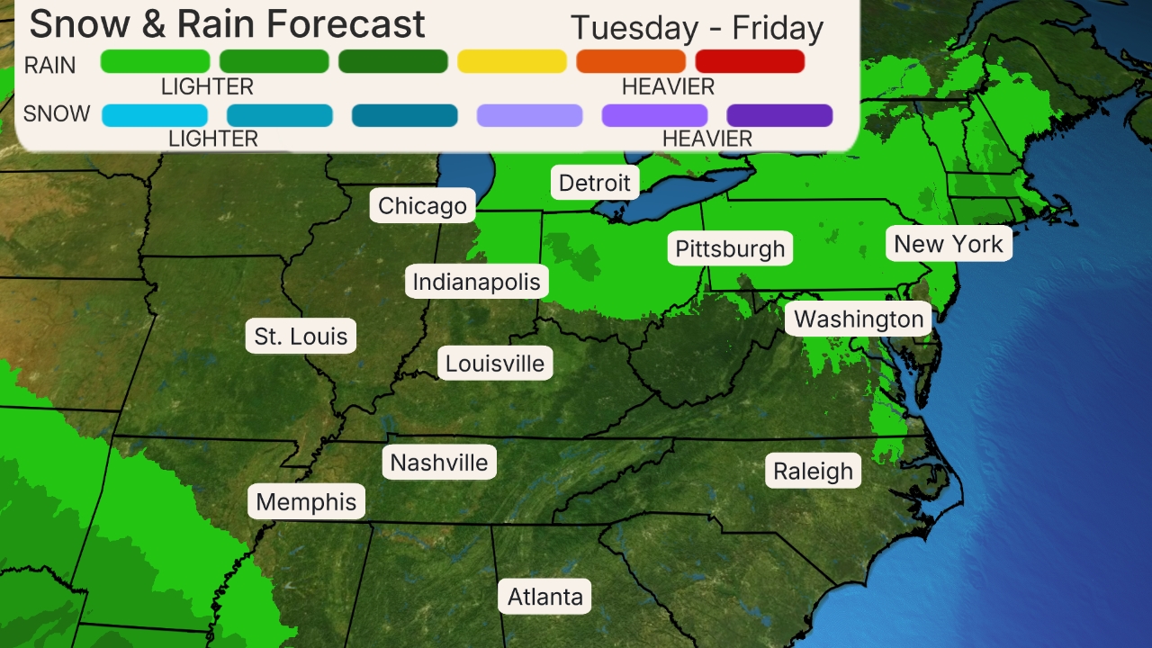
The heaviest additional rain will fall through Monday morning in parts of Kentucky, West Virginia, Tennessee, Arkansas, northern Louisiana, northern Mississippi and northern Alabama. Some of these areas may pick up an additional 3 inches of rain or more.
 Rainfall Outlook
This additional rain, on top of what has already fallen, is likely to trigger additional flash flooding, particularly in hilly terrain, as well as minor, moderate and locally major river flooding.
The National Weather Service has issued flood watches from the lower Mississippi Valley to the Appalachians.

NOAA's Weather Prediction Center issued a moderate risk of excessive rainfall - their second highest risk level - through early Monday morning in much of Kentucky, northern Tennessee and parts of West Virginia.
According to NOAA, atmospheric moisture values - what meteorologists call precipitable water - were near record values for late February in the Ohio Valley, two to three times the average.
Another concern, according to the NWS Ohio River Forecast Center, was in the Appalachians, where rain and warmer temperatures were expected to melt a significant fraction of existing snowpack from eastern West Virginia into southwest Pennsylvania.
Never drive through flooded roads. Over half of all flood-related fatalities occur in vehicles.
By Monday, a cold front will dry out the Ohio Valley and Appalachians, but areas of locally heavy rain could linger in the South through Wednesday as another wave of low pressure forms along the east-to-west oriented frontal boundary in the Deep South.
(MAPS: 7-Day Forecast)
Severe Threat
There is also a threat of severe thunderstorms on the table through early Monday morning.
Humid air by end of February standards, with dew points in the mid-60s, is in place from Texas to the Tennessee Valley. With an active jet stream providing wind shear, the stage is set for at least some severe weather in parts of the South.
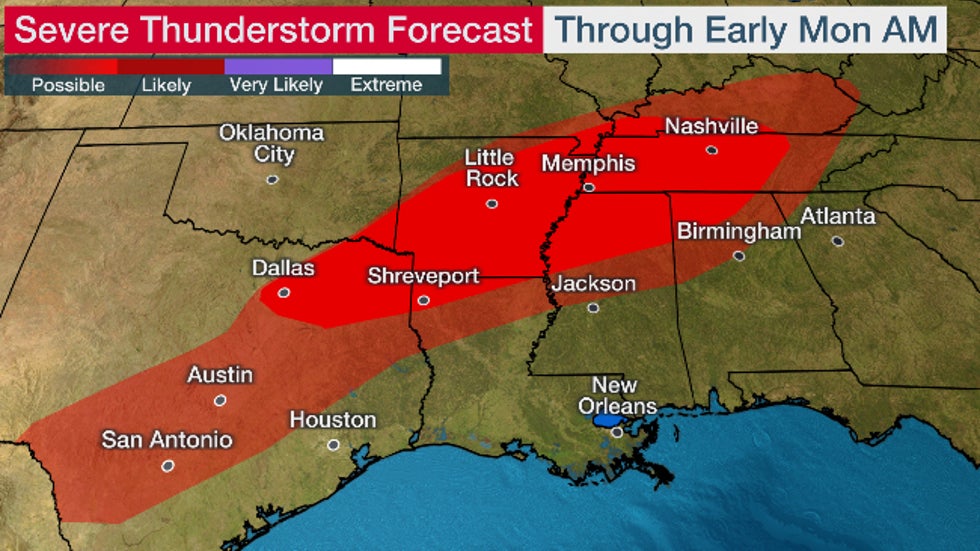
Scattered severe thunderstorms are expected from parts of northeast Texas into southeast Oklahoma, Arkansas, northern Louisiana, northern Mississippi, Tennessee, northern Alabama and southern Kentucky.
Damaging thunderstorm winds and a few tornadoes are possible in these areas. Some large hail is also possible.
(MORE: Will La Niña Trigger a Dangerous Severe Weather Season)
 Severe Thunderstorm Forecast
While thunderstorms are possible in the Deep South Monday and Tuesday, the severe weather threat those days appears to be minimal.
Make sure you have multiple ways of receiving severe weather alerts that can wake you up at night, including your smartphone and NOAA weather radio. Make sure your smartphone is charged and alerts are turned on.
These alerts could provide the precious minutes needed to move quickly to shelter and could save your life.
We have already had two deadly tornadoes in the South so far in 2021 that did not occur in large severe weather outbreaks. Both also occurred at night.
The Weather Company’s primary journalistic mission is to report on breaking weather news, the environment and the importance of science to our lives. This story does not necessarily represent the position of our parent company, IBM.
The Weather Company’s primary journalistic mission is to report on breaking weather news, the environment and the importance of science to our lives. This story does not necessarily represent the position of our parent company, IBM.

No comments:
Post a Comment