Linda Lam
Wintry conditions may develop in parts of the Midwest and East late this weekend into early next week as a precip-packed system moves into the area.
A system will move into the central United States later this weekend. Moisture will stream northward and may overlap with air cold enough to produce snow.
Snow is possible from parts of the Midwest into the mid-Atlantic, but the exact details will come into focus over the next few days depending on how far north precipitation reaches, how much moisture there is and how fast this system tracks east.
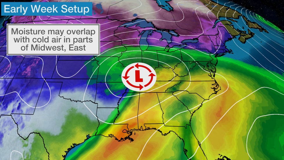 Moisture may overlap with cold air resulting in snow in portions of the Midwest and East late this weekend into early next week.
Forecast Timing
Saturday
An appetizer disturbance will move through the Midwest today with mainly light snow.
Snow will spread eastward into the Upper Midwest throughout the day while slowly intensifying somewhat.
By Saturday night, light to moderate snow will stretch from the eastern Dakotas to the Great Lakes with some flurries persisting across Nebraska.

Sunday
Light snow is possible from Iowa into the Great Lakes, Ohio River Valley and possibly as far east as northern West Virginia.
SPONSORED: Epic winter sale at Sierra Trading Post
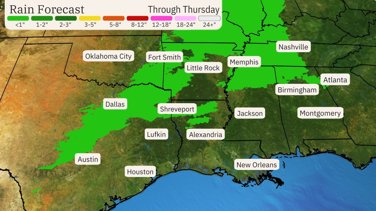
This system will become more organized later Sunday. Snow will fall on the northern edge of the precipitation with rain and thunderstorms possible across the South on Sunday night.
 Sunday's Forecast
On this storm system's southern flank, a few strong to severe thunderstorms are possible Sunday night.
The threat will be focused across northern Texas and southern Oklahoma, including the Dallas/Fort Worth metro area.
The main threat with these storms will be large hail, but gusty winds and an isolated tornado may be possible, but those threats are unlikely. This will be a nocturnal threat.
 Severe Weather Forecast
Monday
This low pressure system will track eastward spreading snow or a mix of rain and snow. Locations that may see wintry weather on Monday stretch from Kansas and southern Nebraska into the southern Great Lakes and eastward into parts of Pennsylvania, Maryland and southern New Jersey. This band of snow may be further north or south depending on how the low pressure system develops. Rain and thunderstorms are expected farther south.
The chance for snow will continue on Monday night from northern Missouri and southern Iowa into the southern Great Lakes and will increase in parts of the Northeast, possibly as far north as central New York and southwestern New England. Some heavier snow may be possible in Pennsylvania. Areas from Indianapolis to Baltimore could see a mix of snow and rain.
 Monday's Forecast
Tuesday
Snow may linger in parts of the southern Great Lakes, Northeast and mid-Atlantic into Tuesday. Rain is most likely across the mid-Atlantic.
However, this will depend on how fast this system moves, as well as how far north its moisture reaches. The details of this forecast will be updated in the days ahead, but there is the potential for some wintry weather in portions of the East early next week.
 Tuesday's Forecast
How Much Snow?
Areas from the Central Plains into the Great Lakes and mid-Atlantic could see some snowfall accumulation Sunday through Tuesday. More than a foot of snow may fall in a small area in southeastern Nebraska or in a neighboring state.
Areas of moderate to locally heavy snowfall are possible as well, shown in purple on the map below, but this system does not appear to be a major snowstorm at this point.
Many cities that could see some snow with this upcoming system have measured less snow than average so far this season. This includes Kansas City, Indianapolis, Chicago and Milwaukee, where about half as much snow as typically is expected has fallen so far. Pittsburgh and Des Moines, however, have seen above average snowfall, so additional snow would add to the surplus.
 Snowfall Forecast
The Weather Company’s primary journalistic mission is to report on breaking weather news, the environment and the importance of science to our lives. This story does not necessarily represent the position of our parent company, IBM.
The Weather Company’s primary journalistic mission is to report on breaking weather news, the environment and the importance of science to our lives. This story does not necessarily represent the position of our parent company, IBM.


No comments:
Post a Comment