Jonathan Erdman
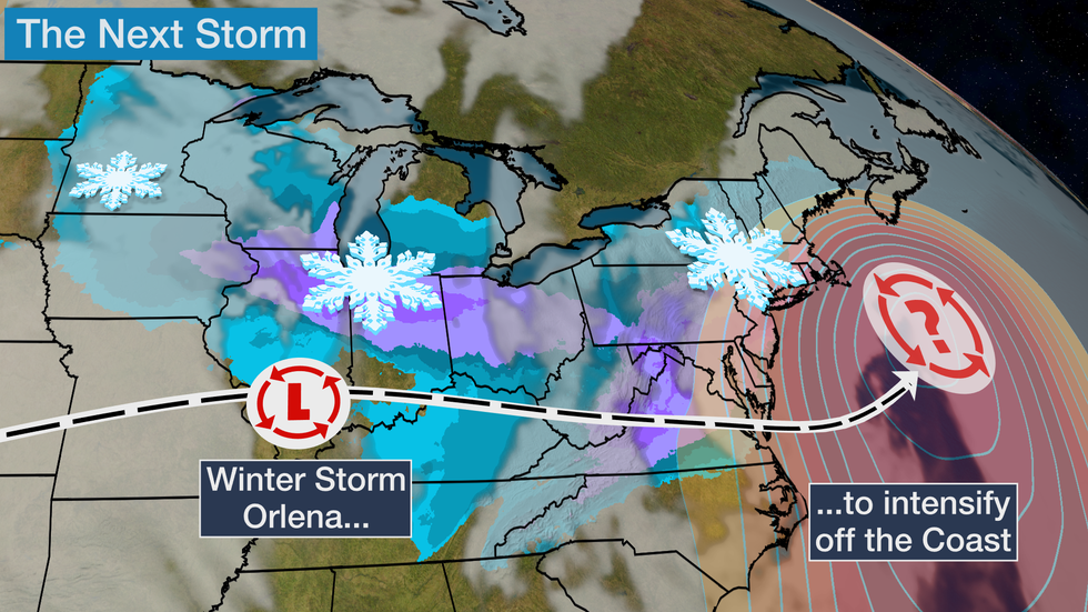
Winter Storm Orlena will hammer parts of the Midwest this weekend, including Chicago, then morph into a nor'easter early next week that could bring heavy snow to Boston, New York, Philadelphia and Washington, D.C.
In the heart of winter, the weather pattern has become quite active.
Winter Storm Nathaniel dumped heavy snow in parts of the Midwest and light to moderate snow in the Northeast this week.
The next system in this parade is currently hammering parts of the West and will move into the Plains and Midwest this weekend. This one will have a second chapter as a significant snowstorm in the Northeast Sunday through Tuesday.
This system has been named Winter Storm Orlena by The Weather Channel.

Winter Weather Alerts
Winter storm watches and warnings are in effect from parts of the southern Great Lakes to the mid-Atlantic and the central and southern Appalachians. The worst conditions are expected over the next 24 hours where warnings are in place, in this case, moderate to heavy snowfall and lowered visibilities and slippery roads.
SPONSORED: Epic winter clearance sale at Sierra Trading Post
Winter weather advisories are also in effect across the Upper Midwest. Roads may become dangerous this weekend.

Let's lay out the forecast timing, then the current snowfall forecasts.
Forecast Timing
Saturday
Orlena will arrive in the Plains and upper Midwest Saturday and will meet up with cold air to produce snow from the eastern Dakotas southeastward into Indiana and southwestern Ohio.
Snow will be heavy and wet in Chicago and Milwaukee once it begins Saturday afternoon. Gusty winds are also likely.
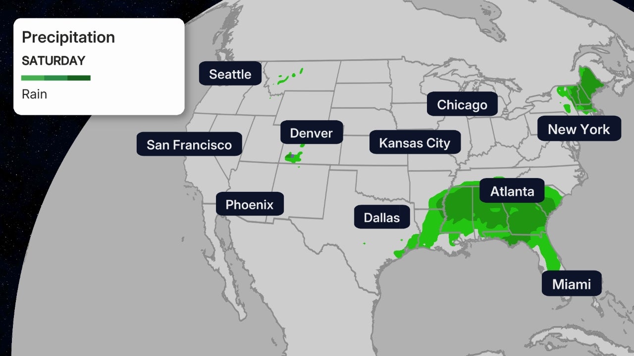
Saturday night, snow, sleet or freezing rain will spread into the Appalachians and adjacent piedmont as far south as northern and western North Carolina. Snow will continue in parts of the Midwest Saturday night.
 Saturday's Forecast
Sunday
Snow will continue Sunday from the Upper Midwest into the Mid-Atlantic States. Heavy, wet snow is likely in the darker blue colors in the map below.
There remains some uncertainty regarding where the snow/ice/rain lines will set up Sunday east of the Appalachians, so some areas with snow in the forecast may see some sleet or freezing rain mix in, at times.
Snow, sleet or freezing rain could extend as far south as northern North Carolina. There may be enough ice to cause sporadic power outages in western North Carolina or western Virginia.
SPONSORED: Epic winter clearance sale at Sierra Trading Post
Sunday night, snow may creep north in the Mid-Atlantic states toward the New York City Tri-state. Some lingering dry air may keep southern New England dry for the time being.
Snow will expand Sunday night in the Ohio Valley, extending as far south as Kentucky, Tennessee, and the Smoky Mountains, while coming to an end across the Upper Midwest.
 Sunday's Forecast
Monday
Computer forecast models predict a secondary area of low pressure will form near or off the Northeast coast Monday.
However, the exact track of this low is crucial to determine such details as how far inland snow falls, where the heaviest snow falls, and whether rain occurs at the coast.
Dry air may also be in place over at least part of the interior Northeast.
(MORE: Why Northeast Snowstorms Can Be Difficult to Forecast)
For now, snow is most possible Monday from southern New England to the Mid-Atlantic states. Lingering snow is expected in parts of the Ohio Valley and the Appalachians.
Gusty onshore or alongshore winds are increasingly likely from the Jersey shore to the Massachusetts coast.
 Monday's Forecast
Tuesday
The best chance of snow continuing into Groundhog Day will be in New England.
It remains uncertain if snow will persist at least part of the day, or will have largely ended farther south, although some lingering snow showers and areas of lake-enhanced snow can't be ruled out in the Ohio Valley and Appalachians.
Snow could linger into Tuesday night or even Wednesday in parts of New England.
 Tuesday's Forecast
How Much Snow?
Midwest
At least 6 inches of snow is most probable in a swath from eastern Iowa, southern Wisconsin and northern Illinois into Indiana and Ohio.
This includes the Chicagoland and Milwaukee metro areas, where winds off Lake Michigan may enhance the snowfall.
A few locations in this Iowa to Ohio zone could measure up to a foot of snow.
Some blowing and drifting snow is possible as winds increase Saturday night into Sunday, particularly in rural areas and near the shores of the Great Lakes.

Northeast
How much snow falls and where it falls depends on the exact track of the low near or off the East Coast and how strong it becomes.
The chances of a significant Northeast snowstorm are increasing, but that's not a guarantee, and it doesn't mean the entire Northeast will see heavy snow.
(MORE: 6 Things You Should Know About Your Snow Forecast)
There could be a sharp gradient between little snow and heavier snow along the northern edge of this storm, which makes snowfall forecasts in northern Pennsylvania, western, central and upstate New York very uncertain.
A low track closer to the coast could mean more rain and less snow near the Northeast coast and possibly parts of the Interstate 95 Urban corridor, at least for a time.
For now, moderate to heavy snowfall is possible in purple areas on the map below.
However, this event is still several days away so snowfall forecasts will change as the forecast details such as the track, timing and strength of this system become clearer.
 Snow Outlook
Snow won't be the only impact.
Strong winds are likely to develop along the coast from the Delmarva Peninsula to coastal New England Monday and could last along the New England coast through Tuesday night or early Wednesday.

These winds could lead to power outages and possibly some tree damage, particularly if in combination with heavy snow.
Also, given the storm's slow movement and persistent onshore winds, coastal flooding may occur from the Delmarva Peninsula to New England, possibly over several high tide cycles.
Check weather.com for updates to this forecast.
The Weather Company’s primary journalistic mission is to report on breaking weather news, the environment and the importance of science to our lives. This story does not necessarily represent the position of our parent company, IBM.
The Weather Company’s primary journalistic mission is to report on breaking weather news, the environment and the importance of science to our lives. This story does not necessarily represent the position of our parent company, IBM.

No comments:
Post a Comment