Chris Dolce
Christmas week will feature a potent storm system heading across the central and eastern states, where it could bring a threat of flooding rainfall, gusty winds and a sharp temperature drop.
A strong cold front will move from the nation's midsection on Wednesday to near or off the Eastern Seaboard by Christmas Day. That front will draw mild and moist air northward from the Gulf of Mexico into the South and East, potentially fueling threats of heavy rain and gusty winds.
Much colder temperatures will follow immediately after this front passes through, and that means some areas could see rain change to snowfall.
 Christmas Week Storm Setup
Here's a general look at what to expect, but keep in mind changes to this forecast are likely as we approach the Christmas holiday.
Forecast
Wednesday
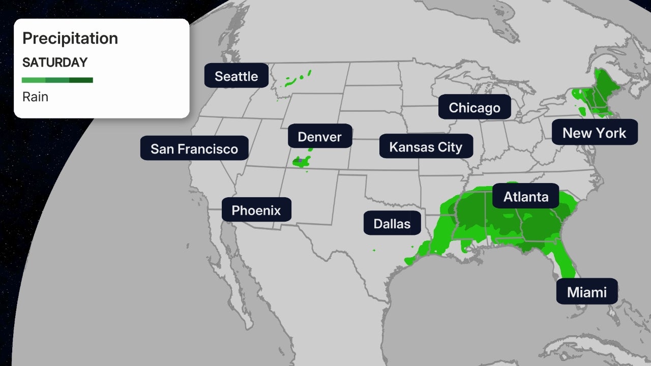
Increasing moisture along the front could allow rain to develop from parts of the Great Lakes southward to the northern Gulf Coast. A few strong thunderstorms cannot be ruled out near the Gulf Coast.
Snowfall whipped around by gusty winds will affect parts of the Northern Plains and upper Midwest. This could create hazardous travel conditions.
 Wednesday Forecat
Christmas Eve (Thursday)
The front will push across the eastern states during the day and overnight on Christmas Eve.
Widespread rain is expected in parts of the South and East, even as far north as Maine. The rainfall could be heavy at times in some locations, and that might stir up flooding concerns.
Snow cover from last week's winter storm in the Northeast is likely to melt amid the milder temperatures and rainfall. This could add to the potential for flooding in parts of the Northeast region, however, specific details are uncertain.
Strong winds are also a possibility as this front sweeps across the eastern states.
After the front passes through, rain might change to snowfall from the Great Lakes and Ohio Valley to possibly as far south as the Tennessee Valley. This transition from rain to snow might spread as far east as upstate New York and central and eastern Pennsylvania on Thursday night.
 Christmas Eve Forecast (Thursday)
Christmas Day (Friday)
Rain might continue into at least a portion of Christmas Day in eastern New England, but that will depend on how fast the front moves eastward.
At the same time, much colder air will quickly sweep in behind the front. That could allow snowfall to return to parts of the interior Northeast that were soaked by rain on Christmas Eve.
(MORE: White Christmas Forecast)
 Christmas Day Forecast (Friday)
Plunging Temperatures
Many cities in the central and eastern states will start the week with temperatures that are near or even above average for this time of year.
A wintertime reality check is expected during the second half of the week when the front ushers in a sharp temperature drop.
Chicago could be near 50 degrees on Wednesday. The Windy City might only manage to reach the lower 20s for highs on Christmas Eve and Christmas Day.
Highs in the 50s to near 60 degrees are forecast in Atlanta through Thursday. The high temperature might struggle to get out of the 30s on Christmas Day, there.
(MAPS: Track the Cold Plunge)

The Weather Company’s primary journalistic mission is to report on breaking weather news, the environment and the importance of science to our lives. This story does not necessarily represent the position of our parent company, IBM.

No comments:
Post a Comment