weather.com meteorologists
Tropical Storm Nana formed quickly in the Caribbean Sea, and is forecast to become a hurricane before quickly moving ashore in Central America with a threat of damaging winds and flooding rain.
Nana was upgraded to a tropical storm Tuesday morning, based on observations from a U.S. Air Force Reserve Hurricane Hunter mission, finding a tight, stronger than expected low-level center of circulation.
(MORE: Hurricane Season Terms You Need to Know)
The map below shows the current tropical storm and/or hurricane watches and warnings in effect. Watches mean conditions are possible, while warnings mean they're expected in the affected areas.
 Current Watches and Warnings
The system is currently centered over 500 miles east of Belize City, moving quickly west. It is bringing locally heavy rain to Jamaica on the eastern side of its circulation.
Nana will track quickly westward toward the coast of Belize or Mexico's Yucatan Peninsula by early Thursday. It is then expected to push inland over Guatemala and eastern Mexico.
 Current Storm Information and Forecast Path
Since Nana is a small tropical cyclone and is forecast to track over warm water in an environment of low wind shear, Nana is expected to intensify up until landfall, with a Category 1 hurricane landfall increasingly possible.
Winds to at least tropical storm force are possible along the coast of northern Honduras by late Wednesday, then into parts of Belize, Guatemala and Mexico's Yucatan Peninsula by Thursday.
A dangerous storm surge will raise water levels by as much as 3 to 5 feet above normal tide levels along the immediate coast near and to the north of where the center makes landfall. Near the coast, the surge will be accompanied by large and destructive waves, according to the NHC.
Locally heavy rain may trigger flash flooding, particularly over mountainous terrain of Jamaica, northern Honduras, Belize, Guatemala and eastern Mexico.
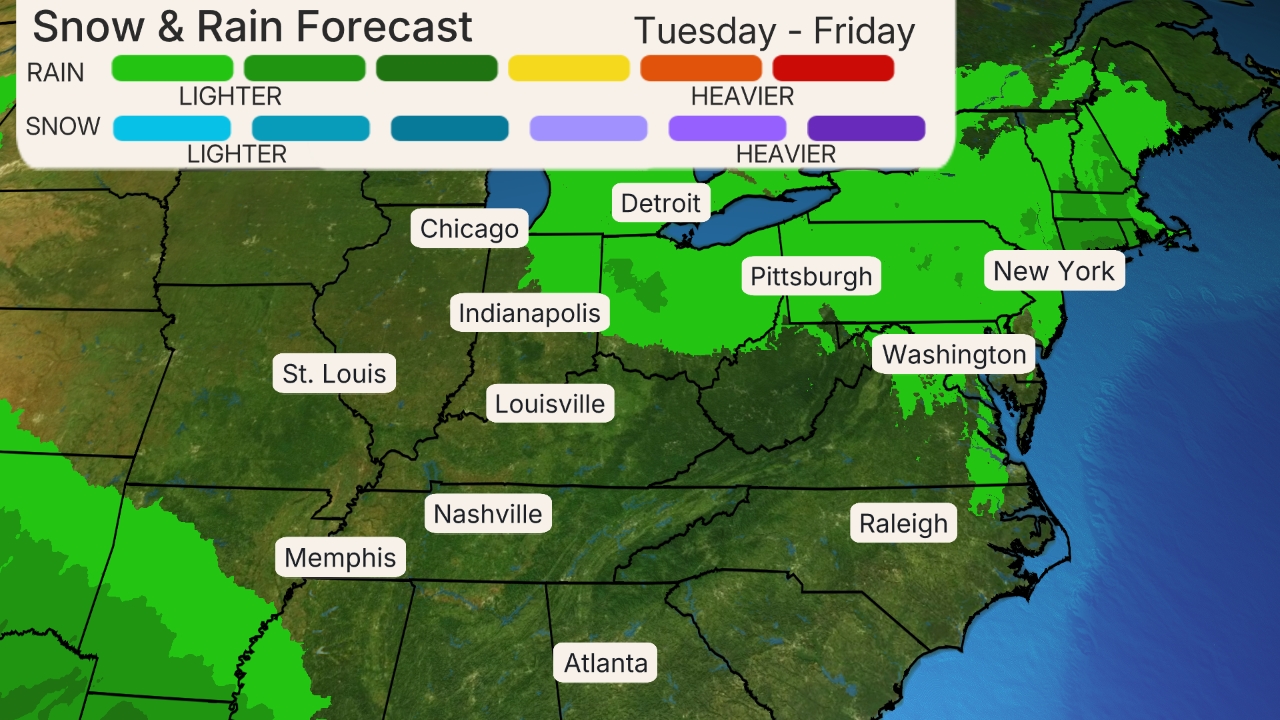
 Rainfall Forecast
This system is no threat to the mainland U.S.
According to Colorado State University tropical scientist Phil Klotzbach, Nana became the record earliest-in-season 14th storm, four days earlier than the previous record, Nate on September 5, 2005.
Entering the Peak of Hurricane Season
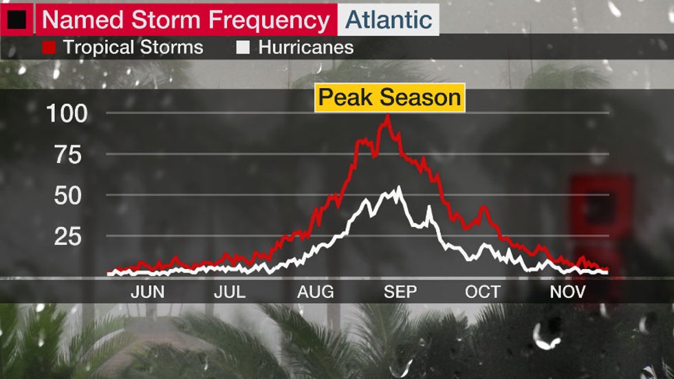
September is the peak month of hurricane season, and the most active day of the year is around Sept. 10, on average.
Colorado State University tropical scientist Phil Klotzbach said that roughly three-quarters of Atlantic hurricane seasons since 1966 have had at least one active named storm on Sept. 10. Also, half of all seasons have had at least one active hurricane on this date.
This doesn't guarantee every Sept. 10 will have a rash of Atlantic named storms.
There's an overlap of favorable factors in early-mid September, including ocean water reaching its highest temperature, the atmosphere's ability to generate thunderstorms hitting its peak, hostile shearing winds declining to a minimum and a parade of disturbances known as tropical waves acting as seeds for development that, while peaking in July, are numerous in September.

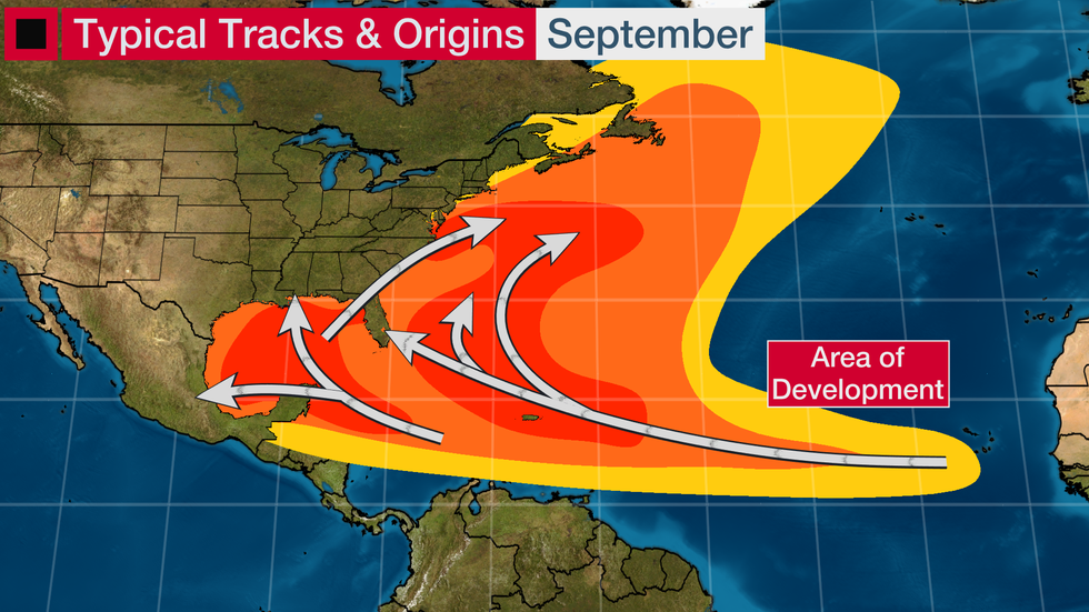
Tropical storms and hurricanes can form just about anywhere in the Atlantic Ocean this time of year.
The most common source of tropical storms begins to shift from tropical waves in the first half of the month toward cold fronts and other low pressure systems late in the month.

With 15 tropical storms on the books already, most forecasting agencies, including IBM, are forecasting 4 to 10 more tropical storms, which may include 3-7 more hurricanes.
Now is the time to make sure you have a hurricane plan in case another storm threatens this season.
Hurricane season continues until the end of November.
The Weather Company’s primary journalistic mission is to report on breaking weather news, the environment and the importance of science to our lives. This story does not necessarily represent the position of our parent company, IBM.
The Weather Company’s primary journalistic mission is to report on breaking weather news, the environment and the importance of science to our lives. This story does not necessarily represent the position of our parent company, IBM.

No comments:
Post a Comment