Jonathan Erdman
Wetter weather through Saturday in Washington and Oregon will bring some relief from the recent siege of wildfires, but a hotter, drier pattern change after that will raise fire weather concerns again in California and the West into the typically volatile month of October.
As of Friday, over half of the 77 large wildfires burning in the West were in California, Oregon and Washington, according to the National Interagency Fire Center (NIFC).
One of the largest wildfires in Los Angeles County history is burning in the San Gabriel Mountains near Mount Wilson, northeast of downtown Los Angeles.
(MORE: L.A. County's Bobcat Fire Threatens 1,000 Homes)
California already has almost doubled its previous record for acres burned in any year since the 1970s. Five of the state's six largest wildfires since the Great Depression have all occurred this year.
Rain late last week tamped down the acrid smoke in Oregon and Washington in one of the most severe, prolonged poor air quality events in at least 21 years in southern Oregon, even as those fires weren't yet put out.
More beneficial rain fell over several wildfires in Oregon and far northwest California Wednesday night and early Thursday.
Medford, Oregon, snapped its streak of over three months (99 days) without rain since the week before Father's Day, one of their longest dry streaks on record.
More Rain Ahead
There's more good news for the Northwest.
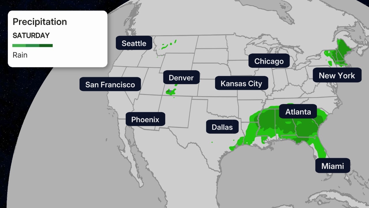
A wet pattern has settled into the Pacific Northwest. A series of weather systems steered by the jet stream will bring periods of rain to Washington, Oregon and the northern Rockies through Saturday.
 Current Pattern
The most significant rain will fall in western Washington and northwestern Oregon, particularly along the western slopes of the coastal ranges, Olympics and Cascades.
However, a decent soaking rain is also expected in Puget Sound and Oregon's Willamette Valley. Some rain should also make it into eastern Washington, the chimney of northern Idaho and northwest Montana.
Additional rain will also fall as far south as southern Oregon and far northwest California.
 Rainfall Forecast
Then Another Heat Wave
Unfortunately for the fire-weary West, there's another pattern change ahead.
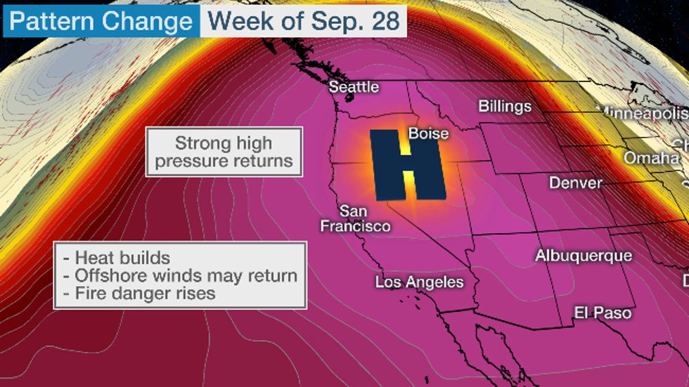
A dome of high pressure aloft will intensify again over the West, and push the jet stream well north into northwest Canada. This stubborn pattern could last through much of next week, possibly into the first weekend of October.
 Another
dome of high pressure aloft will intensify the week of Sep. 28,
bringing more hot, dry and potentially windy weather to the West.
Another
dome of high pressure aloft will intensify the week of Sep. 28,
bringing more hot, dry and potentially windy weather to the West.This means more persistently dry and hot weather for much of the West through next week.
While probably not as hot as the Labor Day weekend record heat wave, some record highs are possible in California and southern Oregon beginning as soon as Monday, according to the National Weather Service.
 6- to 10-Day Temperature Outlook
Along with the hot and dry weather, winds will also be a concern in some areas.
Red flag warnings and fire weather watches have already been issued in much of Northern California Saturday through Monday, including the northern Sierra, the coastal ranges, and the higher terrain around Napa Valley and the Bay Area.
Some north, northeast or east winds may develop, particularly in canyons and higher elevations, that could fan existing fires and lead to rapid spread of new wildfires.
 Fire Weather Alerts
October is notorious for wildfires in California. It caps off the state's dry season with more frequent Santa Ana and Diablo wind events. Typically, the rainy season doesn't start in the Bay Area and Southern California until November.
The Weather Company’s primary journalistic mission is to report on breaking weather news, the environment and the importance of science to our lives. This story does not necessarily represent the position of our parent company, IBM.
The Weather Company’s primary journalistic mission is to report on breaking weather news, the environment and the importance of science to our lives. This story does not necessarily represent the position of our parent company, IBM.

No comments:
Post a Comment