Linda Lam and Chris Dolce
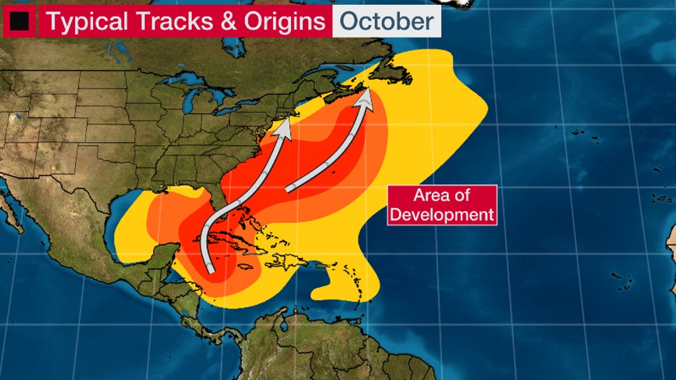
A tropical depression or storm may develop this weekend in the western Caribbean Sea, one of October's typical hot spots, but its future next week remains unclear.
A stalling-out frontal boundary arriving from the Gulf of Mexico, a tropical wave moving westward over the warmer-than-average Caribbean Sea could help develop a tropical depression or storm.
Some computer forecast models suggest something called a Central American Gyre, or CAG, could form. This "gyre" is a large, broad area of low pressure that often forms in late spring and early fall over Central America and the western Caribbean Sea.
What's important about the CAG is that it can instigate the development of tropical storms, often as spokes of energy rotating around it.
Such was the case with Tropical Storm Cristobal - and its eastern Pacific companion, Tropical Storm Amanda - in late May and early June.
Another example of a recent CAG-spawned storm was Hurricane Nate in early October 2017.
For now, the National Hurricane Center (NHC) says there is a better than 50/50 chance of tropical development in the western Caribbean Sea by this weekend.
A Hurricane Hunter mission may investigate the disturbance as soon as Friday afternoon, according to the NHC's "plan of the day" issued Wednesday.
 Area to Watch
It's too soon to determine exactly where this disturbance will track and how strong it may get, since it is yet to form and may not form at all.
For now, the majority of computer forecast models that do develop a depression or storm track it slowly in the general direction of Mexico's Yucatan Peninsula - including Cancún and Cozumel - this weekend, then possibly into the Bay of Campeche by early next week.
Those in the western Caribbean or near the Gulf of Mexico need to be aware of the potential for a developing system. Check weather.com for updates as those details become more clear over the next several days.
The other important note about a CAG is it often is a prolific rain producer in Central America. So, this setup could lead to dangerous flash flooding in parts of eastern Mexico, Belize, Guatemala, El Salvador, Honduras and Nicaragua regardless of whether a tropical depression forms or not.
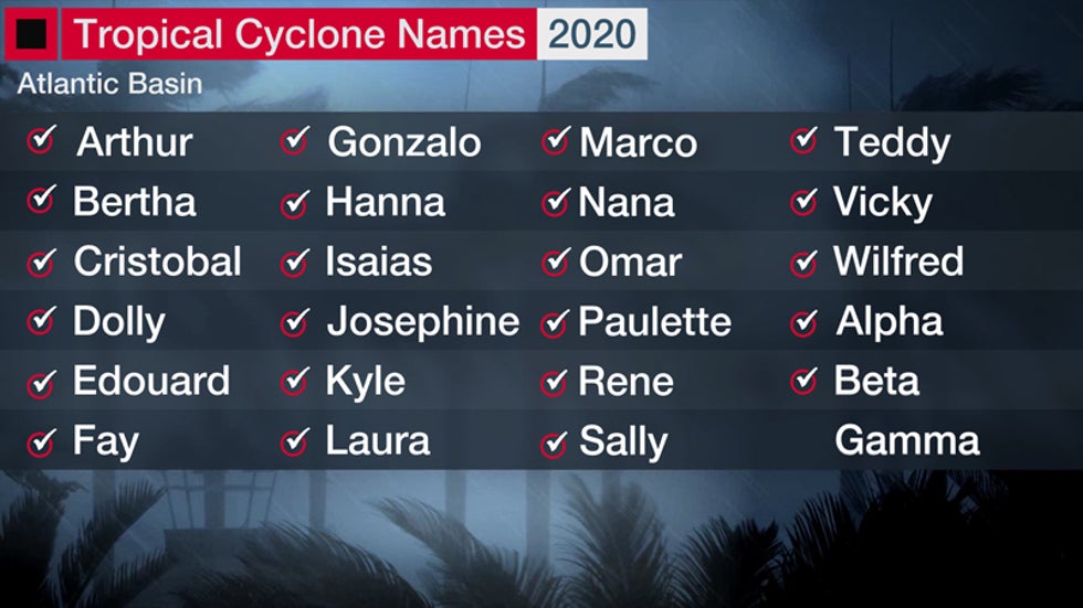
The next tropical storm to form in the Atlantic would be named Gamma.
(MORE: All the Records the 2020 Hurricane Season has Broken So Far)

Western Caribbean an October Hot Spot
Even though the climatological peak of the hurricane season – Sept. 10 – has passed, residents along the Gulf and East coasts need to remain prepared for a hurricane. Roughly one-fifth of all U.S. hurricane landfalls have occurred in October and November.
(MORE: What the Busiest Hurricane Seasons Have Delivered in October)
On average, one hurricane forms every year in October, according to the National Hurricane Center. The most hurricanes to form in October was five in 2010.
By October, the formation zones of tropical storms and hurricanes shift westward toward the western Caribbean Sea, eastern Gulf of Mexico and far western Atlantic Ocean as the "Cabo Verde" portion of the hurricane season, featuring the development of African easterly waves in the eastern Atlantic Ocean, fades.

In South Florida, October is the month with the most hurricane direct hits. Over two dozen October hurricanes have passed within 100 nautical miles of downtown Miami since 1851, according to NOAA's best track database.
Hurricane season quiets down as we head into November, especially for the United States.
There are just three known U.S. hurricane landfalls in the month of November dating to 1861.
Hurricane Kate in 1985 was the latest-in-season hurricane landfall in the U.S. Kate came ashore at Mexico Beach, Florida, on Nov. 21, a week before Thanksgiving.
The Weather Company’s primary journalistic mission is to report on breaking weather news, the environment and the importance of science to our lives. This story does not necessarily represent the position of our parent company, IBM.
The Weather Company’s primary journalistic mission is to report on breaking weather news, the environment and the importance of science to our lives. This story does not necessarily represent the position of our parent company, IBM.

No comments:
Post a Comment