Jonathan Erdman
A much chillier weather pattern has settled into the Midwest, East and South this week and there is the potential for frost and freeze, even a few snowflakes, as the calendar turns to October.
The autumnal equinox officially kicked off fall in the Northern Hemisphere last Tuesday, and as the calendar flips to October this week, it should also feel like fall in much of the eastern half of the nation.
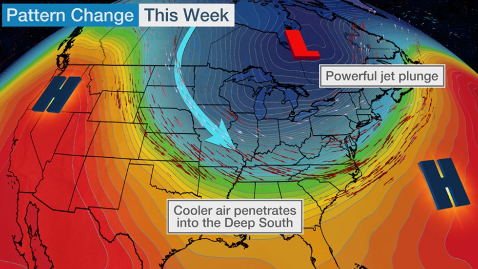
This change is being driven by a shift in the jet stream, which is taking a sharp southward nosedive over the central and eastern U.S. in response to a pair of high pressure systems bulging north over western North America and the western Atlantic Ocean.

This jet stream plunge will tap chillier air from Canada and pull it through much of the central, southern and eastern U.S. At the same time, it will bring drier and hotter weather to the fire-fatigued West.
This pattern should hold into early next week.
High/Lowlights
A second, reinforcing push of chilly air is dropping into the Midwest and will plunge through the South Thursday and Friday. Behind this second front, daytime highs won't rise out of the 40s in the northern Great Lakes, 50s in much of the rest of the Midwest and 60s as far south as the Tennessee Valley and Carolinas late this week.
(MAPS: 10-Day U.S. Forecast Highs/Lows)
Morning lows late this week could plunge into the 30s in the northern and central Plains, parts of the Midwest, and even in a few of the coldest spots of the Appalachians. The coldest spots in the northern Great Lakes will likely plunge into the 20s. Some of these areas could see their first frost or freeze of the season.
Lows in the 40s are likely into the Southern Plains and Deep South.
(MORE: The Earliest You Could See a Freeze in Your Area)
One final chilly reinforcement may plunge through the Midwest this weekend, then into the South early next week.
 Forecast Morning Lows
Lake-Effect Flakes?
There's one other interesting facet to this chillier pattern.
Water temperatures over the Great Lakes are usually still fairly near their annual peak as fall begins because of a summer's worth of heating.
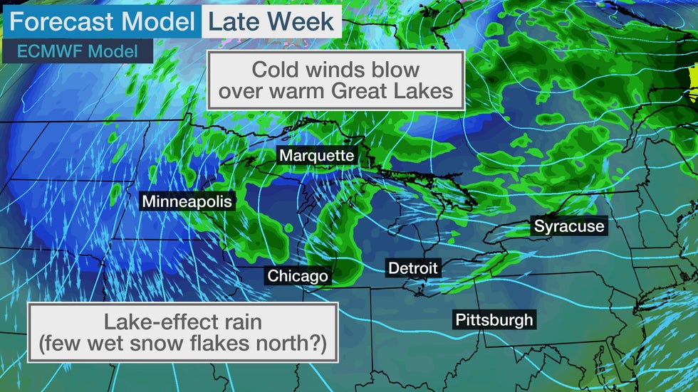
So colder air flowing over these relatively warm bodies of water will generate bands of lake-effect precipitation, primarily rain, at times this week.
 The setup for lake-effect rainbands later this week in the Great Lakes. A few wet snowflakes could also fall in the northern Great Lakes.
The larger the difference between the cold air and warmer lake, the more vigorous the lake-effect precipitation.
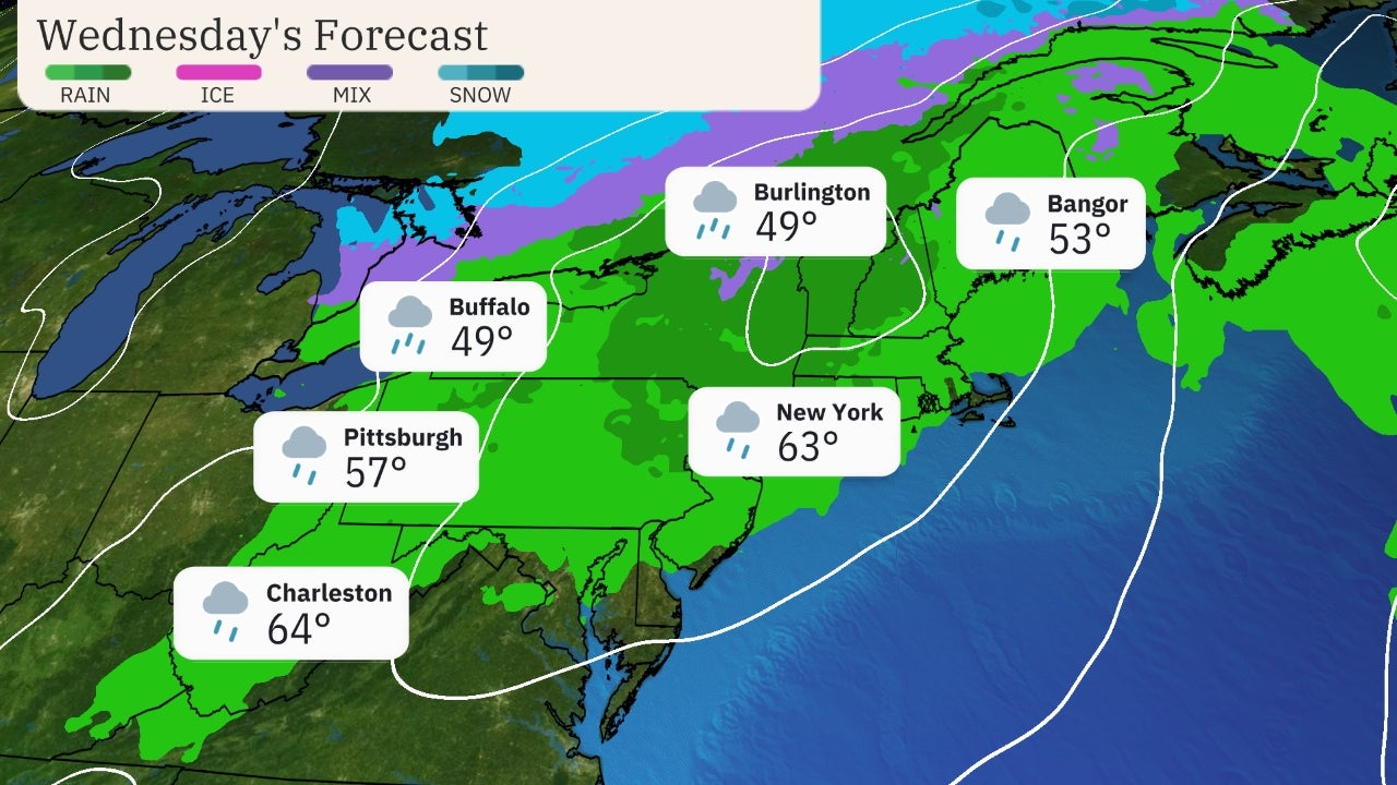
Wednesday afternoon, a band of lake-effect thunderstorms rolled off Lake Erie into Buffalo and other parts of western New York.
There were even some waterspouts Wednesday morning in the eastern Great Lakes, and more are expected through Thursday or Friday, given the air-lake temperature difference and the strength of spin in the atmosphere, or what meteorologists refer to as vorticity.
(MORE: October Temperature Outlook)
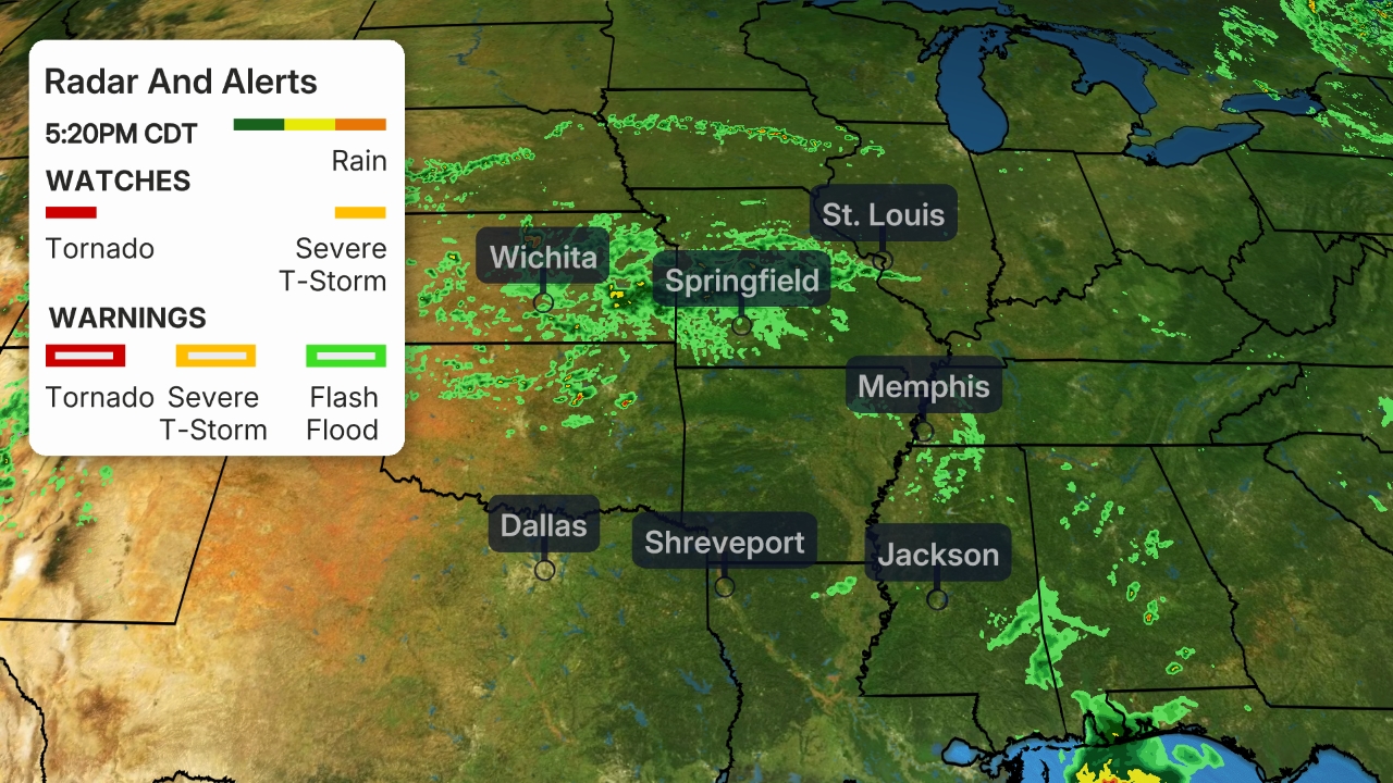
The deep cold air well above the surface was unstable enough to trigger thunderstorms with small hail in the Twin Cities and parts of Michigan, as well, Wednesday.

Parts of the northern Great Lakes could even see a few first snowflakes of the season mix in, most likely Thursday night and Friday night.
If this happens, it would primarily be away from the warmer lakeshore over the interior of Michigan's Upper Peninsula, extreme northern Wisconsin or perhaps the Arrowhead of Minnesota.
Quite the way to usher in October, right?
The Weather Company’s primary journalistic mission is to report on breaking weather news, the environment and the importance of science to our lives. This story does not necessarily represent the position of our parent company, IBM.
The Weather Company’s primary journalistic mission is to report on breaking weather news, the environment and the importance of science to our lives. This story does not necessarily represent the position of our parent company, IBM.

No comments:
Post a Comment