Updated Jun. 1, 2020 5:11 PM
The death toll continues to rise in Central America, following Amanda's landfall in Guatemala on Sunday as a tropical storm.
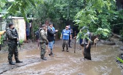
Interior Minister Mario Duran reported of at least 14 deaths in El Salvador as a result of Amanda, as of Sunday night. At least another 40,000 people were evacuated from their homes from the residual flooding.
Amanda strengthened quickly late Saturday into Sunday, going from a depression to a tropical storm before making landfall Sunday morning. Being given the name Amanda, this tropical storm became the first named storm of the 2020 East Pacific hurricane season.
By Sunday afternoon, Amanda was downgraded to a tropical depression and has since weakened to a tropical rainstorm. However, torrential rains continued across El Salvador and Guatemala.
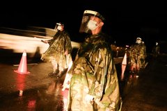
Officials in El Salvador issued an "Red Alert" and extended the state of emergency due to this surge of heavier rain.
Winds toppled over trees, causing power outages and blocking roadways that cut off communities.

The swollen Los Esclavos River flows violently under a bridge during tropical storm Amanda in Cuilapa, eastern Guatemala, Sunday, May 31, 2020. The first tropical storm of the Eastern Pacific season drenched parts of Central America on Sunday. (AP Photo/Moises Castillo)
In Guatemala, nearly 1,500 shelters have been opened for those affected by the storm.
There were reports that a home collapse in the Malpaso community of Guatemala injured two people and left one dead.
The President in El Salvador, Nayib Bukele, pledged on Sunday night that $10,000 would be given to each family in Comunidad Nueva Isreal whose home was flooded out by Amanda.
Reports of flooding were also emerging from Costa Rica at the end of the weekend.
"Amanda is only the second storm to make landfall on the Pacific side of Guatemala since the turn of the century. The last tropical system to do so was Tropical Storm Agatha in May of 2010," said AccuWeather Meteorologist Courtney Travis.
CLICK HERE FOR THE FREE ACCUWEATHER APP
Although Amanda has lost wind strength, the lingering disturbance will continue to bring heavy rainfall to central America into Tuesday.
The same rugged terrain that has helped to rip Amanda apart, will be most at risk for heavy rainfall early this week. Following hundreds of millimetres of rainfall that has already hit the area and completely saturated the soil, more rain is likely to trigger additional mudslides across Central America.

"Widespread rainfall amounts of more than 300 mm (12 inches) fell across Guatemala and El Salvador over the weekend," AccuWeather Senior Meteorologist Randy Adkins said.
These same areas could receive an AccuWeather Local StormMax™ of 500 mm (20 inches) this week as newly formed Tropical Depression Three keeps downpours in the area.
RELATED:
Even as Amanda dissipates, the atmospheric phenomenon that meteorologists refer to as a gyre, will continue to influence the area and bring heavy rain to Central America.
"A tropical gyre is just a large slowly spinning area of disturbed weather, that can be as wide as a 1,500 km (1,000 miles) in diameter. When they form over Central America, they can create extra moisture to spawn tropical development on the Atlantic side or the Pacific side or sometimes both," said AccuWeather Senior Meteorologist Alex Sosnowski.
The same gyre that generated Amanda could be powerful enough produce additional tropical activity in the first week or two of June, including in the western Caribbean or the Bay of Campeche.

This satellite image shows Amanda
Keep checking back on AccuWeather.com and stay tuned to the AccuWeather Network on DirecTV, Frontier and Verizon Fios.


No comments:
Post a Comment