Chris Dolce and Jonathan Erdman
Published: April 28, 2020
Derechos are large clusters of thunderstorms that most commonly form in late spring and summer and cause widespread destruction to trees, power lines and sometimes structures.
From the Spanish word for "straight", these windstorms leave wide, long areas of straight-line wind damage. The winds can be as strong as 60 to 100 mph or higher in extreme cases. They're usually produced by one or more curved lines of thunderstorms known as a bow echo or squall line.
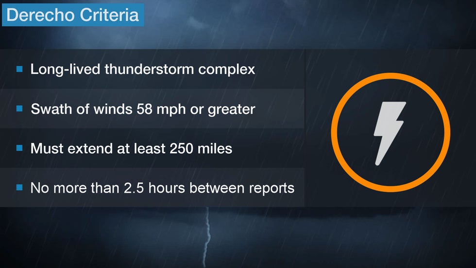
A single severe thunderstorm may produce an area of damaging winds only a mile or two wide and a few miles long, but derechos can produce damage tens of miles wide and hundreds of miles long. They should cover a distance of at least 250 miles, according to a 2005 study by Walker Ashley and Thomas Mote.
Cleanup from the extensive damage from a derecho can take days to weeks. In the worst derecho events, sometimes relief workers from other states are needed to aid in these efforts.

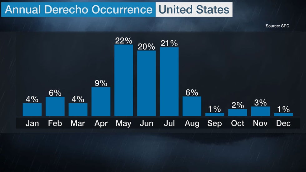
Derechos in the U.S. are most numerous during the late spring and summer. More than 60% of them occur between May and July, according to NOAA's Storm Prediction Center.
The study from Ashley and Mote found that both May and July average over four derechos per year. June is nearly as active with three to four derechos per year.

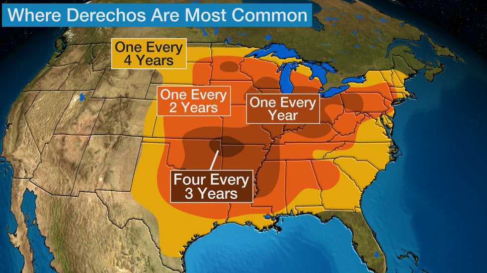
Derechos are a potential threat for many states east of the Rockies. But they are most common in parts of the Great Plains, Midwest and South.
They can occur during the daytime or in the overnight and early-morning hours when people are sleeping.

Ashley and Mote found derechos claimed 153 lives in the 18-year period of their study. Interestingly, three northern states - New York (23), Michigan (17) and Ohio (16) - comprised over a third of all derecho deaths.
Almost 70% of derecho fatalities occurred in areas other than a permanent building, including in vehicles (30 percent), in boats (19 percent), under trees (11 percent) and camping (9 percent).
June 2012 Super Derecho
One of the most notorious derechos in recent memory occurred on June 29, 2012, from the southern Great Lakes and Ohio Valley to the mid-Atlantic.
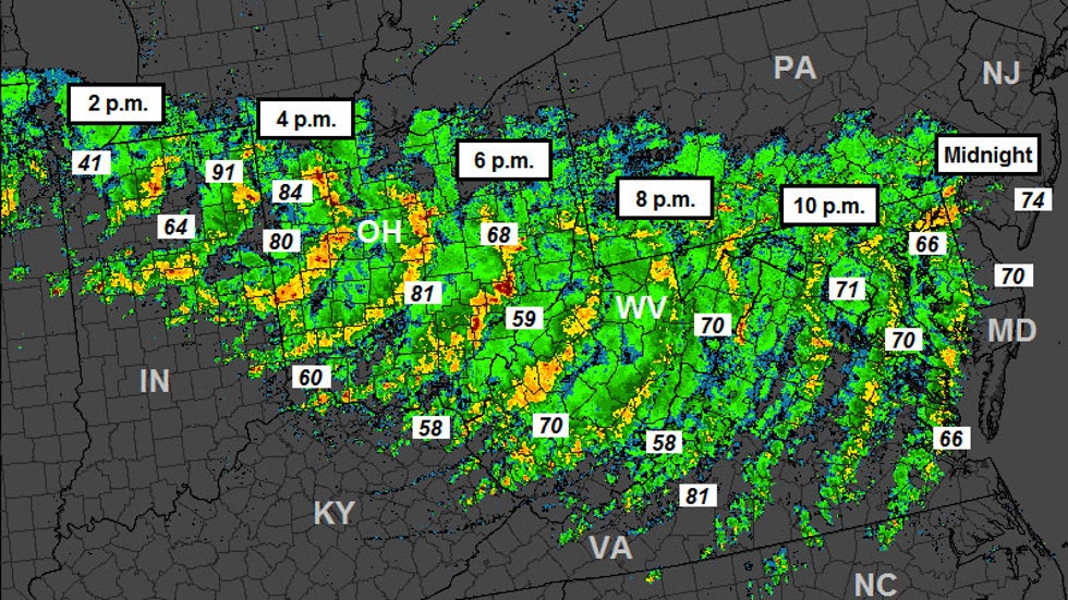
Over a roughly 13-hour period, a line of severe thunderstorms with damaging winds raced east-southeast at a forward speed up to 65 mph. It started west of Chicago in the late morning hours and tracked to the mid-Atlantic coast by around midnight.
Along this roughly 800 mile-long path, over 600 reports of high winds or wind damage came in from 11 states. Wind gusts in some spots topped 80 mph.
 Radar summary of the June 29, 2012, derecho. Plotted are some of the observed wind gusts in the derecho.
Power outages were on a massive scale. At its peak, 4.25 million customers were without power.
States of emergency were declared in Maryland, the District of Columbia, West Virginia, Ohio, and Virginia. Dominion Power compared the restoration effort to that from a hurricane.
Compounding the misery, a heat wave lingered in the mid-Atlantic states for the next week, with daytime highs in the upper 90s and 100s, as those without power tried to sweat it out.
The Weather Company’s primary journalistic mission is to report on breaking weather news, the environment and the importance of science to our lives. This story does not necessarily represent the position of our parent company, IBM.
The Weather Company’s primary journalistic mission is to report on breaking weather news, the environment and the importance of science to our lives. This story does not necessarily represent the position of our parent company, IBM.

No comments:
Post a Comment