weather.com meteorologists
Published: April 25, 2020
April is ending with an unpleasant weather pattern in the Northeast as wet and cool conditions will dominate the region.
This stretch of unsettled weather began earlier this week when rain and thunderstorms spread through the Interstate 95 corridor and snow developed across the interior Northeast. A dusting to a few inches of snow was reported by Wednesday morning from central New York and the Berkshires of western Massachusetts into parts of Vermont and northern Maine. Another system ended the work week on a cool and wet note.
Late Weekend-Early Week System
A southward plunge of the jet stream is in place over the Great Lakes and Northeast. This southward dip is will allow temperatures to be near or below average through the end of April there.
An area of low pressure will track off the Northeast coast Sunday night through Monday.
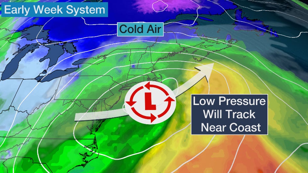
Rain will begin to develop in the mid-Atlantic Saturday night and will spread northward across most of the Northeast on Sunday. A few rumbles of thunder are possible, mainly from northeastern Virginia to the southern New England coast.
Colder air will arrive across the interior Northeast by Sunday night, and that could mean more snowfall for some areas. Snow or a rain-and-snow mix might develop in the higher elevations from West Virginia to parts of upstate New York and northern New England.
 Sunday Night's Forecast
Lower elevations of the Northeast will see rain persist through Monday and wet snow could last into Monday night in some of the higher elevations.
Winds will also increase and will be gusty at times Sunday through Monday, especially toward the coast.
Minor coastal flooding also cannot be ruled out.

Most areas can expect less than 2 inches of rainfall through Monday, although some pockets of heavier rain is possible.
Snowfall accumulations will range from a dusting to perhaps a few inches Sunday night into Monday in the higher elevations of New York and northern New England. Some higher elevations in southern Vermont, northern New Hampshire and western Maine could pick up close to a foot of snow.
 Rain and Snow Forecast Through Monday
Mid-to-Late Week Forecast
There won't be much of a break before another system will begin to arrive Tuesday night or Wednesday.
This next system will be slow moving and may bring precipitation to the Northeast through the end of the week.
Rain is generally expected with this system, although some snow may fall in northern Maine.
Some of the details remain uncertain so be sure to check back to weather.com for updates.
 Thursday's Forecast
The Weather Company’s primary journalistic mission is to report on breaking weather news, the environment and the importance of science to our lives. This story does not necessarily represent the position of our parent company, IBM.
The Weather Company’s primary journalistic mission is to report on breaking weather news, the environment and the importance of science to our lives. This story does not necessarily represent the position of our parent company, IBM.


No comments:
Post a Comment