Brian Donegan
Published: April 5,2020
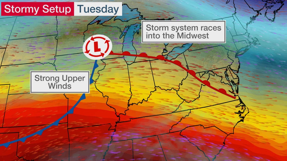
The risk for severe thunderstorms will return to the Ohio Valley on Tuesday as a new storm system races into the Midwest.
A cold front will slide eastward across the Ohio Valley while an area of low pressure develops and moves through the Great Lakes region.
Warm and somewhat humid air will surge northward into the Midwest ahead of the cold front, priming the atmosphere for strong to severe storms by late in the day Tuesday.
 Tuesday's Stormy Setup
Severe Thunderstorm Forecast
Tuesday-Tuesday Night
Severe thunderstorms might develop in the Ohio Valley late Tuesday into Tuesday night.
The greatest chance of severe storms is in an area from eastern Illinois into Indiana, southwestern Ohio and northern Kentucky.
Large hail and damaging wind gusts are the main threats, but an isolated tornado or two cannot be ruled out.
 Tuesday-Tuesday Night Severe Thunderstorm Forecast
Wednesday-Thursday
There might be additional strong to severe thunderstorms Wednesday and Thursday from the Ohio Valley and southern Great Lakes to the mid-Atlantic states.
Exact forecast details remain uncertain, so check back to weather.com for updates in the week ahead.
The Weather Company’s primary journalistic mission is to report on breaking weather news, the environment and the importance of science to our lives. This story does not necessarily represent the position of our parent company, IBM.
The Weather Company’s primary journalistic mission is to report on breaking weather news, the environment and the importance of science to our lives. This story does not necessarily represent the position of our parent company, IBM.

No comments:
Post a Comment