Chris Dolce
Published: March 25, 2020
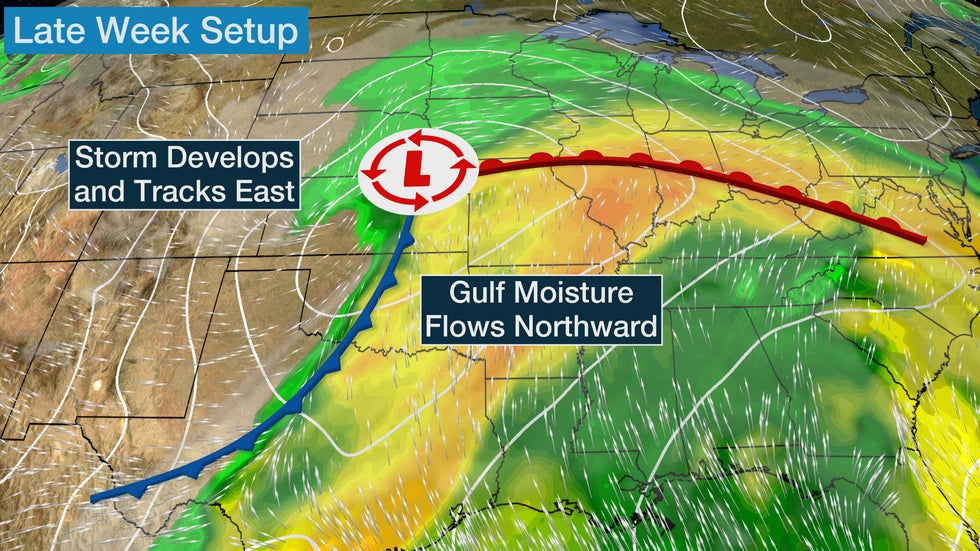
A new storm system will develop and track across parts of the Plains, Midwest and South late this week with widespread rain and the possibility of severe thunderstorms.
Low pressure is forecast to develop Friday in the Plains, where it will draw moisture northward from the Gulf of Mexico. From there, it will track toward the Great Lakes while intensifying into this weekend.
As a result, scattered showers and thunderstorms will develop Friday from parts of the central Great Plains into the Midwest and mid-Atlantic. There could also be a band of snow or a rain-and-snow mix in the northern and central High Plains.
For now, the greatest chance of severe thunderstorms is in eastern Oklahoma, southeastern Kansas and southwestern Missouri. In addition to large hail and damaging winds, there could also be a tornado threat.
 Friday's Forecast
Widespread showers and thunderstorms will continue from parts of the South and Midwest into the Great Lakes and Northeast as the weekend begins. A rain-and-snow mix is possible from central Minnesota into the Upper Peninsula of Michigan Saturday night.
The lower Ohio and lower Mississippi valleys will have the greatest chance of strong to severe thunderstorms Saturday.
The locations at risk for severe weather late this week could change in future updates since this storm system is still a couple of days away. Check back to weather.com for updates.
 Saturday's Forecast
The Weather Company’s primary journalistic mission is to report on breaking weather news, the environment and the importance of science to our lives. This story does not necessarily represent the position of our parent company, IBM.
The Weather Company’s primary journalistic mission is to report on breaking weather news, the environment and the importance of science to our lives. This story does not necessarily represent the position of our parent company, IBM.


No comments:
Post a Comment