WINTER WEATHER Updated Feb. 29, 2020 8:39 AM
One of the biggest lake-effect events of the season continued on Friday as snow totals across the Great Lakes steadily rose. The highest accumulations so far have occurred in western and upstate New York with many locations reporting 2-3 feet of snow.
Blizzard warnings were in effect for areas downwind of lakes Erie and Ontario, but have since been replaced with lake-effect snow warnings.
Cleveland, Erie, Pennsylvania, and Jamestown, New York, were several cities under a lake-effect snow warning Friday.

Areas just east of Lake Ontario have seen the worst of the lake-effect snow with over two feet piling up in some areas. Watertown, New York, reported nearly 7 inches of snow in just a two hour period on Friday morning.
In Carthage, New York, nearly 50 inches of snow had piled up by Friday night. In the village of Copenhagen, New York, about 90 minutes north of Syracuse, 28.5 inches had fallen through early Friday morning.
1/9
AccuWeather Reporter Dexter Henry said visibility was near zero Friday morning in Adams Center, New York. (Photo/Dexter Henry)
The State University of New York at Oswego canceled all classes after 12 p.m. Thursday and on Friday due to the high winds and heavy snow. The cancellations were in effect at the main campus in Oswego and the Syracuse campus.
The dicey conditions were documented by student Kaitlyn Jesmonth on her walk home from class on Thursday, where visibility is shown to be very low with snow blanketing the ground.
Powerful winds not only contributed to whiteouts, but also led to property damage. The 50-mph winds in the area caused damage to a building under construction in Henderson, New York, according to another Oswego State student, Jake Rumowicz, who captured a video of tarps on the construction site billowing in the harsh winds.
AccuWeather Senior Meteorologist Alan Reppert explained that lake-snow effect occurs when cold air travels over the comparatively warmer lakes and forms clouds that eventually produce snow. The term is regional and used in reference to the Great Lakes.
A blizzard is more than just heavy snow. "A blizzard is defined as a storm that brings sustained winds or wind gusts of 35 mph or greater and a visibility less than one-quarter of a mile for three consecutive hours," AccuWeather Senior Meteorologist Alex Sosnowski explained.
By 10:45 a.m. EST Thursday, the National Weather Service (NWS) office in Buffalo confirmed blizzard conditions had hit east of Lake Ontario.
The lake-effect snow was so intense on Thursday evening on the eastern shores of Lake Ontario that thundersnow was reported.
Winds will shift at the start of the weekend, causing the dangerous conditions to lighten up. For the season, Reppert said this will be one of the highest, if not the highest, amounts of snow for the region.
The New York State Thruway Authority has been consistently reminding motorists over social media to stay safe on the snowy roads and in "treacherous" conditions.
In the early hours of the morning on Thursday, the Thruway Authority placed a ban on empty tractor trailers on I-90 from the Lackawanna Toll Barrier to the Pennsylvania state line. The ban was lifted on Thursday night.
RELATED:
By Thursday evening, Fredonia, New York, had reported wind gusts of up to 62 mph. In Maine, where the remainder of the wintry storm was passing through, the highest recorded wind gust was 66 mph in Greenville.

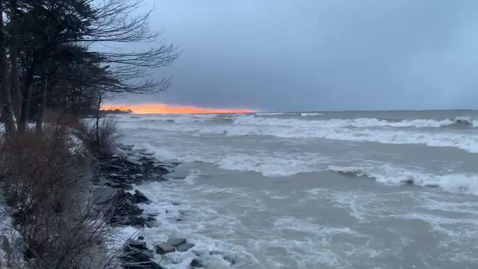
In a moment of calm, the sky cleared just enough for a "fiery" sunset Thursday evening through the clouds above Lake Ontario while the blizzard carried on just north.
Keep checking back on AccuWeather.com and stay tuned to the AccuWeather Network on DirecTV, Frontier and Verizon Fios.


No comments:
Post a Comment