Lake-effect snow with gusty conditions will continue for the eastern Great Lakes snowbelts through Saturday.
Bands of heavy lake-effect snow developed as a low-pressure system funnels cold west to northwesterly winds across the Great Lakes.
 Current Radar and Winds
The low-pressure system, named Winter Storm Odell by The Weather Channel, brought snow from the Great Lakes to northern New England. But the heaviest snow of the event was falling in the wake of Odell, in the form of lake-effect snow as winds align across the Great Lakes.
One lake snowband in particular was over 500 miles long, picking up moisture from Lakes Superior, Huron and Ontario, hammering areas from southern Ontario, Canada, to New York's Tug Hill Plateau, the National Weather Service in Gaylord, Michigan, noted.
Moisture and heat from Lakes Superior and Huron are feeding into a massive lake effect band that's stretching from near Eastern Upper Michigan to the Tug Hill Plateau downwind of Lake Ontario! The line looks broken thanks to radar beams overshooting the snow band.


29 people are talking about this
So far the highest total has been near Carthage, New York, which has picked up 40 inches of snow so far.
Watertown, New York, has picked up 31.6 inches of snow through Friday afternoon. The snowband drifted north into Watertown, New York, Friday morning, and snow fell at the rate of 3 to 4 inches per hour.
City of Watertown is doing their best at keeping up with sidewalk maintenance as heavy lake effect continues to batter the city. #NYwx #LakeEffect

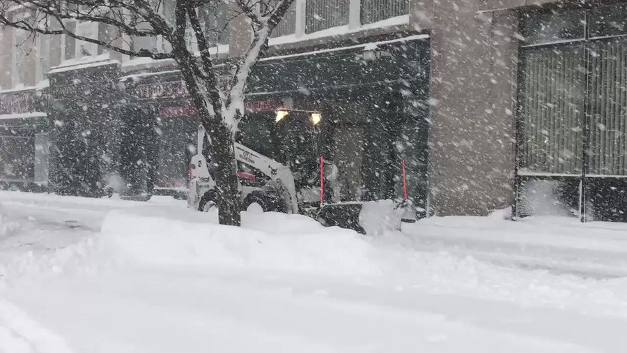
See Kris Hudson's other Tweets
A weather spotter near Copenhagen, New York, about 60 miles north-northeast of Syracuse, reported 28.5 inches of snow from the storm through Friday morning.
Images from back home, in #CopenhagenNY on the #TugHill, from this 2-day #lakeeffect event. Still much more snow to come today! #nywx


See Augusta Williams's other Tweets
Heavy lake-effect snow will continue into Saturday morning in western and central New York, northwestern Pennsylvania and northeastern Ohio.
The heaviest additional snowfall totals are likely to be southeast of Lake Erie in northwestern Pennsylvania and southwestern New York, and east of Lake Ontario in north-central New York. Snowfall rates could top 2 inches per hour in the heaviest snowbands, according to the National Weather Service.
Up to an additional half foot of snow could pile up from far northwest Pennsylvania into western New York.
How Does Lake-Effect Snow Develop?
Lake-effect snow happens when cold air flows over the relatively warmer lake waters in late fall and winter. That can lead to the formation of clouds and sometimes intense bands of snow in localized areas. For more details on the science behind lake-effect snow, see our explainer.
What's unusual about this year is that Lake Erie has less than 1% ice coverage on its surface. In a typical year, ice has covered about 62% of the lake by Feb. 27, according to the 1973-to-2019 average.
Since Lake Erie's waters are wide open, it's able to produce more significant lake-effect snow later in winter.
Storm Recap
Odell spread snow from the Northwest to the interior Northeast and New England, starting on the weekend of Feb. 22-23.
The top snow total from Odell was 31 inches in Lead, South Dakota, in the Black Hills near the Wyoming state line.
Odell then spread snow into the Midwest from Feb. 25-26. Though it produced less snow than earlier forecast in parts of the western Great Lakes, parts of northern Indiana, northwest Ohio and southern Lower Michigan picked up just over 6 inches of snow.
Odell then spread snow into parts of the interior Northeast, from western and central New York to northern New England. The storm was still producing snow across northern New Hampshire and northern Maine on Thursday.
A total of 11.1 inches was reported Thursday afternoon near Randolph, New Hampshire, while 11 inches fell just west of Carrabassett Valley, Maine.
As upper-level energy swung around to the south side of Odell, the storm took on an east-west configuration. This allowed strong west and northwest winds to blow across the Great Lakes for several days, a favorable set-up for lake-effect snow.
Because of unusually mild temperatures this winter, the amount of ice cover has been running well below average across the Great Lakes. This open water enhanced the temperature contrast between the surface and the colder air aloft, which supported intense lake-effect snow.
Blizzard conditions – wind gusts of at least 35 mph and visibilities of less than one-quarter mile for at least three hours – were reported in Watertown, New York, for six hours on Thursday, and near-blizzard conditions continued into Thursday night.
A lightning strike or two on the Tug Hill Plateau were even reported by NWS Buffalo Thursday evening.
In the snow-prone area just south of Buffalo, one location near Springville reported 13.5 inches and Stockton picked up 10 inches by late Thursday.
Winds gusted as high as 62 mph north of Fredonia, New York, 60 mph both in Oswego and Watertown and 59 mph in Buffalo, according to the National Weather Service.
More echelon plowing, this time on I-81 in #JeffersonCounty. The safest place to be is well behind the plows where the road is clear.#DontCrowdThePlow

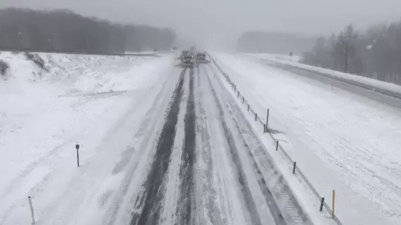
21 people are talking about this
Lakeshore flooding was reported along Route 5 near Hamburg, New York, and portions of the roadway were closed due to the flooding and spray on Thursday. Several homes were coated in a thick layer of ice.
Water levels on the eastern end of Lake Erie rose as much as 3 feet in 24 hours from Wednesday afternoon into Thursday afternoon. While these rises wouldn't usually be a problem, the already higher-than-usual lake levels made impacts a bit higher than they otherwise would have been.
The water level on Lake Erie at Buffalo has risen 3 feet so far and will continue to rise today as west winds increase. Watch for flooding along the lakeshore in places such as Buffalo Harbor, Hamburg, and Dunkirk Harbor. Water is already spraying across Route 5 in Hamburg. #nywx


31 people are talking about this
Lakeshore flooding was also documented in Erie, Pennsylvania, Thursday.
The Weather Company’s primary journalistic mission is to report on breaking weather news, the environment and the importance of science to our lives. This story does not necessarily represent the position of our parent company, IBM.
The Weather Company’s primary journalistic mission is to report on breaking weather news, the environment and the importance of science to our lives. This story does not necessarily represent the position of our parent company, IBM.


No comments:
Post a Comment