WINTER WEATHER Updated Jan. 27, 2020 2:48 PM
An onslaught of storms and rising snow levels will contribute to a heightened danger of flooding and landslides across the Pacific Northwest this week.
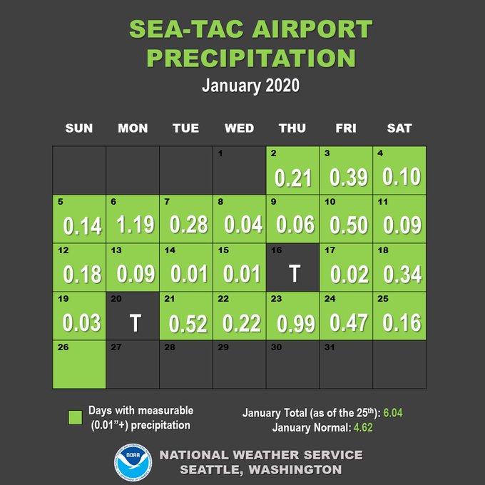
Storms have been frequent visitors to the region this month, with many cities running above normal in terms of their average precipitation.
With the ground already saturated and more rain on the way, there will be little room for additional water to drain into area creeks and streams that are already running high.
Snowmelt from rain and rising temperatures at the intermediate elevations will add a further surge of water downstream.
"The Pacific Northwest will continue to get pounded with heavy rain and flooding this week," AccuWeather Lead Long-Range Meteorologist Paul Pastelok said.

This image, taken during midday Monday, Jan. 27, 2020, shows storms lining up across the northern Pacific Ocean en route to the northwestern United States. (RAMMB/CIRA)
An active Pacific jet stream will keep storms flowing into the region on a 24- to 48-hour basis.
One storm arrived over this past weekend bringing with it areas of rain and snow.

The next significant round of moisture arrived on the coast during Monday and is forecast to spread inland and linger through Tuesday, bringing poor travel conditions with wet roadways to the Interstate-5 corridor from Seattle to Medford, Oregon.
Enough cold air will be present for snow to fall down to pass level, including I-90's Snoqualmie Pass in Washington. Travelers along this stretch will need to be wary of slippery roadway conditions and lane restrictions.
Another dose of soaking rain will accompany a new storm at midweek. This storm will likely take a more northern track, resulting in milder air encompassing the entire Northwest.

A firehose of moisture is expected to remain aimed at the Pacific Northwest through late week. The stream of heaviest rainfall is expected to focus on western Washington and Vancouver Island in British Columbia, Canada.
"Widespread significant flooding is a big concern," Pastelok said.
Cumulatively through the week, rainfall totals could approach a foot along the western foothills of the Cascades and range between 3-6 inches closer to the coast.
RELATED:
Motorists are advised to turn around whenever high water is encountered on the roadway, finding a safer alternate route instead.
"Motorists should exercise caution along secondary mountainside roads as debris may have washed onto the road surface or the road may have been washed away in some extreme cases," AccuWeather Meteorologist Brandon Buckingham said.
Road closures will be possible where mudslides or landslides have occurred.

Snow levels will be high and above pass level much of the time during the middle and latter part of the week, according to Pastelok.
The risk of river flooding will be highest during this time due to the combination of rain and snowmelt. In addition, mountain slopes may be more prone to avalanches due to the changing snow levels.
AccuWeather long-range meteorologists predict the weather to turn quieter during the first several days of February as colder, drier air dives southward across the Northwest.
During the transition period from mild and stormy to cold and fairly tranquil, there may be an opportunity for snow to return to the lower elevations.
Keep checking back on AccuWeather.com and stay tuned to the AccuWeather Network on DirecTV, Frontier and Verizon Fios.


No comments:
Post a Comment