Hurricanes may be the farthest thing from your mind in cold and snowy January, but they've developed before in the Atlantic Basin as recently as four years ago.
In 2016, a low-pressure system made a journey across the Atlantic Ocean from near the Bahamas on Jan. 6 to the eastern Atlantic Ocean six days later.
By Jan. 12, this low had lost its cold and warm fronts, and enough thunderstorms percolated near the low-pressure center for it to be named Subtropical Storm Alex by the National Hurricane Center.
A look at the non-tropical low that was off the Southeast coast Jan. 7, 2016, then moved across the Atlantic before forming into Alex.
Alex didn't stop there.
As thunderstorms continued to pump warmer air up into the core of Alex's circulation, it eventually strengthened into a hurricane on Jan. 14, exhibiting an eye in satellite imagery.
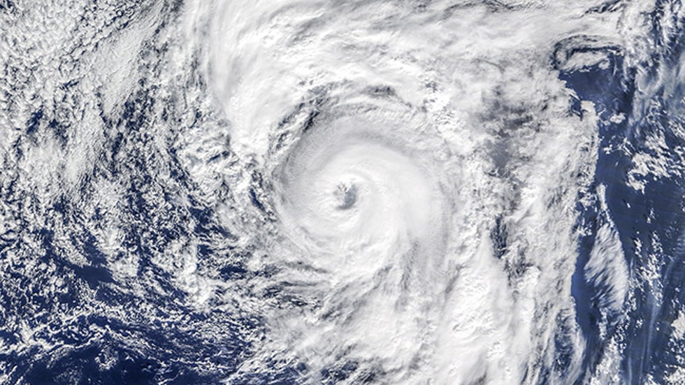
The sight of an Atlantic hurricane with a distinct eye on a mid-January global satellite image from Meteosat-10 was surreal.
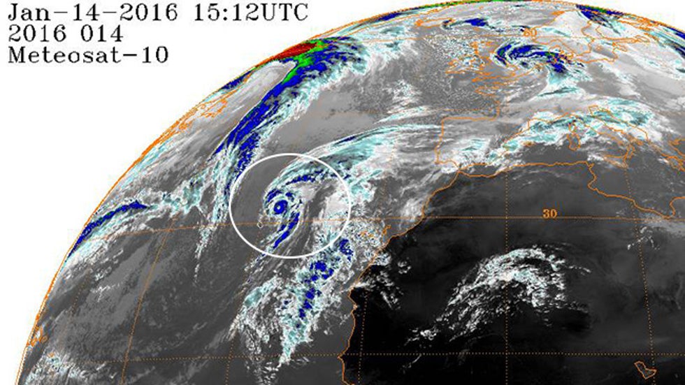
Alex became the strongest January hurricane on record, with maximum sustained winds reaching 85 mph on Jan. 14.
It made landfall on the island of Terceira in the central Azores one day later as a tropical storm.
Alex then transitioned back to an extratropical cyclone – the type you're used to seeing on weather maps with fronts – and took a bizarre turn back toward Atlantic Canada, as The Weather Channel senior meteorologist Stu Ostro documented in an excellent blog post.
A typical rule of thumb used by meteorologists is that water temperatures at least 26 degrees Celsius (about 79 degrees Fahrenheit) are needed to help generate tropical storms and hurricanes.
So how did Alex become a hurricane over water that was only around 22 degrees Celsius in January?
Air several thousand feet above the surface was cooler than usual. This made the atmosphere unstable and allowed thunderstorms to develop near Alex's core despite the marginally warm sea-surface temperatures.
"Usually, storms that form after the season do so from non-tropical sources, including upper-level lows and cold fronts," National Hurricane Center hurricane specialist Eric Blake told weather.com in 2017. "A common scenario is when an upper low cuts off and sits over warmer than normal water for a few days beneath a blocking pattern."
When that happens, clustering thunderstorms can turn what was originally a cold-core, non-tropical system into a subtropical storm, tropical storm, or in Alex's case, a January hurricane.
Has This Happened Before?
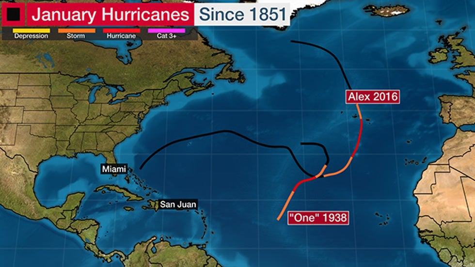
Only one other hurricane was known to have formed in January in the Atlantic Basin.
A 1938 hurricane took a bizarre south-southwest hook in the central Atlantic Ocean, according to a 2014 reanalysis of historic hurricane tracks by NOAA's Hurricane Research Division.
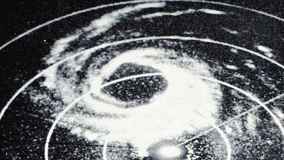
On New Year's Eve 1954, Alice became a hurricane before slamming into the northern Leeward Islands at Category 1 intensity on Jan. 2, 1955.
A pair of unnamed tropical storms were found in reanalysis to have formed in January 1951 and 1978 in the central Atlantic Ocean.
The final named storm of the record 2005 hurricane season, Tropical Storm Zeta, formed on Dec. 30 but persisted until Jan. 7, 2006.
According to NOAA's Hurricane Research Division, 97% of all Atlantic tropical storms and hurricanes from 1851 to 2013 occurred within the June 1 to Nov. 30 official hurricane season.
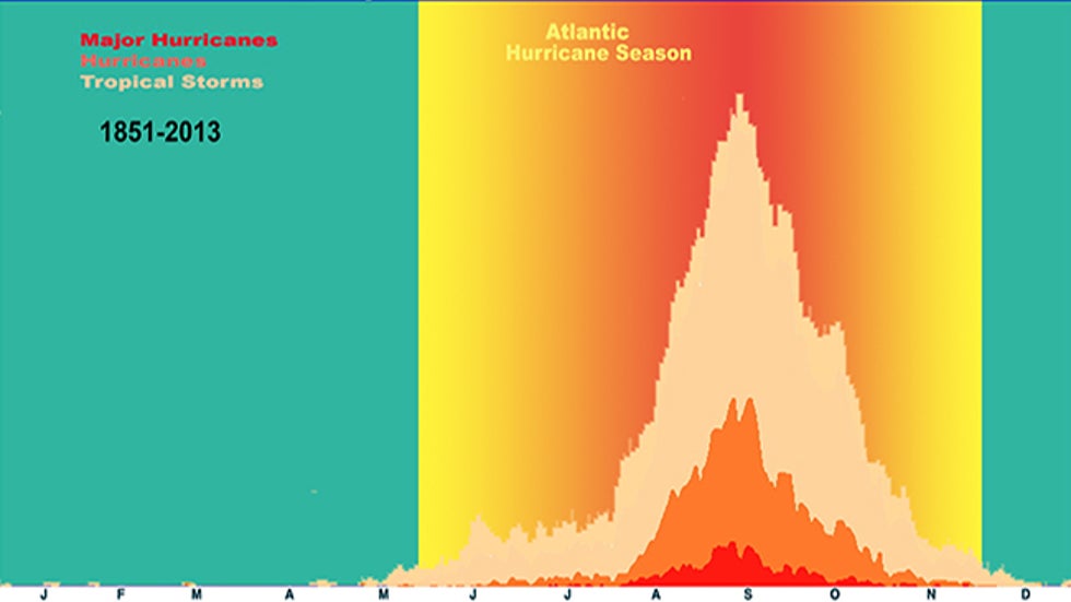
The other 3% formed in the "offseason," primarily in December, but also in January, February and March.
The Weather Company’s primary journalistic mission is to report on breaking weather news, the environment and the importance of science to our lives. This story does not necessarily represent the position of our parent company, IBM.
The Weather Company’s primary journalistic mission is to report on breaking weather news, the environment and the importance of science to our lives. This story does not necessarily represent the position of our parent company, IBM.

No comments:
Post a Comment