Updated Jun. 1, 2020 12:38 PM
Following a stifling heat wave that set records in many parts of the West last week, heat will shift away from some areas, while others remain in its grip this week.
From the middle through the end of last week, heat expanding from the Central Valley of California across the vast majority of the West led to several major cities setting daily records on one or two days.
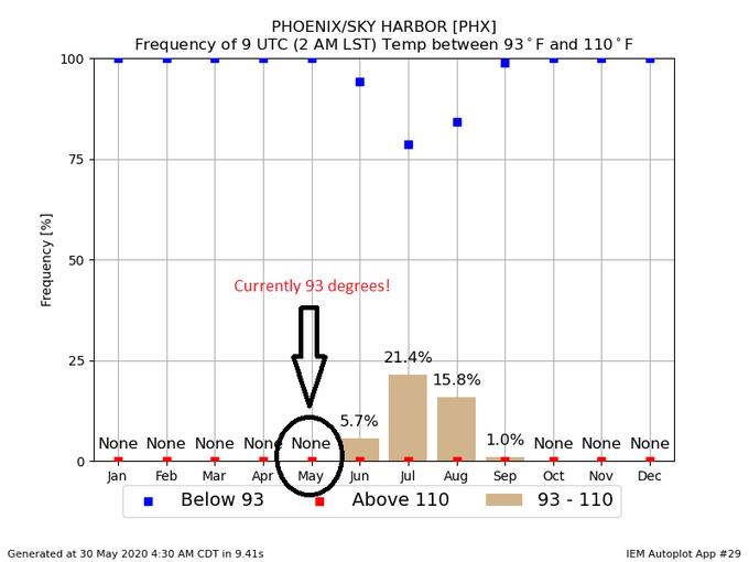
Phoenix came just two degrees shy of it's all-time May record of 114 degrees Fahrenheit on Friday. However, Friday's high of 112 did set a new record for that day, breaking the old record from way back in 1910. With a high of 111 and a low of 84 on Saturday, the average temperature of the day in Phoenix was 98, just 1 degree shy of the May record for daily average temperature.
Boise, Idaho soared to 98 on Saturday, tying the record for the day and falling just 1 degree shy of the record of 99 for the entire month of May.
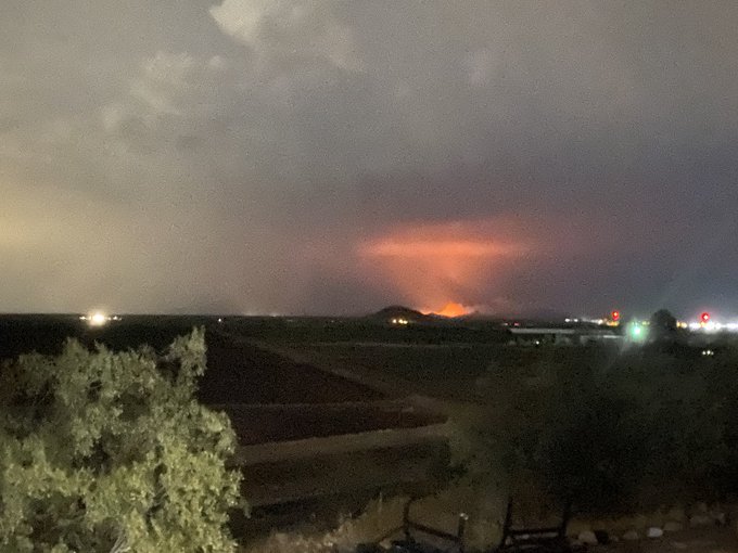
Thunderstorms fired up in the heat across parts mountain west, and may have led to the ignition of wildfires in Utah and Arizona. The wildfire in Arizona, named the Ocotillo Fire, has already destroyed at least 20 structures.
Heading into the first days of June, not much will change across the Southwest.
"The core of heat that baked the West last week will shift eastward a bit, but much of the Southwest and central and southern Rockies will remain very hot," said AccuWeather Meteorologist Brandon Buckingham.
High temperatures in Phoenix will remain in the middle 100s to around 110 through Thursday. Similarly, Las Vegas will be in the triple digits through Thursday. While both places are likely to fall just short of any records for the first few days of June, these temperatures are still several degrees above normal.

Following a cooldown from a storm system that dumped much-needed rainfall and also brought severe thunderstorms to the Northwest, the interior portions of California will also be feeling the heat again this week.
After spending Sunday and Monday with temperatures much closer to normal, Sacramento and Fresno will climb back toward the century mark for the middle of week. Much of the Inland Empire east of Los Angeles will be back into the 90s.
RELATED:
While interior areas are feeling the heat, the coast will be a much different story.
"A nearly stationary area of low pressure sitting off of the California coast for much of this week will lead to onshore flow and much cooler conditions at the coast," explained AccuWeather Meteorologist Tyler Roys.
Along with the cooler conditions at the coast, this pattern will also be conducive to expansive low clouds and fog pestering coastal areas.

A tower from the Golden Gate Bridge in San Francisco rises over a blanket of fog on Jan. 13, 2017. (AP Photo/Marcio Jose Sanchez)
"The contrast of building heat just inland and the cool ocean waters often leads to persistent low clouds and fog along the California coast this time of the year," Roys explained. "So persistent and regular is the phenomenon this time of year that it is often referred to as 'June gloom.'"
The Northwest will also see a reprieve from the heat. While a few spotty mountain showers and thunderstorms can't be ruled out, a storm track through southern Canada will keep the bulk of rainfall just to the north of the Canadian border through the middle of the week.
However, this will also help to keep the intense heat suppressed farther south.
"Along the coast and into the Cascades temperatures will hover right around normal much of this week," Roys explained. "In interior areas it will be a little warmer, with much of the area seeing high temperatures around 5-10 degrees above normal."

For Portland and Seattle, temperatures will generally range from the upper 60s to the lower 70s. Much of the valley areas from central Washington and Oregon into southern Idaho will spend most of the week in the 80s.
The next few days will be very favorable for hikers and any outdoor enthusiasts to enjoy the great outdoors in the Northwest.
However, another pattern change is on the way for the end of the week into next weekend. The low pressure off of the California coast will merge with low pressure diving southward along the Northwest Coast and then push across the West.
This will bring a very active period to end the week with numerous showers and thunderstorms erupting in the mountains and rainy, cool weather returning to the Northwest. Heat will also be trimmed in the Southwest.
Keep checking back on AccuWeather.com and stay tuned to the AccuWeather Network on DirecTV, Frontier and Verizon Fios.


No comments:
Post a Comment