Lots of snow has fallen on the nation's northern tier, but snowfall has been lackluster for much of the East Coast and South because of a persistent storm track.
Blame the jet stream. Most of the winter has lacked a persistent southward-dipping jet stream east of the Mississippi River, which has not only kept temperatures warmer than average, but has also steered storm systems to the north of the Ohio River and Mason-Dixon line.
The result is a persistent storm track that's unfavorable for major Northeast snowstorms.
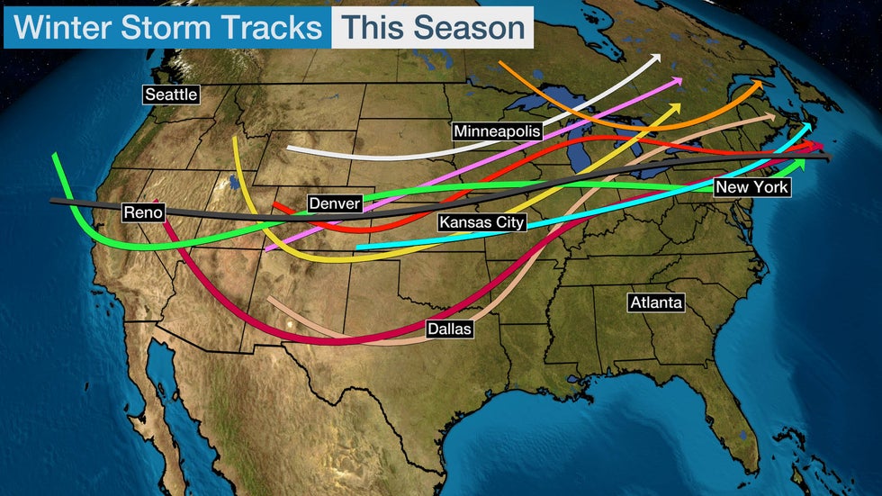
The map below illustrates the tracks of winter storms so far this winter. Each colored arrow represents the approximate track of each center of low pressure.
Most of the season's winter storms have tracked out of the West or Rockies and into the Central or Southern Plains, Midwest, Great Lakes and New England.

Typically, the heaviest snow from a winter storm falls on the northern and western sides of the center of low pressure.
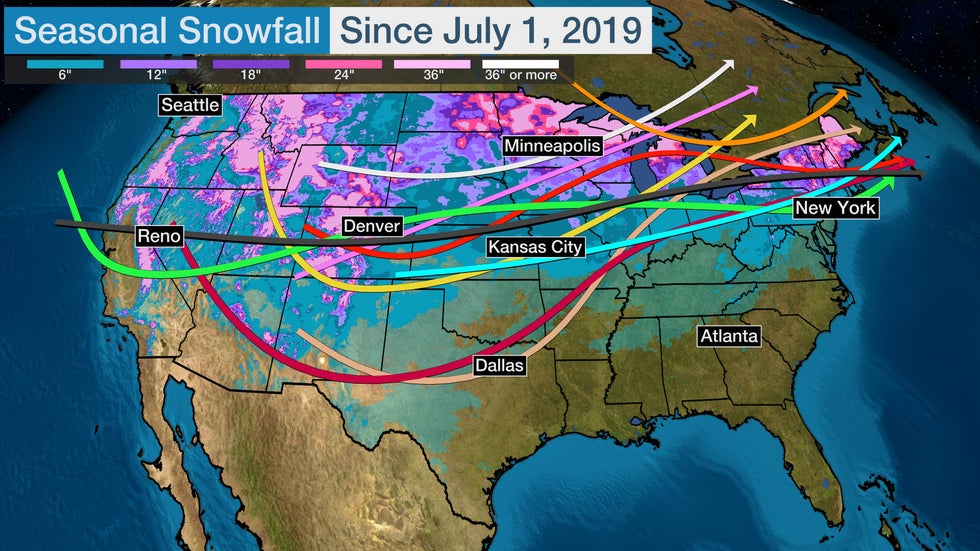
Given this season's persistent storm track, the heaviest snow has been confined to the nation's northern tier, rather than farther south into parts of the mid-Atlantic or South.
The map below shows how much snow has fallen in the Lower 48 states so far this winter. The areas in the purple and pink contours have picked up the most snowfall through Jan. 20. This includes parts of the Mountain West, Rockies, Northern Plains, upper Midwest, northern Great Lakes, upstate New York and northern New England.

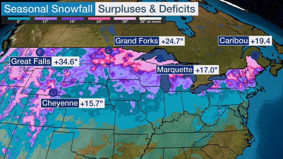
Many cities in the northern tier have seasonal snowfall surpluses due to this persistent storm track, while areas farther south are running behind their long-term averages.
As a result, the usual contrast between northern and southern snowfall has been accentuated this winter.
Great Falls, Montana, has received 63.5 inches of snow so far, which is nearly 3 feet above average by this point in the season. Grand Forks, North Dakota, has picked up 51.9 inches through Jan. 20, which is just over 2 feet above average by that date.
Both of those cities have already had more than a typical entire season of snowfall, and it's still January.
Caribou, Maine; Cheyenne, Wyoming; and Marquette, Michigan, have all measured over a foot of snow above their seasonal averages.

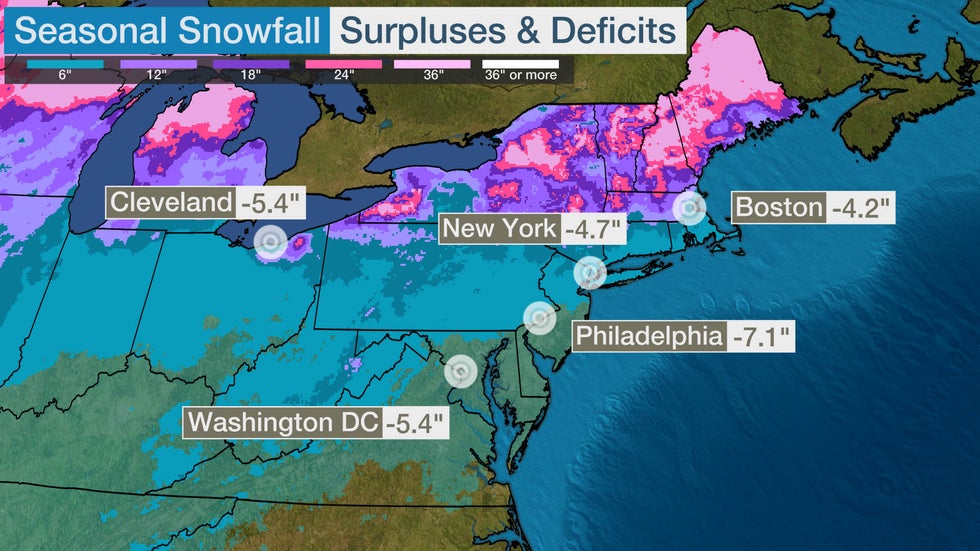
The opposite is true for many of the larger cities in southern New England and the mid-Atlantic, including those along the Interstate 95 corridor.
A measly 0.3 inches of snow has been tallied in Philadelphia this winter, about 7 inches below average by this point in the season. Only 0.6 inches have been measured in Washington, D.C., a deficit of more than 5 inches.
New York City and Boston are running more than 4 inches behind their averages through Jan. 20.

For those hungry for snow in the Northeast and mid-Atlantic, storms would need to shift farther south or track up the East Coast so that those regions are on the colder northern and western sides of the low-pressure systems.
That would increase the odds of colder air remaining in place, instead of being swept out and causing any minimal snow to change over to a wintry mix or rain, which has been the case so far this winter.
Late January into February is the peak time for major Northeast snowstorms, so the snow-starved should not write off this winter yet.
The Weather Company’s primary journalistic mission is to report on breaking weather news, the environment and the importance of science to our lives. This story does not necessarily represent the position of our parent company, IBM.
The Weather Company’s primary journalistic mission is to report on breaking weather news, the environment and the importance of science to our lives. This story does not necessarily represent the position of our parent company, IBM.

No comments:
Post a Comment