Snow, ice and rain will slow down travel from parts of the Plains and Midwest into the Northeast as a storm system tracks through those regions early this week.
This system has been named Winter Storm Finley by The Weather Channel.
A low-pressure system will move from the South toward the northeastern U.S. through Tuesday.
This will generate snow and some ice where the moisture pulled in by the low overlaps with cold air supplied by high pressure to its north. Rain and thunderstorms are expected in the South, and some of those thunderstorms could turn severe.
Happening Now
Snow from this storm is ongoing this morning from the Southern Rockies into parts of Kansas, Nebraska and Missouri. This includes stretches of interstates 70, 80, 29 and 35.
Accidents have been reported in the Kansas City metro area Sunday morning as snow quickly covered roads.

The National Weather Service has posted winter storm warnings and winter weather advisories from the southern Rockies into the Central Plains, mid-Mississippi Valley, Ohio Valley and central Appalachians. This is where snow and ice could result in hazardous travel conditions.

Here's an overview of the forecast timing and how much snow and ice you can expect.
Sunday-Sunday Night
Low pressure will begin to organize in the Southern Plains and start its trek eastward.
A band of snow and some freezing rain or sleet will extend from the Ohio Valley into the mid-Mississippi Valley, Central Plains and Four Corners, including a stretch of Interstate 70 from Kansas City to St. Louis.
Sunday night, that wintry mess will spread through the rest of the Ohio Valley and begin in parts of the mid-Atlantic states.

Monday-Monday Night
The new workweek will start with an expansive area of wintry weather advancing through the Central Plains into the Midwest and mid-Atlantic.
Areas from Kansas to southern New England will have the best chance of snow Monday into Monday night. Sleet and freezing rain will fall south of this snow shield from the mid-Mississippi Valley to the mid-Atlantic states.
Washington, D.C., Baltimore and Philadelphia could begin with a mix of snow, sleet and freezing rain before changing to rain. New York City might see light snow during the day and evening before changing to rain overnight.
Snowy conditions will affect travel beginning late Monday night as far north as Boston and Albany, New York.
Much of the South will have rain and thunderstorms. Some of those thunderstorms could turn severe in parts of the lower Mississippi and Tennessee valleys.

Tuesday
The storm will continue to track through the Northeast on Tuesday.
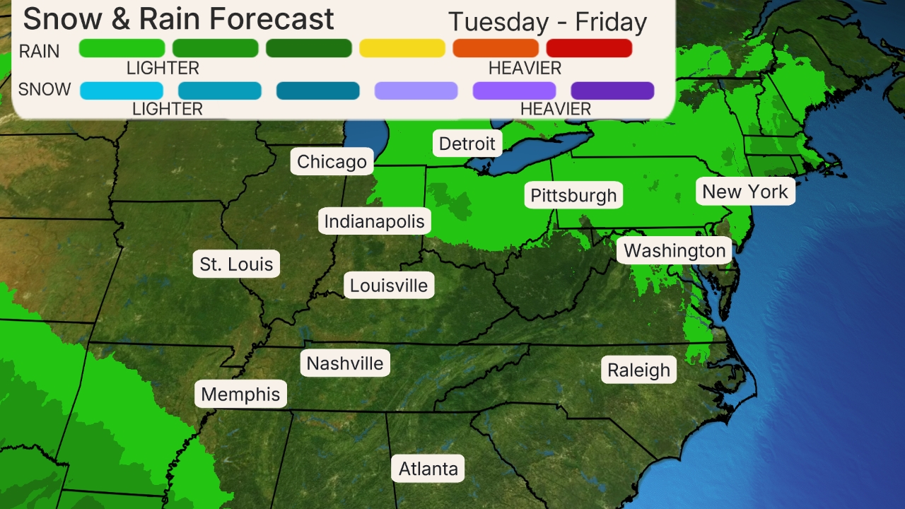
There will be additional snow, sleet and freezing rain from parts of western and northern Pennsylvania to New York state and New England. Rain showers are expected from New York City southward into the mid-Atlantic.
Some lingering snow is possible Tuesday night in parts of upstate New York and New England as the storm moves away.

How Much Snow and Ice?
In general, this will be a modest, but disruptive snow and ice event that will likely trigger travel problems for tens of millions from the Plains to the Northeast.
The best chance of higher snowfall totals stretches along the Interstate 70 corridor from eastern Kansas into southern Illinois, as well as in central and upstate New York into western New England. Snowfall totals of 5 inches or more are possible in these areas.

Ice accumulations are possible from parts of southern Kansas into the Ohio Valley and Northeast.
While some locations on the southern end of the ice area may change over to rain, you should expect icy roads, particularly bridges and overpasses, for a time in the areas shaded in the map below.
Some areas of the mid-Mississippi Valley and interior Northeast may receive higher ice accumulations that could lead to some tree damage and power outages, though a widespread, destructive ice storm is not expected.

The Weather Company’s primary journalistic mission is to report on breaking weather news, the environment and the importance of science to our lives. This story does not necessarily represent the position of our parent company, IBM.
The Weather Company’s primary journalistic mission is to report on breaking weather news, the environment and the importance of science to our lives. This story does not necessarily represent the position of our parent company, IBM.

No comments:
Post a Comment