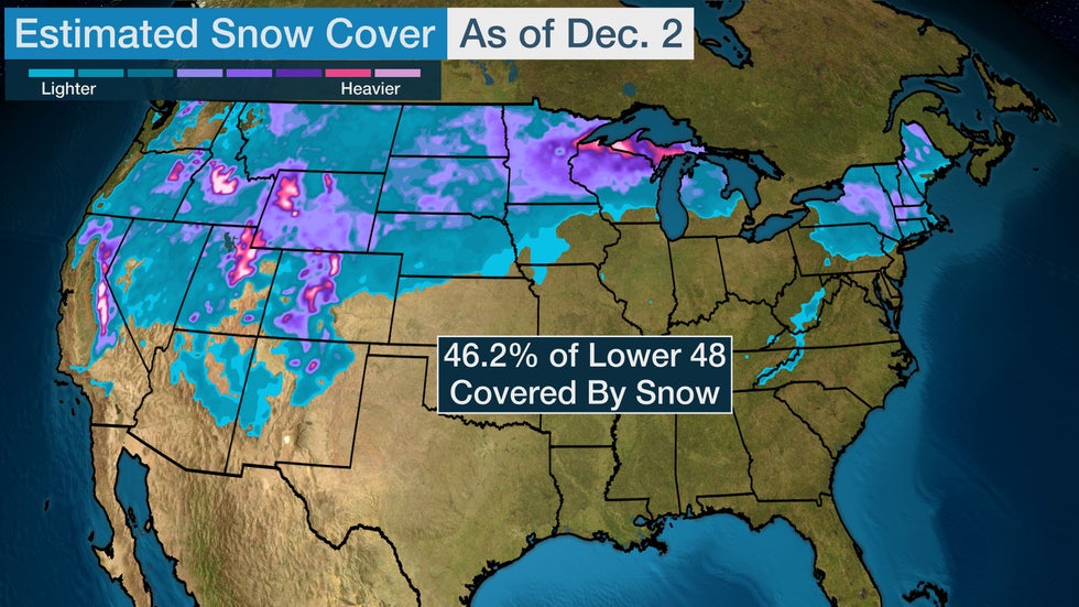
There's snow on the ground across more of the Lower 48 to start December than there has been in at least 16 years.
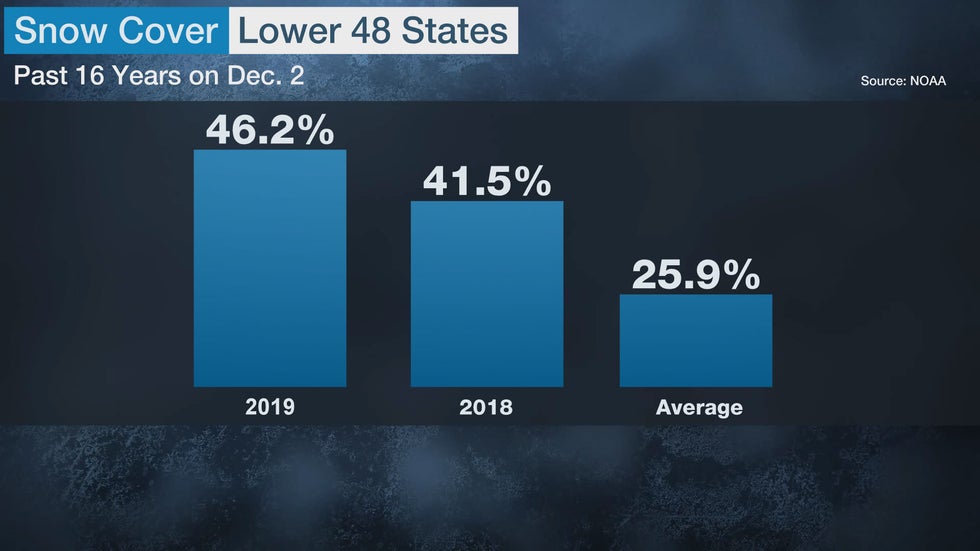
An estimated 46.2% of the contiguous U.S. had snow on ground as of Monday morning, according to NOAA's National Operational Hydrologic Remote Sensing Center. That's well above the 25.9% average Dec. 2 snow cover for the last 16 years.

Back-to-back winter storms during Thanksgiving week helped build up snowpack across the West, Northern Plains, upper Midwest and Northeast.
Winter Storm Ezekiel is the most widespread of the two storms. It entered the West Coast last Tuesday and won't depart the Northeast until this Tuesday. Another winter storm named Dorothy spread snow from the Rockies to the upper Midwest during the first half of last week.
Snow covered just 12.9% of the Lower 48 before those storms arrived a week ago.
No additional widespread snowstorms are expected the rest of this week after Ezekiel departs. Melting snow in the coming days will likely cause the area covered by snow to shrink in size from this early December peak.
Expansive early December snow cover doesn't necessarily mean the rest of the month will be cold and snowy.
Snow covered 41.5% of the Lower 48 states on Dec. 2 of last year, which is the second-most for that date since 2003. That was followed by the ninth-warmest December on record for the contiguous U.S.
The Weather Company’s primary journalistic mission is to report on breaking weather news, the environment and the importance of science to our lives. This story does not necessarily represent the position of our parent company, IBM.

No comments:
Post a Comment