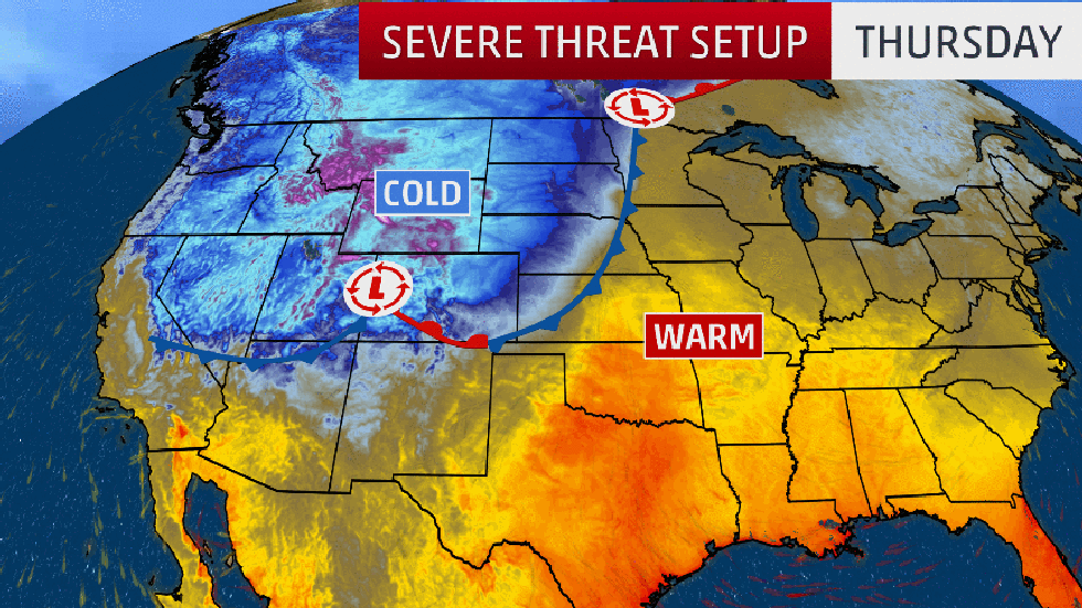
Severe thunderstorms will threaten the southern Plains and Midwest Thursday on the warm side of a major October snowstorm in the northern Plains and Rockies.
A powerful cold front responsible for the coldest air so far this season will slide eastward into the Plains and Midwest. The sharp temperature gradient between the cold air behind the front and the warm, humid air ahead of it will destabilize the atmosphere, setting the stage for severe thunderstorms, especially on Thursday, from the southern Plains to the mid-Mississippi Valley.
Scattered severe storms erupted on Wednesday evening from parts of North Texas into Oklahoma. At the town of Mobeetie in the eastern Texas Panhandle, a barn was destroyed and large tree limbs were downed, the NWS Storm Prediction Center reported. Hail a bit larger than quarter-size was reported in south-central Kansas in parts of Sedgwick and Sumner Counties.
On Thursday, showers and thunderstorms will be ongoing in the morning across the central and southern Plains and mid-Mississippi Valley, but the best chance for severe storms will be in the afternoon.
As the cold front approaches those regions from the west, fast-moving thunderstorms will develop rapidly along the front by mid- to late afternoon and continue through the evening.
Damaging wind gusts and large hail will be the main threats in this broad corridor from North Texas to western and southern Iowa. A few tornadoes are also possible.

Showers and storms are expected farther east on Friday, but severe weather is unlikely.
The Weather Company’s primary journalistic mission is to report on breaking weather news, the environment and the importance of science to our lives. This story does not necessarily represent the position of our parent company, IBM.
The Weather Company’s primary journalistic mission is to report on breaking weather news, the environment and the importance of science to our lives. This story does not necessarily represent the position of our parent company, IBM.


No comments:
Post a Comment