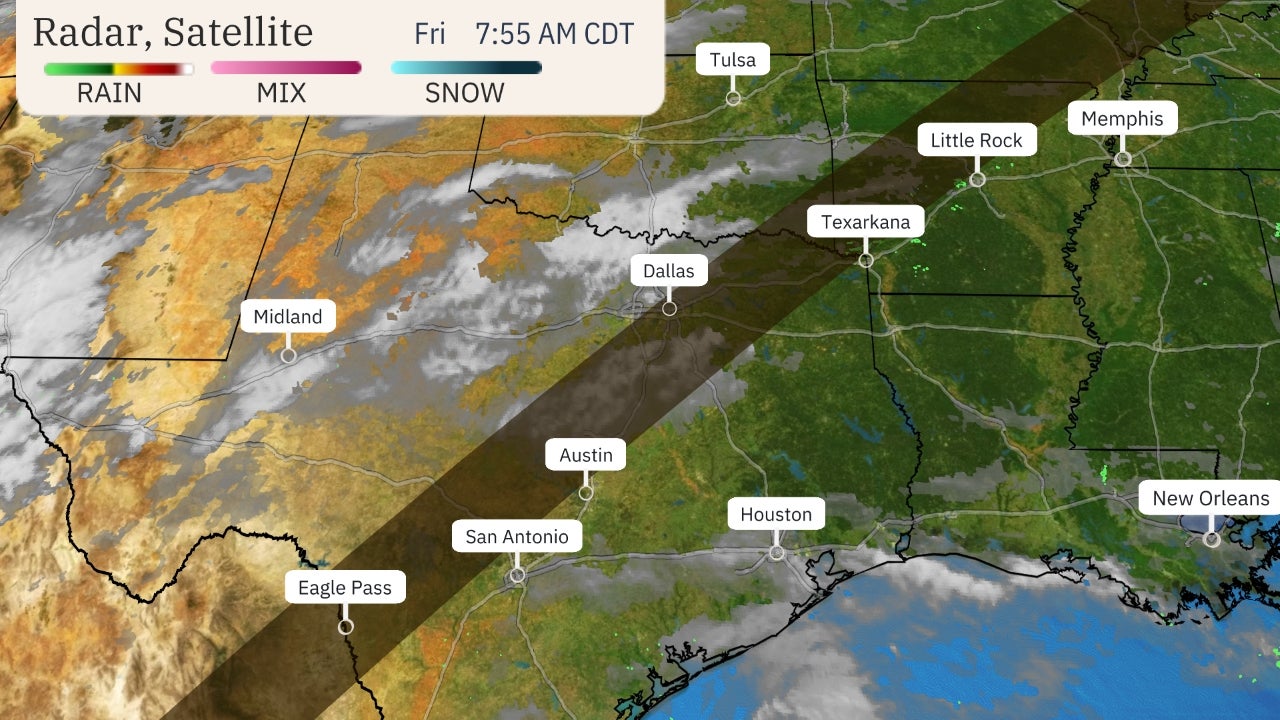
Strong winds will raise the danger of rapidly spreading wildfires in parts of California through Friday, during what is typically the peak time of concern for wildfires in the Golden State.
The National Weather Service has posted red flag warnings for parts of Northern and Southern California Wednesday through Friday. These warnings include the hills around the San Francisco Bay Area, the northern Sierra and Siskiyou foothills and a large area of Southern California from Ventura County to San Diego County.
Additionally, a fire weather watch is in effect for the Kern County mountains and a portion of Sequoia National Forest.
The combination of a southward-plunging jet stream from the northern Rockies to the Desert Southwest and high pressure behind a cold front building into the Great Basin will help drive strong offshore winds in California during the latter half of this week.
In Northern California, these winds, known locally as Diablo winds, are expected to be strongest Wednesday night over the hills north of downtown San Francisco, according to the National Weather Service. Some gusts up to 60 mph are possible.
In Southern California, Santa Ana winds are expected to ramp up Thursday and persist into Friday, with gusts below passes and canyons of 60 mph or higher.
The offshore winds will also bring heat and low relative humidities, near-ideal conditions for rapid spreading of existing and newly ignited wildfires.
It's already been a hot week in parts of the state. The nation's hottest temperature Monday was in Anaheim (98), two degrees hotter than Death Valley, a typical U.S. hotspot.
These offshore winds should relax by Saturday, but some computer forecast models suggest another round of offshore winds may blow through the state early next week.
The End of the Dry Season
Unlike most locations in the Lower 48 states, California has pronounced wet and dry seasons. The last weeks of the dry season happen in fall.
"California's Mediterranean climate makes it unique, as our warmest months coincide with our driest," said Jan Null, certified consulting meteorologist and adjunct professor in the Department of Meteorology and Climate Science at San Jose State University.
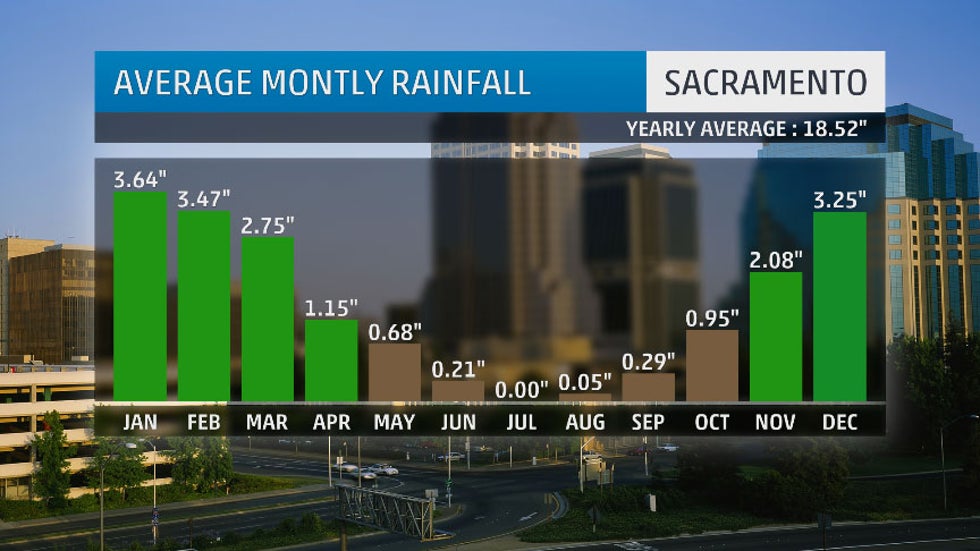
Both Los Angeles and San Francisco typically pick up only 9% of their average annual precipitation in the six-month "dry season" from May through October.
This amounts to a six-month average rain total of only 1.3 inches in L.A. and 2.25 inches in San Francisco.

It is a similar story in Sacramento, which gets about 11% of its average annual precipitation from May through October.
"By the end of the summer and into early fall, the state's vegetation has dried out," Null said.
This is true even after a wetter than average winter. Winter precipitation can cause an increase in grasses and other fuels, which add to the dry vegetation available to feed wildfires by fall.
High Winds Return to Fan the Flames
Summer's wildfires in California tend to burn more slowly and start in more remote areas, often due to lightning.
In the fall, California's offshore winds typically kick into gear, according to a 2017 climatology study.

"In September and October, we begin seeing high pressure developing over the Great Basin, and this creates dry, warm offshore winds," said Null. "Since the Great Basin is nominally 4,000 feet in elevation, the air is compressed as it descends to sea level, warming and drying it. When this flow is forced over mountains and through canyons, it accelerates."
If the jet stream is also located to the east of the state over the Great Basin, a downward push of strong winds can occur, intensifying the offshore wind event. These intense offshore winds can occur from fall through spring.
What makes them particularly dangerous in the fall: they occur when soil moisture is at its driest.
These Santa Ana or Diablo winds can quickly whip either an existing wildfire or a just-developed small brush fire into an inferno, blowing embers downstream, starting many more spot fires, sometimes in more heavily populated areas.
The fires can also persist for several days if the jet stream pattern persists, bringing high pressure to western North America, as occurred in both early December 2017 and early November 2018.
The Weather Company’s primary journalistic mission is to report on breaking weather news, the environment and the importance of science to our lives. This story does not necessarily represent the position of our parent company, IBM.
The Weather Company’s primary journalistic mission is to report on breaking weather news, the environment and the importance of science to our lives. This story does not necessarily represent the position of our parent company, IBM.


No comments:
Post a Comment