A stormy pattern will persist across the north-central United States with rounds of severe weather expected through Sunday.
Hot, humid air centered over the nation's midsection will continue to provide fuel for violent thunderstorms to develop, intensify and maintain their strength for dozens of miles.
Late this past week, Montana and portions of the Midwest were hit with hail and wind damage from severe storms.
Severe weather occurred as far north as southern Canada late Friday.
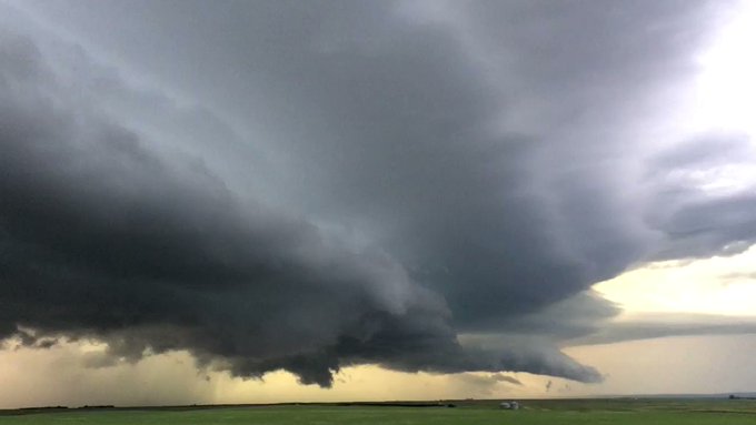
MONSTER shelf cloud on supercell in southern SK. Trying to recycle now. Time is 910 pm #skstorm @accuweather

38 people are talking about this
The pattern will remain conducive for thunderstorm complexes to ride around the top of the core of the heat, according to AccuWeather
Funnel clouds were spotted in Valley County, Montana, on Friday night, as a line of severe storms swept through the northeastern corner of the state.
This line may remain violent with damaging winds, hail and downpours being the primary threats as it crosses the northern half of North Dakota into Saturday afternoon.

Later Saturday afternoon and night, communities farther east will need to be on alert for the potential for severe storms to move in.
This includes around Aberdeen, South Dakota; Fargo, North Dakota; and International Falls, St. Cloud and Duluth, Minnesota. Winnipeg, Canada, may also be at risk.
Any of the storms in this swath can produce wind gusts high enough to knock over trees and power lines, large, damaging hail and torrential downpours. An isolated tornado can also spin up.
There is the potential for a heavy to locally severe storm to dive as far southeastward as Minneapolis and parts of western Wisconsin on Saturday night.
The severe weather dangers are expected to shift slightly farther south and east as the weekend comes to a close .
This will put communities from the eastern slopes of the central Rockies to the upper Mississippi Valley and western Great Lakes at risk.

While damaging storms will not hit this entire swath, any storm that does develop can produce damaging winds, hail, downpours and perhaps a tornado or two.
It does not take a storm to be severe for it to produce potentially deadly lightning strikes.
RELATED:
Top 10 US cities with the highest density of lightning strikes
Scientists discover a new way to look at lightning
Is it safe to talk on your cell phone during a thunderstorm?
#ICYMI: Blistering heat wave scorches records in Europe, a hurricane comes and goes and fleeting weather phenomena in the sky
Anyone with plans to be outside this weekend should make sure they keep a close eye to the sky and seek shelter indoors as soon as the sky darkens or thunder is heard.
If there is no other suitable option, a hard-top vehicle can also provide protection from dangerous lightning strikes.
Even in the absence of severe weather, downpours accompanying the storms will make for poor driving conditions with reduced visibility and a heightened risk of hydroplaning while traveling at highway speeds.
Boston expects a similar pattern to remain in place next week, leading to additional thunderstorm complexes rumbling through the North Central states, including during the July Fourth holiday.
Download the free AccuWeather app to stay aware of the latest severe weather watches and warnings. Keep checking back for updates on AccuWeather.com and stay tuned to the AccuWeather Network on DirecTV, Frontier and Verizon Fios.


No comments:
Post a Comment