By Chaffin Mitchell, AccuWeather staff writer
By Kevin Byrne, AccuWeather staff writer
The onslaught of severe weather continued across the central United States on Tuesday as a new round of severe thunderstorms erupted over the region. The most powerful storms focus on Kansas and Missouri, with a monstrous tornado tracking dangerously close to Kansas City.
At least 15 injuries have been reported after a tornado tracked through Linwood, Kansas, on Tuesday evening. The tornado prompted a rare tornado emergency to be issued by the National Weather Service.
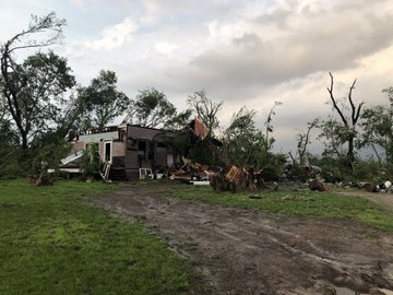
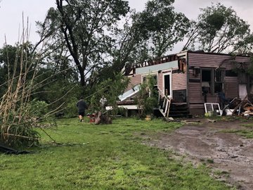
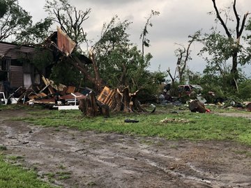
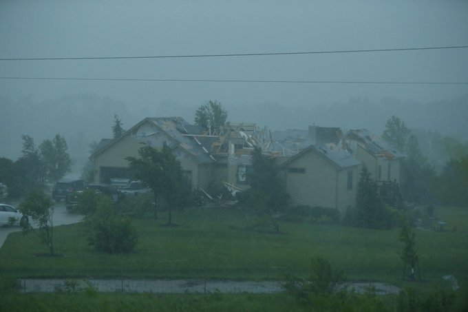
 Joe Armison looks over damage to his home after a tornado struck the outskirts of Eudora, Kan., Tuesday, May 28, 2019. (AP Photo/Colin E. Braley)
The storms also unloaded heavy rain across the region, leading to additional round of flooding.
Click here for a full recap of the severe weather event. Scroll below to read real-time storm reports from Tuesday May 28.
RELATED:
'I'm done with you people!' TV meteorologist responds to angry 'Bachelorette' fans following interruption
'The scariest thing I’ve ever been through:’ Children survived powerful tornado by sheltering inside church bathrooms
The difference between tornado watches and warnings
Tornadoes, flooding remain a danger as severe weather onslaught continues in central US
Download the free AccuWeather app and enabling audible alerts on your cell phone to receive severe weather bulletins when they are issued for your area, or watch the AccuWeather Network on DirecTV, Frontier and Verizon Fios.
1:15 a.m. CDT Wednesday:
Over 1.5 inches of rain fell in Kansas City, Missouri, on Tuesday, pushing the current monthly total into record-breaking territory. This is now the wettest May on record in the city.
Although the threat for damaging winds, tornadoes and large hail has generally subsided early Wednesday morning, the threat for flash flooding will continue from northern Missouri and southeastern Iowa into western Illinois.
12:15 a.m. CDT Wednesday:
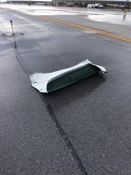
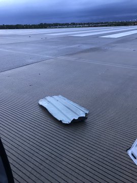
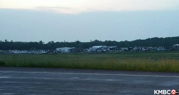
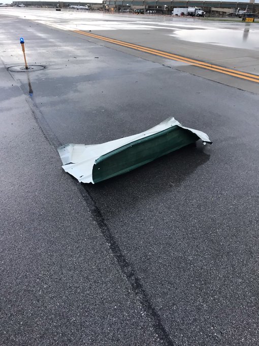
After being closed due to storm debris being tossed onto runways, the Kansas City International Airport has reopened.
The debris was presumed to have come from the tornado damage in Linwood and Lawrence, Kansas.
11:30 p.m. CDT Tuesday:
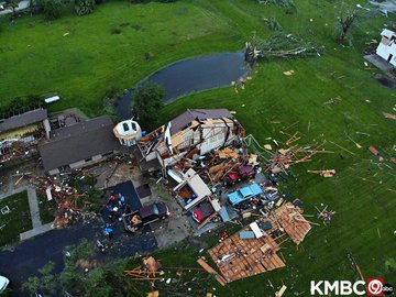
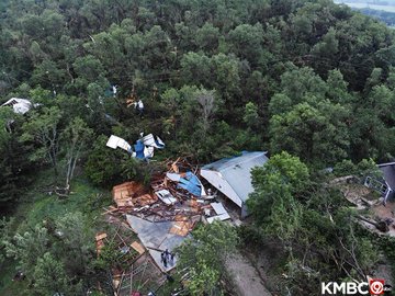
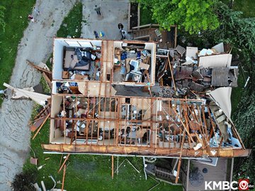
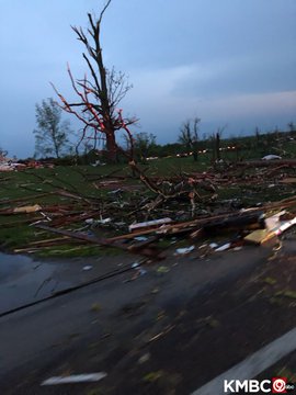
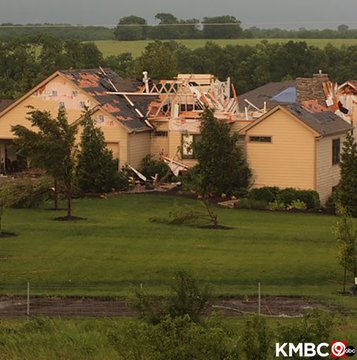
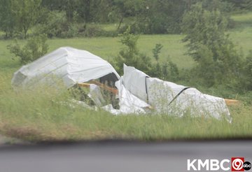
The massive tornado that hit Lawrence and Linwood, Kansas, late Tuesday afternoon virtually wiped out entire parts of these communities, leaving behind complete destruction of homes and buildings.
10:30 p.m. CDT Tuesday:
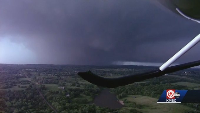
Dozens of homes have been destroyed near Lawrence, Kansas, after a massive tornado tore through the area late Tuesday afternoon.
A chopper pilot estimated the width of the tornado to be around 1 mile.
9:30 p.m. CDT Tuesday:
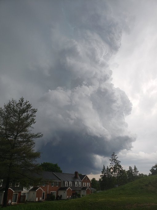
A tornado has been confirmed near Morgantown, Pennsylvania, after the National Weather Service in Mount Holly, New Jersey, received video showing the tornado on the ground.
A storm survey team will assess the strength of the tornado on Wednesday.
9:15 p.m. CDT Tuesday:
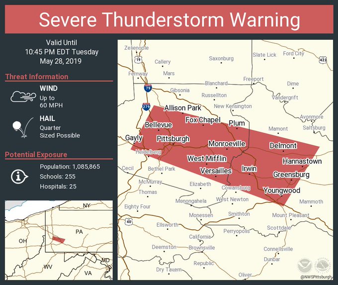
A severe thunderstorm warning is now in effect for Pittsburgh, Pennsylvania, until 10:45 p.m. EDT Tuesday.
9:00 p.m. CDT Tuesday:
The airfield at the Kansas City International Airport remains closed due to storm debris that was launched onto the airfield from nearby storms that produced the massive tornado in Lawrence, Kansas, earlier on Tuesday.
8:15 p.m. CDT Tuesday:
Major structural damage in Lawrence, Kansas, following a large tornado that hit the area.
8:11 p.m. CDT Tuesday:
Those in Excelsior Estates, a tornado is expected to arrive in about 10 minutes, according to NWS Kansas City.
Excelsior Springs Hospital is very close to, if not in, the path of this tornado. If you live on the north side of Excelsior Springs, take shelter now!
8:00 p.m. CDT Tuesday:
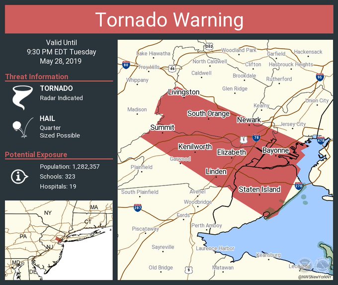
There is a tornado warning in effect near New York City, New York, including Staten Island; Newark and Elizabeth, New Jersey, until 9:30 p.m. EDT.
7:30 p.m. CDT Tuesday:
There are damage reports of trees and highway signs down in Maywood, Kansas.
A house is reportedly "totaled" in Bradford County in Rome, Pennsylvania.
Storm-related injury reported in Claymont, Delaware, where a tree fell onto a tent.
7:02 p.m. CDT Tuesday:
The Kansas City International Airport is moving customers to a shelter due to the severe weather threat in the area.
6:46 p.m. CDT Tuesday:
There is a Tornado Emergency including Kansas City, Shawnee, and Bonner Springs, Kansas. If you are near these areas seek shelter immediately!
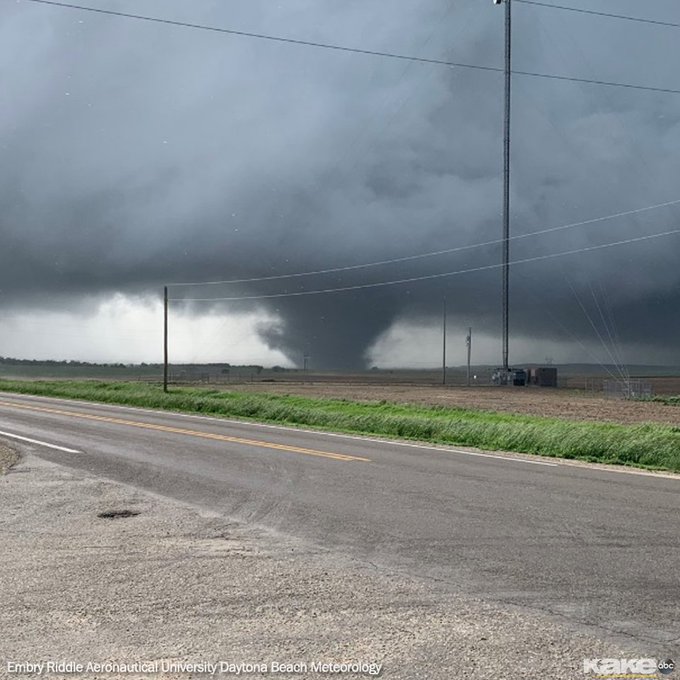
AccuWeather Extreme Meteorologist Reed Timmer is reporting that a monster wedge tornado is approaching west side of Kansas City.
6:30 p.m. CDT Tuesday:
Major damage has been reported in South Lawrence, Kansas. Lawrence Dispatch is being inundated with calls about emergencies.
The storm is now passing Lawrence. A role call on the radio verified all officers are accounted for. Officials urge residents to remain in their shelter until the warning has passed.
6:20 p.m. CDT Tuesday:
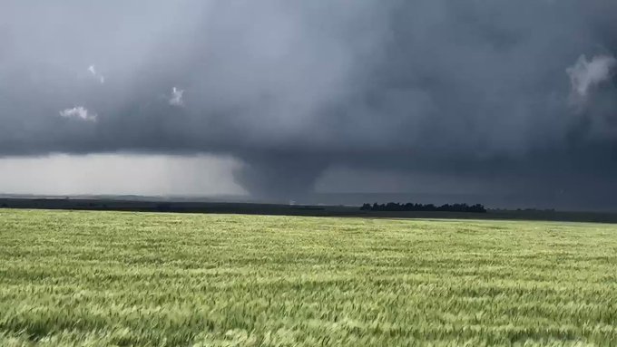
A large, confirmed tornado is on the ground near Lone Star, approaching an area south of Lawrence, Kansas.
6:15 p.m. CDT Tuesday:
A violent and large tornado was reported north of Luray, Kansas, it has since dissipated.
5:30 p.m. CDT Tuesday:
A large tornado has been spotted near Waldo, Kansas.
5:15 p.m. CDT Tuesday:
There are reports of damage in the area of Clarks Summit, Pennsylvania.
A Particularly Dangerous Situation tornado warning is in effect for Scranton, Pennsylvania.
4:36 p.m. CDT Tuesday:
A funnel cloud has been reported near Valley View, Pennsylvania in Schuylkill County.
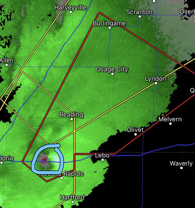
AccuWeather Extreme Meteorologist Reed Timmer is targeting a tornado warned storm just to the southwest of Reading, Kansas. The storm is heading toward Osage City, Kansas.
2:50 p.m. CDT Tuesday:
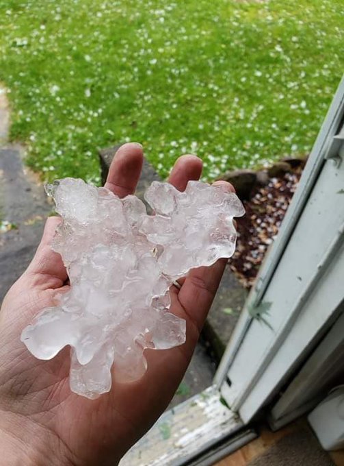
Golf ball-sized hail near Sandy Lake, Pennsylvania, as well as Kittanning, Pennsylvania.
2:30 p.m. CDT Tuesday:
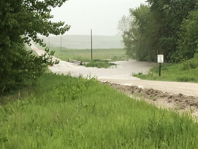
Other roads and low-lying areas in central to southern Iowa may have standing water or water overflowing from creeks and small streams through tonight.
1:55 p.m. CDT Tuesday:
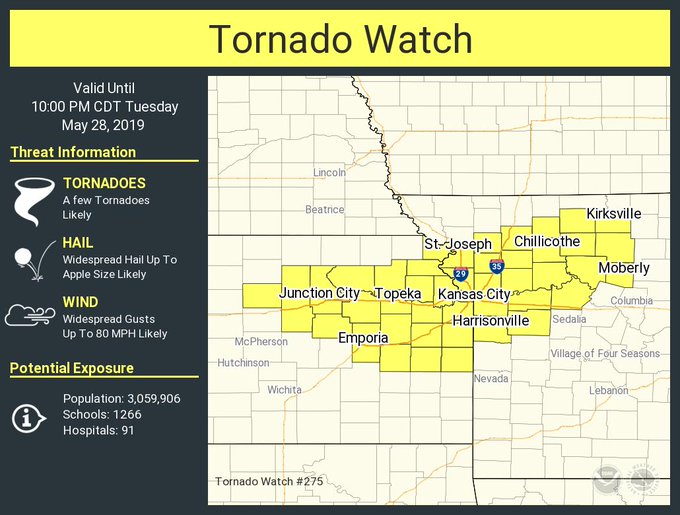
A tornado watch has been issued for northeastern Kansas and northern Missouri, including Kansas City. The NWS notes that a couple of intense tornadoes and significant wind gusts over 80 mph will be possible in this area between now and 10 p.m. CDT.

RELATED:
'I'm done with you people!' TV meteorologist responds to angry 'Bachelorette' fans following interruption
'The scariest thing I’ve ever been through:’ Children survived powerful tornado by sheltering inside church bathrooms
The difference between tornado watches and warnings
Tornadoes, flooding remain a danger as severe weather onslaught continues in central US



















No comments:
Post a Comment