Jonathan Erdman
New York City received its first measurable snow of 2022-23 on Wednesday morning, February 1, a record-long wait for the season's first snowfall in over 150 years.
For the first time in records dating to 1869, Central Park's first-snow drought extended into February.
Central Park measured 0.4 inches of snow early Wednesday in a small band of snowfall overnight.
Prior to this winter, the city's longest wait to measure the first 0.1 inches of snowfall was Jan. 29, 1973. Snowfall this season in New York City was about 14 inches below their average season snowfall to date through the end of January.
This happened about 24 hours after a near-miss on Jan. 31. Wet snow mixed with rain for about two hours, before ending. Despite amounting to 0.2 inches at the National Weather Service on Long Island, Central Park yet again didn't pick up at least 0.1 inches of snowfall.
Three other January storms, named winter storms Iggy, Jimenez and Kassandra by The Weather Channel, each dumped significant snow in the interior Northeast, but predominantly only rain in New York City.
Instead, flowers were seen blooming in Central Park on Jan. 25, as The Weather Channel field producer Mike Bogad and meteorologist Jen Carfagno found.
Usually, the city picks up its first measurable snow by mid-December. In the 2021-22 season, the first measurable dusting arrived on Christmas Eve.
Not Just The Big Apple
The lack of snow wasn't been confined to New York City.
Philadelphia, Baltimore and Washington finally received their first measurable snow of the season on February 1, with 0.3 inches, 0.2 inches and 0.4 inches, respectively. Baltimore and Washington have previously waited as long as Feb. 21 and 23, respectively, also in 1973.
Philadelphia's only season without measurable snowfall was also in 1972-73. And that was New York City's least snowy season, in which only 2.8 inches fell that fall, winter and spring combined.
Why The Lack Of Snow?
The weather pattern since fall has been most favorable for snow from the West into the Northern Plains.
More specifically, low-pressure systems have most often plowed into the West Coast, intensified in the High Plains of the Rockies, then tracked into the northern Great Lakes or eastern Canada. That's a pattern typical of late fall or spring, steering winter storms through the Dakotas or areas nearby.
Meanwhile, high pressure has been stubbornly in place over eastern Canada and the Northeast, keeping much of that area warmer than average.
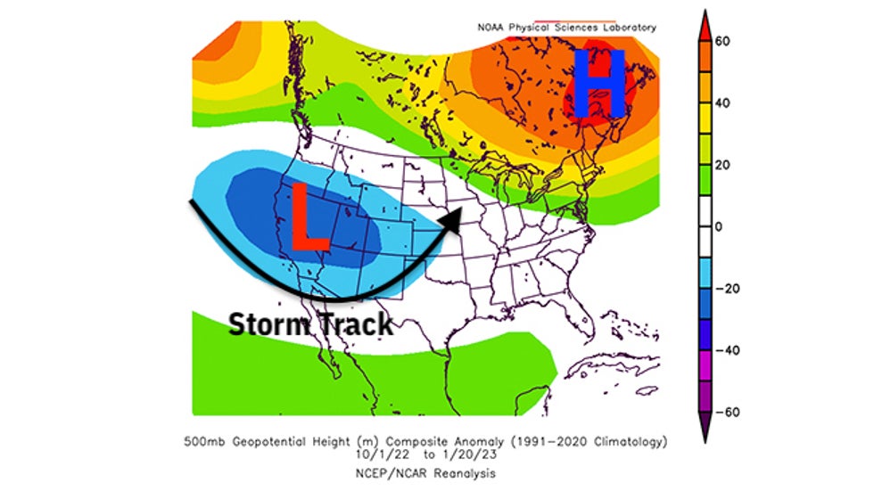 Anomaly in the upper-level weather pattern over the U.S. and Canada from Oct. 1, 2022, through Jan. 20, 2023. Areas of persistent lower pressure are highlighted by the "L" and the blue contours over the West and Plains. Areas of higher pressure are highlighted by the "H" and the green, yellow and orange contours over eastern Canada and the Northeast.
According to the Southeast Regional Climate Center, the three-month period ending Jan. 3 was among the warmest such late October through late January periods on record in the Northeast and New England.
January only accentuated that anomalous warmth, the warmest January on record in Central Park.
Using a "winter misery index" combining both temperatures and snowfall, New York City had its mildest start to winter since 1950, through the end of January.
When cold air swept into the Northeast, it whipped across the Great Lakes and manufactured two rounds of prolific lake-effect snow in Buffalo and Watertown, New York, in late November and December.
And as we alluded to earlier, January storm tracks brought snow to the interior Northeast, but pulled warm air into the Interstate 95 Northeast Urban Corridor, with rain the result.
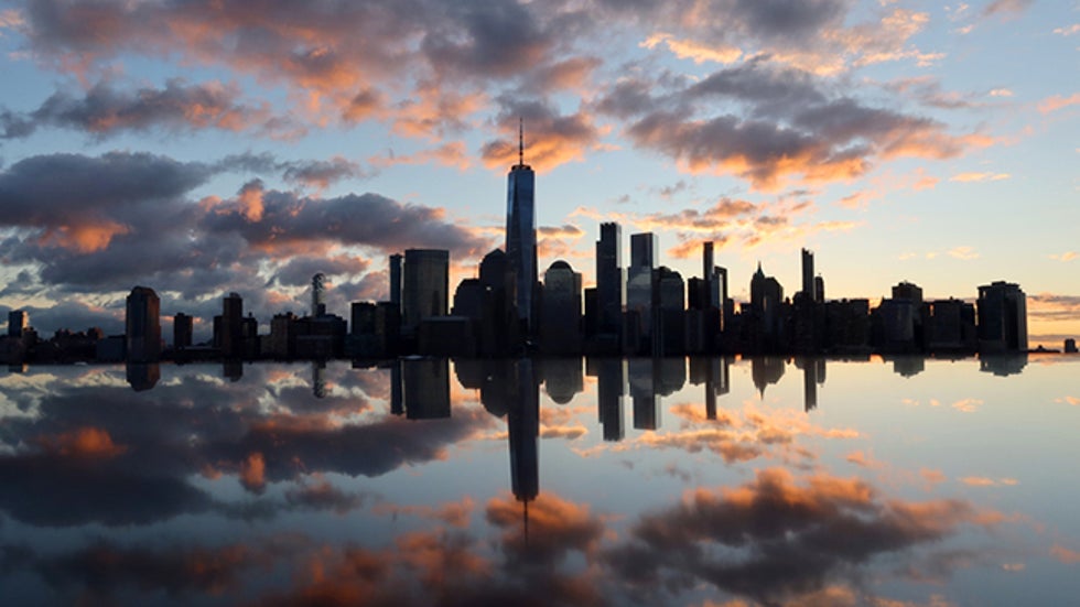 The skyline of lower Manhattan and One World Trade Center is reflected in the top of a granite monument as the sun rises in New York City on January 26 as seen from Jersey City, New Jersey.
Snowiest Month Is February
Despite this snowless scenario, it's far too soon to proclaim the rest of the snow season in New York City a dud.
New York City's average snowiest month is February (10.1 inches). This typically coincides with the historical peak in major Northeast snowstorms from late January through February.
Typically, Central Park picks up just over half its snowfall after Jan. 31. That amounts to just over 15 inches if the rest of the season was average.
So if you dread shoveling or driving in snow, enjoy this extended break from it while you can.
The Weather Company’s primary journalistic mission is to report on breaking weather news, the environment and the importance of science to our lives. This story does not necessarily represent the position of our parent company, IBM.
The Weather Company’s primary journalistic mission is to report on breaking weather news, the environment and the importance of science to our lives. This story does not necessarily represent the position of our parent company, IBM.


No comments:
Post a Comment