Linda Lam
An active winter weather pattern will continue into next week, but the good news is that the next system is not expected to be a major winter storm.
The next system will push into the central U.S. by Sunday. This low pressure system will track eastward across the Midwest into the Northeast early next week.
(MORE: Snow Coverage in the U.S. Is the Most Widespread in 17 Years)
Unlike other recent systems, this next one isn't expected to strengthen into a major winter storm and milder conditions will result in snow being confined to areas farther north, with rain to the south.
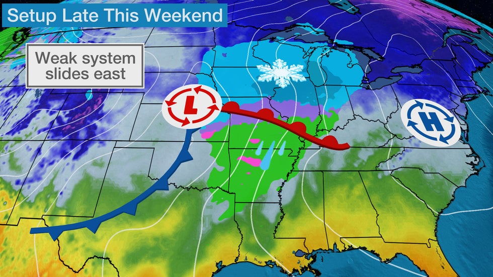
Late Weekend, Early Week Forecast
Snow showers will develop in parts of the central U.S. into Sunday morning as this disturbance emerges in the Plains.
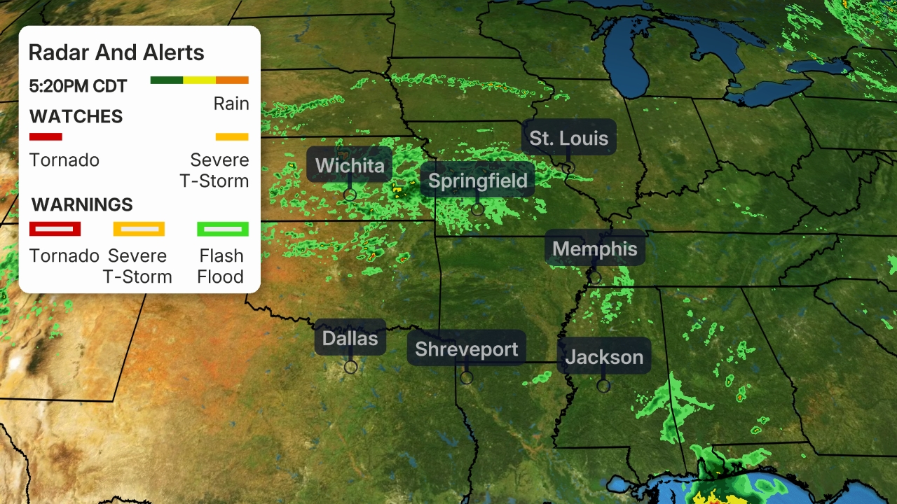 Current Radar
Sunday Forecast
On Sunday, snow will expand into parts of the Great Lakes region. Most areas will experience light snowfall, although pockets of moderate snow are possible. Locations farther south from central Missouri and southern Illinois into Arkansas, eastern Oklahoma and northeastern Texas can expect rain showers from this next system.
SPONSORED: Major winter sale at Columbia Sportswear
Snow and rain will move eastward Sunday night, reaching into the interior Northeast and the central Appalachians while continuing in portions of the Midwest. Rain showers are likely for much of the Ohio Valley and South, but some snow may fall as far south as western North Carolina.
Breezy conditions are likely in parts of the Midwest with this system.
 Sunday's Forecast
Monday
On Monday, snow is expected in much of the Northeast, although a mix of rain and snow is likely from southeastern Maine southward to Washington D.C. and northern and central Virginia.
Portions of the interior Northeast may see moderate snowfall at times Monday. Meanwhile, rain is expected from southeastern New England down the mid-Atlantic coast into the Southeast.
Snow may linger in parts of New England and New York on Monday night, with a mix of rain and snow toward the Northeast coast. Lake-effect or lake-enhanced snow may develop into Tuesday.
 Monday's Forecast
How Much Snow and Rain?
This system won't be as strong as other recent storms and will move fairly quickly. This will keep snowfall totals generally on the light side.
Most areas from southern Minnesota, Iowa and far northern Missouri through the Great Lakes region into the interior Northeast will see snowfall totals of 1 to 5 inches.
Some higher snowfall amounts are possible in the eastern Great Lakes, especially in New York's Tug Hill Plateau region.
Most locations from southeastern New England and Long Island to the mid-Atlantic coast are expected to see mainly light rain from this system.
 Snowfall Forecast
The Weather Company’s primary journalistic mission is to report on breaking weather news, the environment and the importance of science to our lives. This story does not necessarily represent the position of our parent company, IBM.
The Weather Company’s primary journalistic mission is to report on breaking weather news, the environment and the importance of science to our lives. This story does not necessarily represent the position of our parent company, IBM.


No comments:
Post a Comment