Published: February 14, 2021
Another cross-country storm will bring more snow and ice to parts of the Northwest, South, Midwest and East as it tracks right on the heels of Winter Storm Uri into late week.
This weather system has been named Winter Storm Viola by The Weather Channel.
Viola will take a similar track as Uri, but won't produce the exact same impacts in every location. The storm could bring the second round of wintry weather in just a few days to cities like Dallas-Fort Worth, Oklahoma City, Little Rock and Cincinnati.
Here's an overview of the storm's forecast, but keep in mind changes are likely in future forecast updates.
Forecast Timing
Through Monday
Snow, ice and rain from this storm will impact areas from the Northwest into the Rockies through Monday night.
The Portland, Oregon, area could see significant amounts of freezing rain into early Monday. This may cause more tree damage and power outages.
Eventually, all lower elevation locations along the Interstate 5 corridor should change to rain on Monday, bringing an end to the recent siege of snow and ice there.
Seattle may pick up some additional snowfall through Sunday night before that change to rain occurs.
 Winter Weather Alerts
Tuesday-Tuesday Night
Accumulating snowfall from this storm will spread out of the southern Rockies into the Southern Plains by Tuesday. This might include Oklahoma City and Amarillo, Texas.
Tuesday night, snow could develop in northern Texas, including in Dallas-Fort Worth. Freezing rain and sleet might break out in central and eastern parts of Texas.
 Tuesday's Forecast
Wednesday-Wednesday Night
Snow will continue to spread northeastward out of Oklahoma and northern Texas into parts of Arkansas, Missouri and the Ohio Valley on Wednesday.
Freezing rain and sleet could hamper travel from central and eastern Texas into parts of northern Louisiana and the lower Mississippi Valley
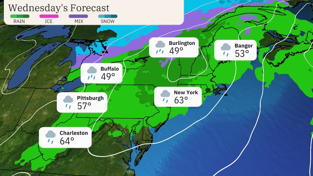
Wednesday night, snow could expand farther east through the Ohio Valley, central Appalachians and mid-Atlantic. Significant icing might develop to the east of the Appalachians as far south as southern Virginia and north-central North Carolina.
 Wednesday's Forecast
Thursday-Thursday Night
This storm is likely to spread its reach across most of the Northeast on Thursday and Thursday night.
Parts of the Interstate 95 corridor, including New York City, could start out with snowfall before transitioning to a wintry mix or even rain. Interior areas of southern New York and Pennsylvania might also start with snow and then change to a wintry mix.
Icing may continue for a time as far south as southern Virginia and northern North Carolina until a change to rain occurs.
Snowfall will also continue on the backside of this system from parts of the Great Lakes into the Ohio and Mississippi valleys.
The storm will begin to exit the Northeast on Friday, but snow might linger across interior parts of the region. Coastal areas would likely be mostly rain by that point time.
It's too early to provide specific snow and ice totals along the path of this storm. Check back to weather.com for updates and more specific details over the next few days.
 Thursday's Forecast
The Weather Company’s primary journalistic mission is to report on breaking weather news, the environment and the importance of science to our lives. This story does not necessarily represent the position of our parent company, IBM.
The Weather Company’s primary journalistic mission is to report on breaking weather news, the environment and the importance of science to our lives. This story does not necessarily represent the position of our parent company, IBM.

No comments:
Post a Comment