Chris Dolce
A siege of winter storms since late January has contributed to the most widespread snow cover across the contiguous U.S. in at least 17 years.
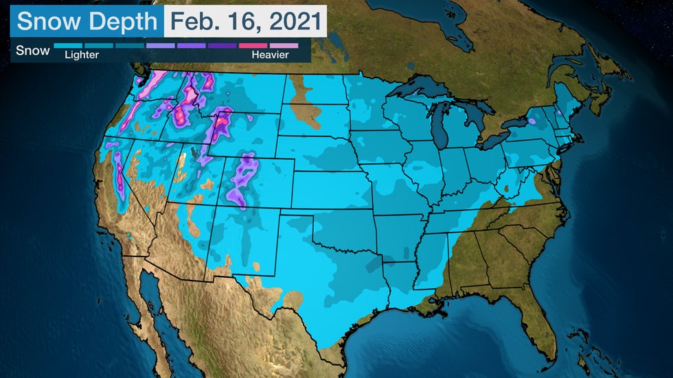
Snow was on the ground in 73.2% of the Lower 48 on Feb. 16, according to the National Operational Hydrologic Remote Sensing Center (NOHRSC). That's the highest snow cover extent for any day in the NOHRSC database dating to fall 2003, according to NOAA.
Winter Storm Uri's snowfall deep into the South played a big role in this large expansion. Snow covered about half of the U.S. three days earlier prior to when Uri tracked from coast to coast.
 Estimation of snow cover across the U.S. on Feb. 16, 2021.
Parts of the Southeast and Southwest are the largest areas without snow cover right now. Some locations in central and western Dakotas also have no snow, which is an odd exception when compared to the rest of the northern U.S.
SPONSORED: 25% off Anthropologie sale
Only one other year in the NOHRSC database has had snow cover 70% or greater, according to Steve Bowen, a meteorologist with the reinsurer, Aon. That was Jan. 12, 2011, when snow covered a broad area of the country, including the Southeast.
The growth of snow cover in recent weeks is quite a turnaround when compared to mid-January.
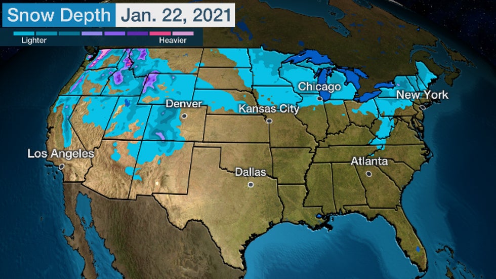
On Jan. 22, only 26% of the Lower 48 had snow on the ground. That was the lowest coverage for that date in NOHRSC's database.
There was no snow in large areas of the Plains, Midwest and East. Snow is a less frequent occurrence in the South, so the widespread absence of snow cover there is not as unusual.
 Estimation of snow cover across the U.S. on Jan. 22, 2021.
The Weather Company’s primary journalistic mission is to report on breaking weather news, the environment and the importance of science to our lives. This story does not necessarily represent the position of our parent company, IBM.
The Weather Company’s primary journalistic mission is to report on breaking weather news, the environment and the importance of science to our lives. This story does not necessarily represent the position of our parent company, IBM.

No comments:
Post a Comment