Sunday, January 31, 2021

Winter Storm Orlena Maps Tracker: Forecast Snow, Alerts, Timing and More


weather.com meteorologists
Published: January 31, 2021


Winter Storm Orlena will create travel headaches across parts of the Northeast early this week as it pounds the region with heavy snow and strong winds.

(MORE: Our Latest, Complete Forecast)

These maps will help you track the latest information on the storm.

Winter Alerts

Article imageWinter Weather Alerts

Current Radar

Article imageCurrent Radar

Winter Storm Severity Index

Article imageWinter Storm Severity Index

Additional Snowfall Forecast

Article imageSnowfall Forecast

Wind Gust Forecast

Article imageWind Gust Forecast

Forecast Timing

Monday

Article imageMonday's Forecast

Monday Night

Article imageMonday Night Forecast

Tuesday

Article imageTuesday's Forecast

Estimated Snowfall So Far

Article imageEstimated Snowfall

The Weather Company’s primary journalistic mission is to report on breaking weather news, the environment and the importance of science to our lives. This story does not necessarily represent the position of our parent company, IBM.

The Weather Company’s primary journalistic mission is to report on breaking weather news, the environment and the importance of science to our lives. This story does not necessarily represent the position of our parent company, IBM.

Winter Storm Orlena to Pummel East Coast as a Nor'easter With Heavy Snow, Strong Winds


weather.com meteorologists
Published: January 31, 2021


Winter Storm Orlena is set to pummel the East Coast with heavy snow and strong winds expected from parts of New England to the northern mid-Atlantic, including the Boston, New York City and Philadelphia metro areas.

SPONSORED: Epic winter clearance sale at Sierra Trading Post

Here's a look at where the storm is now followed by the forecast for what's to come.

Latest Status

Snowfall will intensify as it moves northward from the mid-Atlantic states toward the New York City Tri-state through Sunday night and early Monday. However, some lingering dry air may keep most of southern New England dry for the time being.

Snow will also expand Sunday night in the Ohio Valley, extending as far south as Kentucky, Tennessee, and the Great Smoky Mountains, while coming to an end across the Upper Midwest.

(MORE: Orlena Cancels Flights, Causes Accidents)

Article image

Winter storm warnings and winter weather advisories are in effect from the Appalachians and mid-Atlantic states into New England. The worst winter conditions are generally expected in the areas under winter storm warnings.

Article imageWinter Weather Alerts

Orlena will bring widespread moderate to major (locally extreme) impacts across the Northeast, as depicted below in the latest Winter Storm Severity Index from NOAA. The index takes into account snow, ice, wind, temperatures, location and population to determine the expected impact from a winter storm.

One of the expected impacts is that travel in the Northeast will be severely disrupted by the snow and strong winds from Orlena into Tuesday.

Article imageWinter Storm Severity Index

Forecast Timing

Monday

Monday will be the peak day of the storm in the Northeast.

Snow, likely heavy at times, is expected from southern New England to the New York City metro area and the northern mid-Atlantic states. The snow could change to rain or sleet for a time near the immediate coast from southeast New England to portions of Long Island and southern New Jersey.

There may also dry air several thousand feet above the ground, known to meteorologists as the "dry slot," that could take away at least a few hours of heavier precipitation wherever it tracks.

Lingering snow is also expected in parts of the Ohio Valley and the Appalachians on Monday.

Monday night, that heavier snow is expected to spread farther north into New England and into parts of upstate and central New York, but may continue in parts of the northern mid-Atlantic states.

Strong winds will buffet the Northeast coast Monday and Monday night. Near-blizzard conditions cannot be ruled out where heavier snow overlaps with stronger winds, possibly including parts of the New York City metro area.

SPONSORED: Epic winter clearance sale at Sierra Trading Post

Article imageMonday's Forecast

Tuesday

The best chance of snow continuing into Groundhog Day will be in New England, but some lighter snow may linger as far west as central New York and as far south as New Jersey or the Delmarva Peninsula.

Some snow showers can't be ruled out in the Appalachians.

Snow could linger in these areas Tuesday night or even Wednesday.

Article imageTuesday's Forecast

Snow Forecast

Widespread, heavy snowfall totals are forecast throughout parts of the Interstate 95 corridor from southeast Pennsylvania to New York City and New England.

Some areas south or east of Interstate 95 could see rain or sleet mix in for a time. Therefore, there could be very large differences in snowfall over short distances across the following areas:

-From the north and west suburbs to the south shore in the Boston metro area.

-From southeast Pennsylvania to southern New Jersey.

-From eastern Long Island to New York City, northern New Jersey and the Lower Hudson Valley.

Heavy snowfall is possible in purple areas in the map below and most likely in the darkest purple contours. Widespread totals of 6 to 12 inches are expected in these areas. Some of the locations shaded in darkest purple or pink could pick up 1 to 2 feet of snow, including from eastern Pennsylvania to northern New Jersey and southeast New York.

This heavy snow threat includes all or parts of the Boston, Hartford, New York City and Philadelphia metro areas.

Article imageAdditional Snowfall Forecast

Wind, Coastal Flood Impacts

Snow won't be the only impact.

Strong winds are likely to develop along the coast from the Delmarva Peninsula to coastal New England Monday and could last along the New England coast into Tuesday.

Article image

Strong north to northwest winds could develop over the interior Northeast, Appalachians and piedmont of Virginia and North Carolina Tuesday and linger in parts of the Northeast into Wednesday.

Winds could lead to power outages and possibly some tree damage, particularly if they occur in areas of heavy accumulated snow.

Given the storm's slow movement and persistent onshore winds, coastal flooding may occur from the Delmarva Peninsula to New England.

The National Weather Service has issued coastal flood alerts along parts of the East Coast.

Article image

The high tides of most concern for coastal flooding along the New Jersey shore are late Monday morning, late Monday night and late Tuesday morning.

Moderate to locally major coastal flooding is possible Monday night in southern and eastern parts of Long Island.

At Boston Harbor, high tides of concern are just after midnight Tuesday morning and again early Tuesday afternoon.

The National Weather Service expects mainly minor to moderate coastal flooding at high tide Waves may lead to beach and dune erosion in some areas.

Check weather.com for updates to this forecast.

Orlena's History

Orlena began its cross-country journey in California last week and then tracked into the Midwest over the weekend.

It wrung out feet of snow in California's Sierra Nevada and other parts of the West. For full details, click here.

In the Midwest, Chicago's O'Hare airport had picked up 8.8 inches of snowfall as of early Sunday afternoon.

More than a half-foot of snow fell across the Milwaukee metro area and northern Indiana.

Below is a general look at the estimated snowfall that Orlena has produced since Saturday.

Article imageEstimated Snowfall

The Weather Company’s primary journalistic mission is to report on breaking weather news, the environment and the importance of science to our lives. This story does not necessarily represent the position of our parent company, IBM.

The Weather Company’s primary journalistic mission is to report on breaking weather news, the environment and the importance of science to our lives. This story does not necessarily represent the position of our parent company, IBM.

New York City Could See a Foot or More of Snow in Winter Storm Orlena. Here's How Often That Happens.

 Chris Dolce

Published: January 31, 2021


Winter Storm Orlena has a chance to be the first winter storm to bring New York City a foot or more of snowfall in just over five years.

The last time the Big Apple picked up a foot or more of snowfall in a single winter storm was Jan. 22-24, 2016, when Winter Storm Jonas buried the city under 27.5 inches. That stands as the heaviest snowstorm at the city's official Central Park reporting station in records dating to 1869.

On average, Central Park has seen a foot or more of snow in a single winter storm about once every 4 years. That's a total of 36 such winter storms in the past 151 years, according to statistics compiled by the National Weather Service.

The last storm to make a run at joining the city's list of foot-plus snowstorms was Winter Storm Gail in mid-December 2020. Gail came up just short after it produced 10.5 inches of snow at Central Park.

Snowstorms that have produced 20 or more inches in New York City are even rarer. That's happened at Central Park just seven times since 1869, with four of them occurring this century.

Whether Orlena joins New York City's list of foot-plus snowstorms is still uncertain. It's a possibility as long as the Big Apple sees heavier bands of snowfall from the storm and avoids having the snow mix with or change to sleet or rain for a time.

Article imageNew York City Snowfall Forecast

The Weather Company’s primary journalistic mission is to report on breaking weather news, the environment and the importance of science to our lives. This story does not necessarily represent the position of our parent company, IBM.

The Weather Company’s primary journalistic mission is to report on breaking weather news, the environment and the importance of science to our lives. This story does not necessarily represent the position of our parent company, IBM.

Major Winter Storm to Hit Chicago on Anniversary of One of Its Worst Blizzards on Record

 Jonathan Erdman

Published: January 30, 2021
Article imageCars were stranded on Lake Shore Drive in Chicago on Feb. 2, 2011, after the Groundhog Blizzard.

Chicago will dig out from a snowstorm this weekend, but it won't be anything like the crippling blizzard it endured almost 10 years ago to the day.

In early February 2011, Chicagoland was pummeled by one of its heaviest snowstorms. The Groundhog Blizzard dumped 21.2 inches of snow at Chicago's O'Hare Airport Jan. 31-Feb. 2, 2011.

It was the city's third heaviest snowstorm, trailing only the January 1967 storm (23 inches over two days) and the New Year's 1999 storm (21.6 inches over three days).

The Groundhog Blizzard did set the city's all-time 24-hour snowfall record, as 20 inches of snow buried O'Hare from the afternoon of Feb. 1 through the morning of Groundhog Day, Feb. 2. That's over half of the city's average annual snowfall of 36 inches in just 24 hours.

Article imageVisible satellite image of the Groundhog Blizzard on Feb. 1, 2011.

The storm produced occasional lightning, and 50 to 70 mph wind gusts reduced visibility to less than one-quarter mile for 11 straight hours at O'Hare and to near zero at Midway Airport on Feb. 1, according to the National Weather Service (NWS).

About 1,300 flights were canceled at both O'Hare and Midway before the storm.

High winds tore off part of a roof panel from Wrigley Field and closed sidewalks and nearby streets, according to the Midwest Regional Climate Center.

The NWS said the Groundhog 2011 Blizzard was only the second Chicago snowstorm in modern records to be considered a true blizzard, based on criteria of sustained winds or frequent gusts and severely-reduced visibility. The January 1967 storm was the other.

Drifts of 2 to 5 feet were common, with some exceeding 10 feet, which made it challenging for some residents to even leave their homes. Drivers abandoned their vehicles on Lake Shore Drive in one of the most iconic winter storm scenes in recent years.

However, the NWS office in Chicago said a good forecast issued well in advance cut the number of stranded motorists significantly compared to the January 1967 blizzard.

Despite that, 11 people in Illinois died in the storm.

A Rare Category 5 Winter Storm

This wasn't just a Chicago snowstorm.

Blizzard warnings were issued for eight states, from Oklahoma to Lower Michigan, where over 10 inches of snow blanketed the ground.

Article imageA map showing snowfall accumulations during the Groundhog Blizzard of 2011.

States of emergency were declared in Illinois, Missouri, Oklahoma and Wisconsin.

It was the heaviest one (13.2 inches) and two-day (14 inches) snowfalls on record in Tulsa, Oklahoma. A foot of snow fell in Oklahoma City and closed Will Rogers World Airport for 20 hours. Parts of the Sooner State picked up 20 inches of snow.

In southeast Wisconsin, vehicles were stranded on Interstates 43 and 94 south of Milwaukee.

The Groundhog 2011 Blizzard was one of only four other storms in the Ohio Valley region since 1900 to be categorized by NOAA as a Category 5 winter storm, the strongest category on the Regional Snowfall Index scale.

The Weather Company’s primary journalistic mission is to report on breaking weather news, the environment and the importance of science to our lives. This story does not necessarily represent the position of our parent company, IBM.

The Weather Company’s primary journalistic mission is to report on breaking weather news, the environment and the importance of science to our lives. This story does not necessarily represent the position of our parent company, IBM.

Blizzard conditions eye New York, Boston as nor'easter bears down

 By Jake Sojda, AccuWeather meteorologist

Updated Jan. 31, 2021 3:16 PM EST


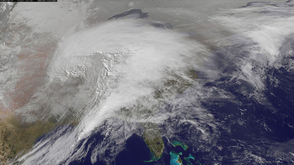
A powerful nor'easter was taking shape along the mid-Atlantic coast Sunday. Forecasters say to "buckle up" as the developing winter storm will be a long-duration event for some areas and unload an AccuWeather Local StormMax™ of up to 36 inches. The system will lash parts of the Northeast into the middle of the week with a slew of different hazards.

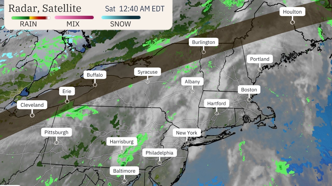
Winter storm warnings and winter weather advisories were in effect across the Northeast as snow and ice began breaking out across the region Sunday.

Winter warnings, watches and advisories in place Sunday morning. Check the AccuWeather Severe Weather Center for the latest winter alerts in your area.

"As a storm shifting through the Ohio Valley slowly moves east, a secondary storm will take shape along the Carolina coast later Sunday," explained AccuWeather Senior Meteorologist Danny Pydynowski.

"The coastal storm will then become the dominant storm of the two, strengthening into a full-blown nor'easter along the Atlantic coast."

As the two storms interact with one another, a broad area of snow will expand from the Ohio Valley through the Northeast.

"The two storms will pull a lot of moisture from the Atlantic across the region. With Arctic air still in place, this will lead to a broad swath of accumulating snow that will persist for days," explained AccuWeather Meteorologist Brett Rossio.

Some locations in the Ohio Valley and central Appalachians, where snow created slippery travel on Sunday, can expect rounds of snow to last all the way into Monday night. In much of the mid-Atlantic, the storm is forecast to extend from Sunday to Tuesday. Part of New England will face storm impacts from Monday to early Wednesday.

"This will allow for snowfall totals to really build up over large areas of the Northeast," Rossio explained. A large area of 6-12 inches of snow will stretch all the way from Ohio through the central Appalachians into New England.

"Even though the forecast is for nearly a foot of snow in some of these interior areas, it could be a little misleading in terms of what impacts to expect," AccuWeather Senior Meteorologist Kerry Schwindenhammer said. "With the gradual nature of the accumulation in many of these areas, clean-up crews may be able to 'keep up' in a relative sense."

CLICK HERE FOR THE FREE ACCUWEATHER APP

However, closer to the coast, forecasters warn it will be a much different story. "It will be very different near the coast," as this region is expected to get hammered by the heaviest snowfall, Schwindenhammer said.

Pydynowski compared the predicted storm impacts for inland areas to coastal locations to the fable of The Hare and the Tortoise. "Many areas farther inland will be like the tortoise, slowly but steadily building up impressive snowfall totals. Coastal areas will be like the hare, with impressive snowfall totals piling up very quickly. We'll see who ultimately wins the race and sees the highest report."

Accuweather meteorologists expect widespread snowfall totals of 12-18 inches where the heaviest snow falls. A bullseye of nearly 2 feet could target a small area just north and west of New York City, into the Pocono and Catskill mountains, with an AccuWeather Local StormMax™ of 36 inches.

The densely populated Interstate 95 corridor in the Northeast will be in the thick of the winter storm. Sunday morning snow was already spreading across the nation's capital, with slushy roads and slippery travel developing. Forecasters warn that in these areas, snow could become heavy and pile up very quickly.

Snow will continue to gradually spread northeastward through the mid-Atlantic and New England Sunday and Sunday night.

"Snow is expected to arrive in New York City this afternoon, but may take until after midnight until it really becomes steady," Pydynowski said. "Boston will start to get in on the action later Monday morning."

Snowfall rates will be much heavier near the coast, closer to the center of the powerful nor'easter. Snowfall rates could reach 1-2 inches per hour along the I-95 corridor from New Jersey through New England. There could also even be the chance for some thundersnow.

AccuWeather meteorologists expect New York City to see a major snowfall from this event, somewhere in the 10- to 15-inch range is likely. Boston will also see significant snowfall from the storm, about 6-12 inches, even if there is some mixing for a brief time.

Some milder air higher in the atmosphere could cause precipitation to change to a wintry mix, including sleet, then perhaps rain near the coast. This scenario is most likely near Cape Cod as well as along the southern mid-Atlantic coast.

"Much of the Jersey Shore, Long Island and New England coast should remain just cold enough at all levels of the atmosphere to stay all snow through the storm," Rossio said.

Farther south, more mild air will mix in as well, keeping snowfall totals a bit lower in places looking to erase a long-lasting snow drought. As of midday Sunday around an inch or 2 of snow has been reported in the Washington D.C. area. Another couple of inches are expected into Sunday evening before precipitation changes over to some light rain and drizzle.

In Philadelphia, a similar situation could unfold, although enough cold air is likely to hold on to result in more snow. "At least a few inches of snow is likely in the Philadelphia area Sunday afternoon and evening, before changing to a mix of sleet and perhaps some plain rain and drizzle for a time late Sunday night," explained AccuWeather Senior Meteorologist John Feerick

"However, it will change back to all snow late Monday morning or midday with a few more inches likely to come after that. There is a chance it could stay all snow through Sunday night, resulting in higher snowfall amounts."

Along with the significant snowfall, powerful winds will develop near the coast. Wind gusts of 30-50 mph, with an AccuWeather Local StormMax™ of 65 mph, will create blizzard conditions at times. Travel in areas from Trenton to New York City to Boston could become nearly impossible during the height of the storm from later Sunday night into Monday night.

The strong winds blowing onshore will also lead to some coastal flooding and beach erosion from the rough surf it will generate. Localized power outages will also be possible where the strongest gusts occur from any downed tree limbs or power lines.

As the storm reaches peak strength Tuesday just off of the New England coast, the heaviest snow will also begin to shift off into northern New England and Atlantic Canada. However, lingering areas of light-to-moderate snow will still plague the Northeast and the wind field will also expand.

With this interior areas of the Northeast will also start to get breezier. "Much of the snow that piles up in interior areas will not be accompanied by much wind Sunday and Monday," Rossio said. "However on Tuesday, areas all the way through the mid-Atlantic into the western Ohio Valley will see a gusty breeze develop."

This will prolong impacts from the storm in these parts by creating areas of blowing snow. "Much of the snow that falls across these areas will become light and fluffy by the end of the storm, so any wind will be able to blow it around pretty easily," Rossio added.

Travel delays along major thoroughfares like Interstates 90, 81, 80, 76 and 70 could be extended through Tuesday with blowing snow recovering plowed roads in open areas. Farther east in the mid-Atlantic and Northeast, some issues with blowing snow could persist all the way into Wednesday.

"It really won't be until Thursday, when high pressure briefly moves in ahead of the next storm forming in the central U.S., until folks in the Northeast will really be able to put a wrap on this nor'easter," Rossio said.

RELATED:

Keep checking back on AccuWeather.com and stay tuned to the AccuWeather Network on DirecTV, Frontier and Verizon Fios.

At least one person left buried in snow after avalanche in Utah

A photo taken from the Summit County Sheriff's Office drone operators show Square Top after mitigation led to additional slides of the snow. (Photo/ Summit County Sheriff's Office @SummitCountySO)

Rescuers were called in to Square Top Mountain in Utah on Saturday after a backcountry avalanche buried at least one person.

The Summit County Sheriff's Office received the report of the avalanche at 3:26 p.m. local time on Saturday. The avalanche occurred off resort boundaries near Park City Mountain Canyons Village.

At least one man was buried by the avalanche, but one of his friends was able to pull him out. The condition of the man who was buried has not been released by officials. It is also not clear if there were any other people involved in the avalanche.

"The area is extremely unstable and rescuers are working to get into the area safely," The Summit County Sheriff’s Office said on Twitter.

According to a news release from Sheriff Justin Martinez, the avalanche was triggered by two skiers, one of which was the man trapped in the snow.

Due to extreme avalanche danger, rescuers were not able to get to the area before nightfall and rescue operations, conducted by Summit County Search and Rescue and the Utah Department of Public Safety helicopter, had to resume on Sunday morning.

Rescue operations began again at 7 a.m., local time. The Utah Department of Public Safety assisted in the search with the use of a helicopter. The county's sheriff's office said they are trying to make the site where the skier was buried safe for so personnel can reach it.

The Summit County Sheriff's Office posted photos of the avalanche site on Sunday morning. According to Martinez, mitigation efforts in the area led to additional slides.

Avalanches can naturally occur from new snowfall on existing snowpack, a significant change in temperature, the breaking of snow cornices, or even earthquakes.

CLICK HERE FOR THE FREE ACCUWEATHER APP

There were a few warmer days in the area at the end of the week and into the weekend, according to AccuWeather Senior Meteorologist Alan Reppert.

As rescue efforts get underway, Reppert said the following days will also be warmer than normal for the area, and there is a chance for more snow on Tuesday night into Wednesday.

Skiing in the backcountry is inherently risky because it is not controlled or patrolled, according to the National Ski Patrol. The condition of the snow is also unpredictable compared to at resorts.

According to the Utah Avalanche Center, avalanche danger is currently high for high elevations facing northwest through north and southeast. Travel is not recommended in avalanche terrain.

"The Summit County Sheriff's Office reminds people to use extreme caution when entering the backcountry," the news release read. "People should check avalanche conditions at the Utah Avalanche Center, avoid areas where there is avalanche danger and be prepared with the proper equipment."

Keep checking back on AccuWeather.com and stay tuned to the AccuWeather Network on DirecTV, Frontier and Verizon Fios.


Man missing at sea for nearly 2 weeks found alive in life raft off Washington coast

  One of two men missing at sea for nearly two weeks was found alive on Thursday by a Canadian fishing boat in a life raft in Canadian water...