More than 2 million homes and businesses were still without power Thursday evening after Zeta, which came ashore Wednesday in Louisiana as a strong Category 2 hurricane, wreaked havoc across seven states Thursday.
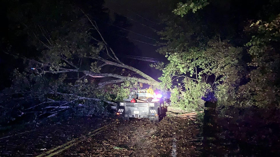
The storm ripped off roofs, knocked down power lines and trees and flooded streets as it roared through Mississippi, Alabama and Georgia early Thursday. Heavy rain and winds also pounded eastern Tennessee and the Carolinas throughout the day.
At the height of the outages, more than 2.6 million homes and businesses were without power. In Georgia alone, more than 550,000 customers remained without electricity as of 5:30 p.m. according to poweroutage.us., after the number reached more than 1 million earlier. Alabama had more than 414,000, and Louisiana was reporting about 444,000 outages. More than 300,000 remained without power in North Carolina and South Carolina reported more than 125,000 customers without electricity. More than 55,000 outages were reported in Virginia.
At least six people died in the storm. In Louisiana, a 55-year-old New Orleans man was electrocuted by low-hanging power lines. In Mississippi, a man taking video of the storm in Biloxi drowned at a marina, the Sun Herald reported. In Georgia, three people died after trees fell on their homes. One person also died in Alabama when a tree fell on a home, the Associated Press reported.
(WATCH: Jim Cantore Surprised by Waves in Parking Garage)
The storm made landfall about 4 p.m. CDT Wednesday near Cocodrie in Terrebonne Parish and moved over New Orleans with howling winds and driving rain. Here's a look at some of the impacts of the storm state by state.
The Carolinas
In North and South Carolina, hundreds of trees were toppled, knocking power out to more than a half-million homes and businesses.
The city of Greenville, South Carolina, said it had received more than 50 reports of downed trees before 10 a.m. Many of those were blocking roads.
In neighboring Spartanburg County, the town of Landrum was hit especially hard.
"We had lots of wind damage with trees down. There's been trees down with a lot of damage to homes. Highway 14 was blocked by a downed tree and power line. We are busy getting the trees cleared," Landrum Mayor Robert Briggs told the Spartanburg Herald-Journal.
Interstate 26 near Landrum also was closed because of a downed tree, Spartanburg County Emergency Management Coordinator Doug Bryson said.
"There are trees and power lines down everywhere. We are doing the best we can. There are hundreds of roads that are closed," Bryson told the Herald-Journal.
To the east, York County also reported trees blocking roads throughout the county.
In Statesville, North Carolina, a mail carrier escaped injury when a tree smashed his mail truck.
“Thank goodness John, our mail carrier, is okay. He was leaning out of his truck delivering mail when a tree fell on him. This is in the Eastbrook neighborhood in Statesville,” said James Hogan in a Twitter post.
Flooding was reported in Lenoir after almost 2 inches of rain fell in Caldwell County. Nearly three inches of rain was recorded around Morganton in Burke County, with almost two inches of rain being reported in Lenoir and Caldwell County. Charlotte's rain totals were much lower with the biggest impact of the storm being high winds and damaging gusts.
In Asheville, flooding forced residents of a mobile home park to evacuate when 2 feet of water washed through.
"Got up about 6:30, the water was still in the banks; by 7:30 it started coming out in the yards," John Collins, a resident of the Fernwood Mobile Home Park, told WLOS. "It took out some underpinning, washed out the foundation."
Georgia
A man died in Cherokee County when a large oak tree uprooted and fell through the corner of a mobile home in Acworth, Capt. Jay Baker of the Cherokee County Sheriff’s Office said. Two other adults and a child were in the home at the time of the incident but weren't injured, the AP reported.
Two adults were killed in Buford in Gwinnett County when a tree crashed into their home and pinned them to their bed, Gwinnett Fire and Rescue spokesman Tommy Rutledge told WXIA-TV.
Zeta put Atlanta under a tropical storm warning for the second time ever. Its first warning was in 2017 when Hurricane Irma roared into Florida as a deadly Category 4 storm.
And Zeta delivered. The storm downed trees and power lines across northern Georgia. At one point Thursday, more than 1 million homes and businesses had their power knocked out.
Georgia Power said its website and mobile app were overwhelmed with high volumes of traffic.
 A large tree fell on a vehicle on Arnold Mill Road in Cherokee County, Georgia, on Thursday, Oct. 29, 2020, as Tropical Storm Zeta roared across the South.
Several school districts either moved classes fully online or canceled classes all together Thursday. Many planned to remain closed Friday, including Fulton County, where 40 schools had no power, the Atlanta Journal-Constitution reported.
First responders had to rescue an Atlanta man pinned to his bed when a large tree fell into his bedroom. The man had minor injuries and was taken to a hospital, according to a fire department spokesman.
Trees were down across the state blocking dozens of roads, including Interstate 20 in Fulton County and in Dekalb County.
In Gwinnett County, a fallen tree closed I-985 South between Buford Drive and I-85, the Atlanta Journal-Constitution reported.
At least 15 counties delayed opening their early voting sites because of Zeta, the Georgia Recorder reported. Three of the counties reported outages in at least one location, Secretary of State Brad Raffensperger said. Douglas County said all six of its early voting locations were without electricity.
“We’re still assessing the situation, and obviously some counties will be delaying early voting this morning, but we don’t see there will be an overall impact to voting at this time because we still have early voting for the balance of today and tomorrow and obviously the full election on Tuesday,” Raffensperger said.
(MORE: Outages Complicate Voting in the South)
Locations without power Thursday evening will likely make up for the lost time by extending their hours into the evening, he said.
Louisiana
More than 1,900 National Guard personnel were helping with clean up and recovery, Gov. John Bel Edwards said in an afternoon news briefing. Some 5,500 linemen were working to restore power and more will arrive this weekend, Edwards said.
"The good news is the storm's forward speed was 24 mph so it moved through the area much faster than most storms and as a result, it didn't drop as much rain, the high winds didn't pound the area as much as would otherwise have been the case," Edwards said. "However there's significant damage to homes, to businesses, to infrastructure throughout southeast Louisiana. We know it caused vessels to be thrown about and into bridges that have to be inspected and damage has to be repaired."
More than 80% of customers in Jefferson Parish were without power, according to Parish President Cynthia Lee Sheng.
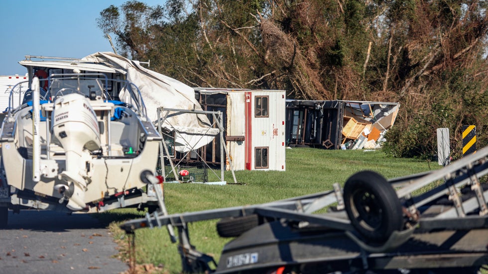 Overturned trailers sit along LA-46 after Hurricane Zeta on Oct. 29, 2020, in Reggio, Louisiana.
Edwards said more than 3,300 evacuees were in hotels and shelters, but nearly all of them were from hurricanes Laura and Delta which previously hit the state.
Zeta was the fifth tropical system to make landfall in the state this season.
About 25 people had to evacuate when Zeta caused part of an apartment building to collapse near Gretna in Jefferson Parish, WDSU reported. One person was injured.
One person was taken to the hospital after a roof collapsed on a building in New Orleans, The Advocate reported. The lights went out on Bourbon Street.
Thursday morning, the Lake Pontchartrain Causeway Bridge was closed in both directions because of the severe weather, the state Department of Transportation announced.
Video on WDSU from Grand Isle, a barrier island in Jefferson Parish, showed large homes with their roofs torn off, a crumpled gas station canopy and downed utility poles and wires.
"We're really getting beat. We're looking at wind over 100 (mph) for sure," Grand Isle Mayor David Camardelle said in an interview with WDSU as Zeta's eyewall moved over the island.
The Jefferson Parish government posted an image on Twitter showing three breaches in Grand Isle's levee, known as the "burrito levee" because it's a large roll of plastic filled with sand. The levee was severely damaged by Cristobal at the beginning of the hurricane season and work continued through the summer to shore it up.
 The Jefferson Parish government posted an image on Twitter showing three breaches in Grand Isle's levee, known as the "burrito levee."
In St. Bernard Parish, the Chalmette Ferry broke free from its mooring and was lodged under a dock at Chalmette Refining, WDSU reported.
"Zeta gave us a good punch," Parish President Guy McInnis told the station. "We were experiencing 120 mph gusts in the lower end of the parish and 90 to 105 in the upper end of the parish."
“We have multiple reports of people in distress with their roofs being blown off,” McInnis said. “We’re going to get out there as soon as we can.”
Terrebonne Parish officials said they had received several reports of downed power lines and utility poles.
"Please stay home and off roadways and highways until first responders can assess road conditions," the parish emergency management office said in a Facebook post.
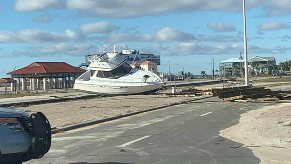
The Lafourche Parish Sheriff's Office, just to the east of where Zeta came ashore, said similar reports were coming in there. Public Information Officer Brennan Matherne shared video from the sheriff that showed a large boat washed on to a highway.
Four or five buildings collapsed in the southern part of the parish, Lafourche Parish President Archie Chaisson told WDSU. He said a wind gust to 136 mph was recorded by an anemometer on a boat in the parish.
A video from Plaquemines Parish showed debris from a destroyed mobile home blowing across a road. The Sheriff's Office said it had received numerous reports of down trees, power lines and utility poles throughout the parish.
Mississippi
Leslie Richardson, 58, of Theodore, Alabama, was watching Zeta come ashore in Biloxi when the storm surge rolled in. He tried to leave but his car was surrounded by water and began to float, according to AL.com.
Richardson called 911 about 7:30 p.m., but rescuers were unable to reach him because the water on U.S. Highway 90 was already higher than the hoods of their military-style vehicles, AL.com reported. He told dispatchers he was going to leave the car and try to reach high ground.
About two hours later, a hotel guest reported seeing a man in the water. The caller tried to resuscitate him.
Harrison County Coroner Brian Switzer said he pronounced Richardson dead at the scene.
In addition to the death, the Mississippi Emergency Management Agency reported multiple injuries in Harrison County.
 A large boat sits on U.S. Highway 90 in Long Beach, Mississippi, on Thursday, Oct. 29, 2020, after Hurricane Zeta roared through the state.
In Pass Christian, U.S. Highway 90, which crosses Bay St. Louis, was covered with water, according to Harrison County Emergency Management Director Rupert Lacy. The surge also lifted boats onto the highway.
“We’ve got a mess,” Pass Christian Mayor Chip McDermott said while surveying the damage Thursday morning, “a total mess. It’s pitiful.”
“I’ve never seen so many trees down and the harbor looks like Pearl Harbor,” McDermott told the Sun Herald. “It’s sickening. It’s going to take six months to get cleaned up. This is awful.”
Harrison County Fire Chief Pat Sullivan said, “I shudder to think what it would of been like if it had not been moving as quickly as it had.”
On the eastern side of the county, cars in a parking garage at a casino in Biloxi floated like toys in the surge. The Weather Channel meteorologist Jim Cantore said the storm surge was likely 8 feet in Biloxi. He said it was 8.2 feet in Bay St. Louis.
Multiple semitractor-trailers were knocked over on Interstate 10 near Bay St. Louis, according to stormchaser Aaron Jayjack.
The Mississippi Highway Patrol said eastbound 1-10 over the Pascagoula River had to be closed because of an overturned semi.
Zeta's strong winds ripped the steeple off Bay Vista Baptist Church in Biloxi.
"When I opened up the door, it just blew it right off," Jewell Thomas, the church's caretaker, told WLOX. "It was amazing that it didn’t do any more damage than what it’s done."
In Lucedale, the steeple of the Rocky Creek Baptist Church toppled over and pierced another part of the building.
The storm also severely damaged the roof of a historic African American gathering place in Bay St. Louis. About a quarter of the roof of the 100 Men Hall was ripped off, WLOX reported.
Former Bay St. Louis Mayor Les Fillingame said the storm was “very intense” when it blew through.
“It was a noisy storm. It was a truly howling wind,” he told the AP, but he added it was also fast-moving. “It was a lot of wind for several hours which is enough.”
The National Weather Service reported trees down on houses in Forrest County and Lamar County.
Alabama
Gov. Kay Ivey said in a tweet, "Zeta proved to be an intense storm! Folks are without power and trees are down all across AL. Please use caution if you head to work this morning, and stay off the roads if possible. Let’s give the utility workers and first responders patience and space to do their work!"
In Elmore County, the Emergency Management Agency declared all county-maintained roads and bridges impassable until further notice, the Montgomery Advertiser reported.
Officials in Chilton County, Dallas County and Etowah County reported lots of downed trees and blocked roads.
Two schools were damaged in Autauga County, the Advertiser reported.
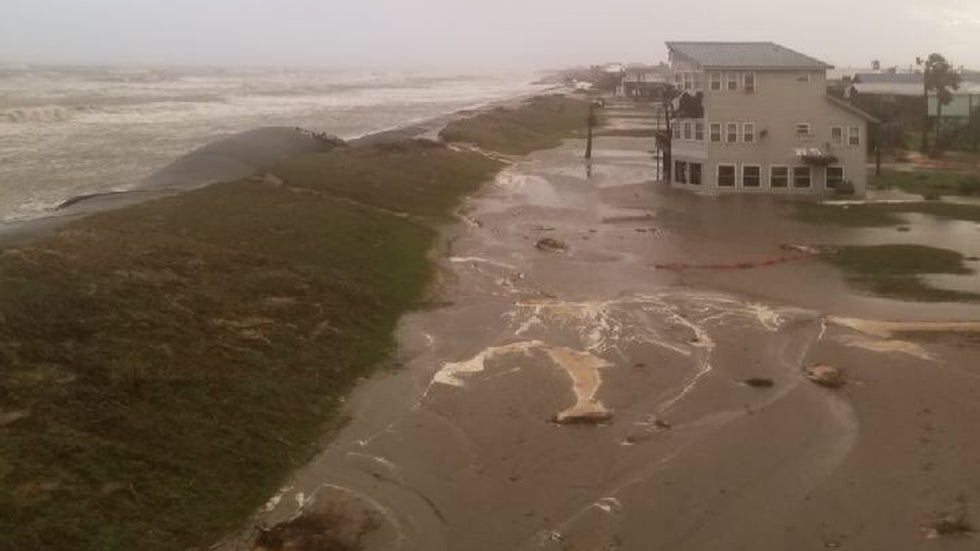
The storm surge was causing flooding in Mobile, Alabama, late Wednesday night.
Trees fell on a house and cars on Dauphin Island at about 9:15 p.m., according to the National Weather Service. Rushing water closed the Dauphin Island Causeway. Mobile Fire Rescue conducted a water rescue on the causeway at the Dog River Bridge.
The police chief of Greenville reported that many roads in the city were impassable because of downed trees and power lines.
The city of Citronelle in Mobile County sustained "major damage," according to Mayor Jason Stringer.
"Stay home and off the roads please. We have people hurt that we are trying to help them and we do not need anyone else hurt. Please, Please Stay Home!!!" Stringer said in a Facebook post.
The city of Orange Beach continued to fly double red flags meaning the ocean was off limits because of dangerous currents. However, the beach remained open. The city said it had no reports of damage and the streets were clear.
Many school districts that had planned to provide online classes only canceled all classes because of power outages.
The Weather Company’s primary journalistic mission is to report on breaking weather news, the environment and the importance of science to our lives. This story does not necessarily represent the position of our parent company, IBM.
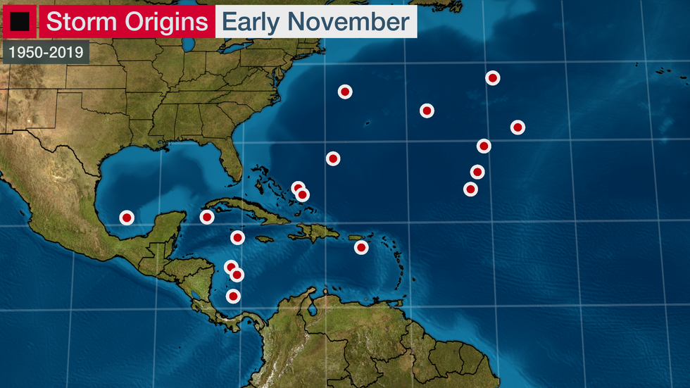
 Chance of Tropical Formation in the Caribbean