Much of the U.S. has been roasting this summer, but parts of the Northwest and northern Rockies have been spared from the heat so far.
This summer's weather pattern has resulted in prolonged and persistent heat, at times, from the Southwest to the East. This has allowed for relatively cooler conditions in portions of the Northwest and northern Rockies.
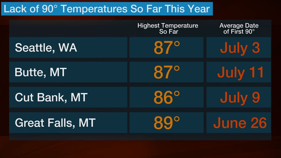
As of Saturday, a few locations have yet to reach 90 degrees this year, including Great Falls, Montana. The latest date for the first 90-degree reading there is July 29, meaning this year will be one of the latest first 90-degree temperatures on record. Spokane, Washington, reached 90 degrees for the first time this year on Thursday, coming just a few days shy of the latest date on record of July 21.
In addition, the first half of July is off to one of the coolest starts on record in both Cut Bank, Montana, and Olympia, Washington.
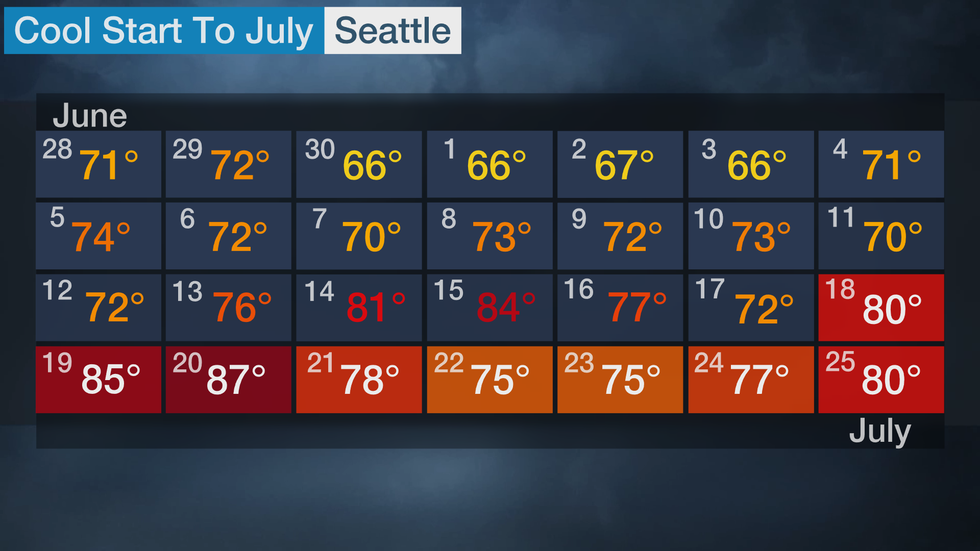
Mild temperatures have also prevailed in Seattle recently. A 17-day streak of below-average temperatures ended July 14. Highs were generally in the 60s and lower 70s during this period.
The highest temperature in Seattle so far this year occurred in the spring – May 10, when the thermometer topped out at 87 degrees.
However, a warmer trend appears likely to emerge next week in much of the Pacific Northwest, and Seattle may get close to 90 degrees.
(MORE: Hottest Temperature Recorded in All 50 States)
Temperature Changes Ahead?
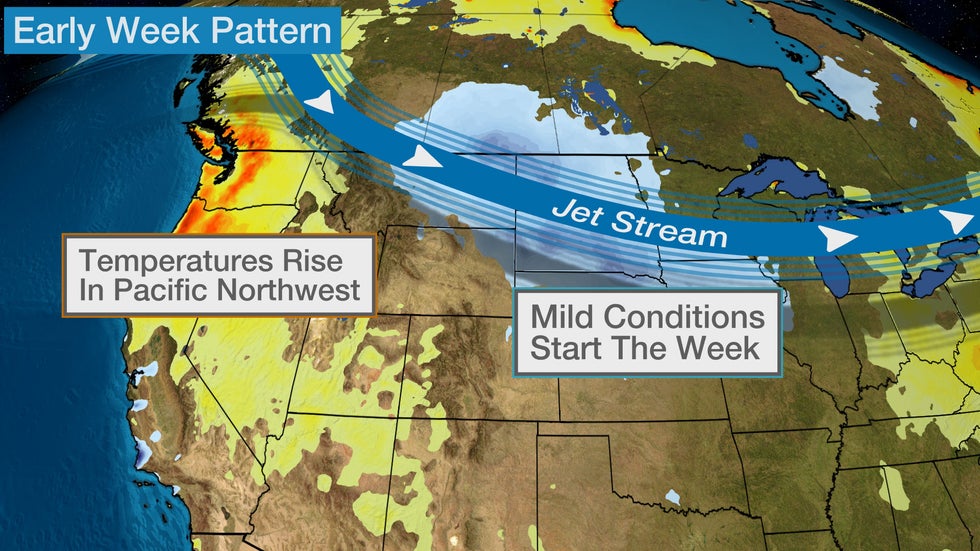
A weak cold front has pushed through the Pacific Northwest and will keep temperatures near average for most spots into the weekend.
Temperatures will also drop behind the front as it moves through the Northern Plains, giving parts of the central U.S. at least a brief break from the heat. High and low temperatures will be 5 to 15 degrees cooler than average in the Northern and Central Plains into early next week. Highs in the 90s will be replaced by the 80s.
 Forecast Highs
Farther west, a ridge of high pressure will build near the West Coast early next week. This will allow temperatures to rise up to 20 degrees above average in the Northwest.
The cooler conditions in parts of the northern Rockies and Northern Plains will give way to warmer temperatures toward the middle of next week.
Highs will likely top 90 degrees in parts of Montana next week because of this pattern shift, but a few other spots like Seattle might have to wait longer.
Dry conditions will also accompany the warmth, which may raise the concern for wildfire potential.
The trend of above-average temperatures and dry conditions could last into the second half of next week in parts of the Northwest and the northern Rockies.
(MAPS: Weekly Planner)
 Forecast Highs
The Weather Company’s primary journalistic mission is to report on breaking weather news, the environment and the importance of science to our lives. This story does not necessarily represent the position of our parent company, IBM.
The Weather Company’s primary journalistic mission is to report on breaking weather news, the environment and the importance of science to our lives. This story does not necessarily represent the position of our parent company, IBM.


No comments:
Post a Comment