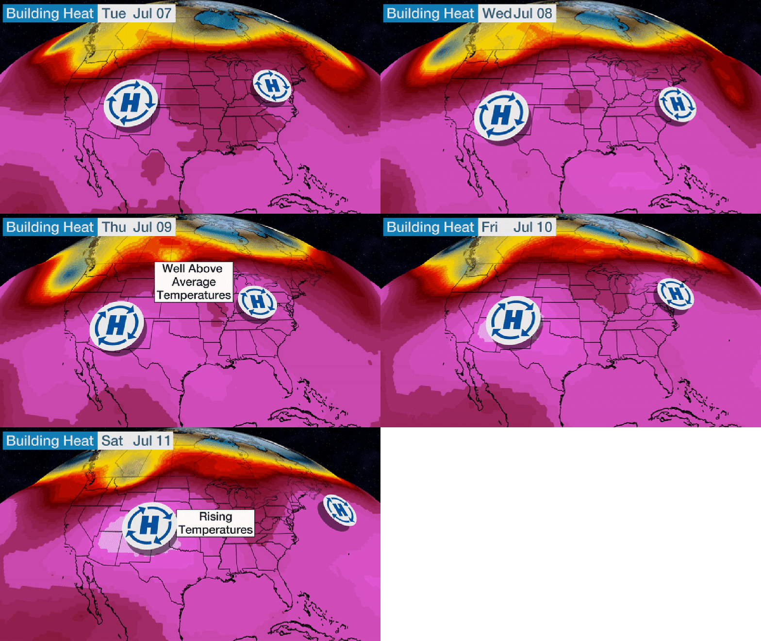
An extended heat wave is expected to bring highs in the 90s to much of the country's midsection potentially through mid-July. This heat wave could bring dangerous heat to parts of the Mid-South and Midwest.
This heat wave won't necessarily bring the hottest temperatures, but it will be long-lasting, which can be just as dangerous.
A broad ridge of high pressure and a jet stream that will remain well to the north will allow heat to spread across large sections of the Plains, Midwest, Northeast and Rockies.
This pattern will be supported by two domes of high pressure – one over the East and a second, stronger dome over the Southwest – that will cause air to sink and warm over their respective regions. The domes will also bring warmer air northward on their western and northern sides and diminish rain chances.

The most abnormal heat will be focused around the Great Lakes through the first 10 days of the month with the easternmost dome of high pressure in control.
As you can see in the current temperatures map below, the only relatively cooler areas are the Northwest, which is located north of the jet stream, and spots in the South and Plains that are seeing garden variety summer thunderstorms.
 Current Temperatures
Temperatures will be up to 20 degrees above average in the Upper Midwest this holiday weekend.
The epicenter of the heat is expected to be over Michigan and portions of Canada's Manitoba and Ontario provinces where highs will be well into the 80s to around 90 degrees in some spots. A spot or two in Manitoba or Ontario could climb to near the century mark.
Modest humidity values could add a couple of degrees to the numbers below to get a slightly higher heat index.
The added humidity could become more problematic toward the middle of the upcoming week, especially during the overnight hours. Overnight lows will be kept up by the humidity.
This means overnight temperatures may not dip below the low to mid 70s in many spots from the southern Great Lakes to the Northeast, which could set daily record warm lows in a few spots.
 Forecast Highs and Departures from Average
This kind of heat will continue through much of next week.
Many of the big cities in the Midwest and Northeast will be 5-10 degrees above average through the upcoming week.
More impressively, some cities could set records for most 90-degree days in a row.
Chicago could string together multiple week-long stretches with highs in the 90s each day perforated by highs in the upper 80s. If Chicago can string together more than 11 straight 90-degree days, it would set a record-long streak.
Detroit is currently forecast to see 10 90-degree days, which is just two days short of their record set in July of 1964.

Toward the end of next week, a second, stronger area of high pressure may amplify temperatures even further in the Plains.
High temperatures and high humidity could create dangerous conditions from the southern and central Plains into the southern Great Lakes, including heat indices over 100 degrees, and in some places, actual afternoon temperatures over the century mark.
 Extended Temperature Outlook (Week 2)
This heat isn't going anywhere fast. In fact, it could get worse.
NOAA's Climate Prediction Center has issued a "High Risk" of excessive heat for portions of the Central Plains and the Ozarks between July 11-17. Heat indexes of 105-110 degrees are likely in this area, and heat indexes higher than 110 degrees are possible.
Another twist to this forecast is that the building dome of high pressure will also cut off any moist flow from Mexico through mid-month if the forecast plays out.
This means that the already-delayed Southwest monsoon, which typically brings increased thunderstorms to the Desert Southwest, could be delayed even further.
The Weather Company’s primary journalistic mission is to report on breaking weather news, the environment and the importance of science to our lives. This story does not necessarily represent the position of our parent company, IBM.
The Weather Company’s primary journalistic mission is to report on breaking weather news, the environment and the importance of science to our lives. This story does not necessarily represent the position of our parent company, IBM.

No comments:
Post a Comment