A massive plume of dust from the Sahara Desert has already surged into the Caribbean Sea, and it's expected to reach the Gulf of Mexico and parts of the United States this week.
Known as the Saharan Air Layer (SAL), this dry dust plume commonly forms from late spring through early fall and moves into the tropical Atlantic Ocean every three to five days, according to NOAA's Hurricane Research Division (HRD).
The densest plume began to emerge off western Africa last weekend and has now traveled over 3,000 miles across the Atlantic Ocean to the eastern Caribbean Sea, covering an area larger than the contiguous United States and western Europe.
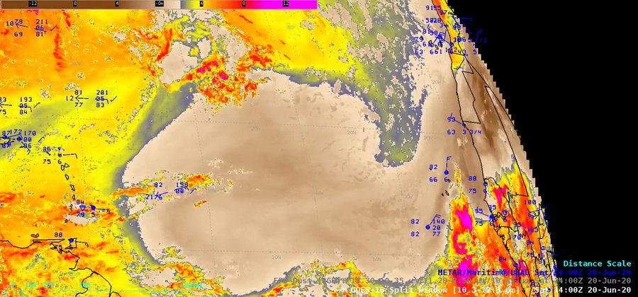
#GOES16/#GOESeast Split Window Difference and Dust RGB images indicate that the leading edge of the latest major pulse of Saharan Air Layer #dust has nearly reached the Lesser Antilles: go.wisc.edu/a27lqv
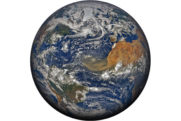
University of Maryland scientist Santiago Gassó noted late last week that the densest dust within the plume covered an unusually large area, as estimated by satellite. NASA's Terra satellite captured an amazing image Friday of the dense plume hanging over Cabo Verde, a group of islands off the western coast of Africa.
A tremendous plume of dust is in the process of traversing the Atlantic Ocean. earthobservatory.nasa.gov/images/146871/…
NASA’s Terra satellite captured this view of dust over Cape Verde. The thickest parts of the plume appear to stretch about 2,500 kilometers (1,500 miles) across the Atlantic.
Saharan dust tracks as far west as the Caribbean Sea, Florida and the Gulf of Mexico each year – a 5,000-mile-long journey.
NOAA's HRD says the Saharan Air Layer is typically located between 5,000 and 20,000 feet above the Earth's surface. It is transported westward by bursts of strong winds and tropical waves located in the central and western Atlantic Ocean at altitudes between 6,500 and 14,500 feet.
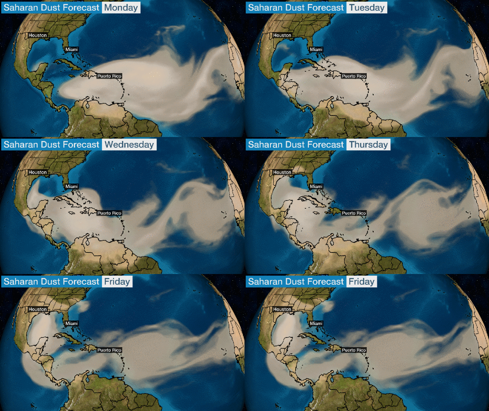
The Saharan dust plume is forecast to continue plowing westward through the Caribbean Sea, then reach parts of the Gulf Coast and Deep South later this week. You can see this in the forecast below from NASA's GEOS-5 model.

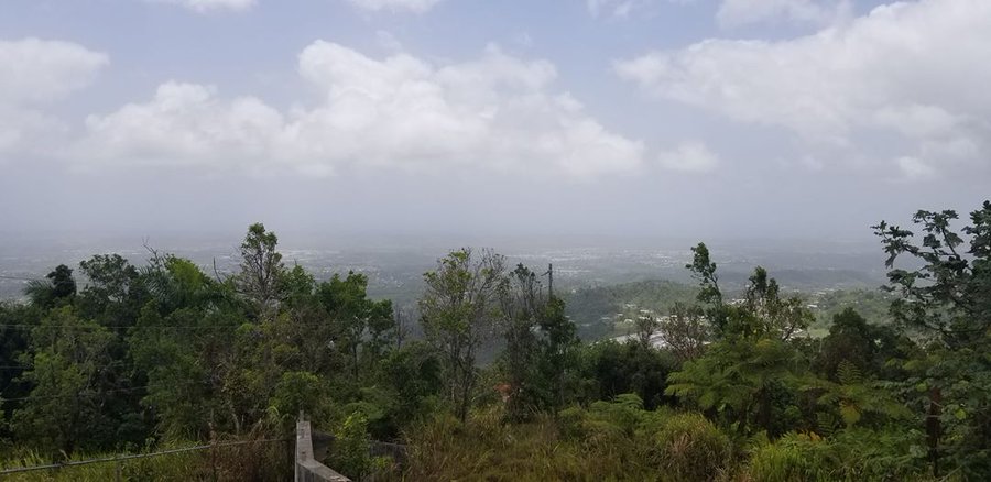
The dust particles can contribute to hazy skies and spectacular sunrises and sunsets in the Caribbean Islands, South Florida, the Florida Keys and the U.S. Gulf Coast.
The dust can also cause toxic algal blooms in the Gulf of Mexico, according to NASA. It can also aggravate those suffering from respiratory issues such as asthma and COPD. Air quality was already categorized as "unhealthy" Sunday morning in the Lesser Antilles.
NASA says this Saharan dust also plays beneficial, crucial roles in both fertilizing soil in the Amazon and maintaining Caribbean beaches.
What the Saharan Air Layer Means for Hurricane Season
Given the SAL is most common during hurricane season, research has been done on how it can affect the development of tropical storms and hurricanes. According to NOAA, some of the potential impacts to tropical development caused by the SAL include:
- The dry air can create downdrafts (sinking air) around tropical storms and hurricanes, which may result in the weakening of tropical cyclones.
- Strong winds associated with the SAL can contribute to increased vertical wind shear – the change in wind speed with height – which makes the environment hostile for tropical cyclone development.
- The role dust plays in tropical storm and hurricane intensity is not known. However, some research says it might impact cloud formation.
The early part of hurricane season is typically quiet in the tropical Atlantic. But this outbreak of dust along with unfavorable upper-level winds will likely put a lid on any significant tropical development in the near-term future.
The Weather Company’s primary journalistic mission is to report on breaking weather news, the environment and the importance of science to our lives. This story does not necessarily represent the position of our parent company, IBM.
The Weather Company’s primary journalistic mission is to report on breaking weather news, the environment and the importance of science to our lives. This story does not necessarily represent the position of our parent company, IBM.


No comments:
Post a Comment