California will have rain and Sierra Nevada snow into early this week from a Marchlike system that could be the final spring storm before the state's dry season arrives.
The stretch of weather since late April has resembled summer, not spring, in much of California.
From April 22 through May 12, a total of 427 daily warm records were either tied or set in California, according to data compiled by NOAA. In San Diego, it has been the third-hottest start to any May on record, according to the Southeast Regional Climate Center.
That hot, dry pattern has now ended.
A strong plunge of the jet stream, known as a trough, is moving into the West Coast. This trough has pulled in a decent tap of moisture from north of Hawaii and guided it into the West.
 Current Pattern
Forecast
The storm system is now bringing rain to parts of the West Coast from the Pacific Northwest to Northern California.
Northern California will have its most soaking rain from this storm through Monday. Although the rain is needed, slow-moving showers and storms could cause localized flash flooding from around Redding to the Sacramento Valley.
The National Weather Service has issued winter storm warnings in the Sierra Nevada for elevations above 6,000 to 7,000 feet, where heavy, wet snow and strong winds could make travel difficult. These areas will have the most significant snowfall through Monday night.
 Rain and Snow Forecast
Needed Precipitation Nearing the End of the Wet Season
As mentioned earlier, this is a system more reminiscent of March than May.
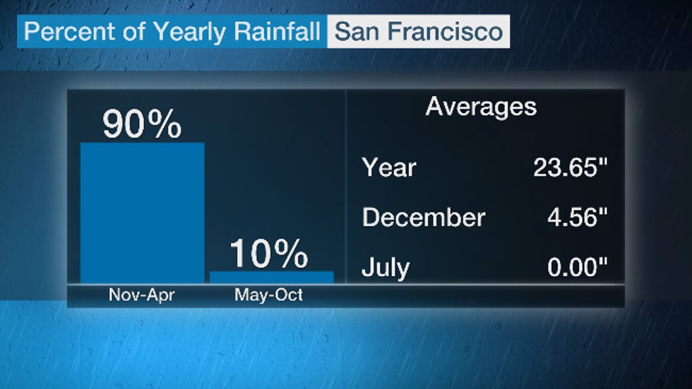
California has pronounced wet and dry seasons. For example, San Francisco picks up 90% of its average precipitation in six months, from November through April.

Usually, by late May, the dry season is shifting into gear. So any rain and Sierra snow this late in spring is considered a gift by those concerned about drought and the state's water supply.
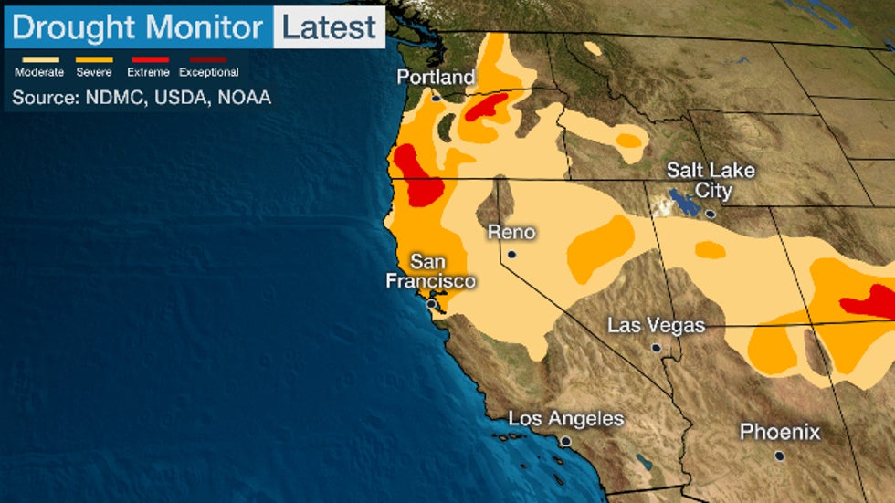
As of May 12, just under half of the state was classified in drought, according to the Drought Monitor analysis. A few areas near the Oregon border were considered in the second-highest drought category, extreme drought.
 Current drought status as of May 12, 2020. Areas in darker colors were analyzed in a higher magnitude of drought.
Despite this recently developed drought, the state's major reservoirs, one source of California's drinking water, are in good shape.
Most major reservoirs in the southern Sierra and Southern California are above average for mid-May, while those in Northern California are only slightly lower than average.
Water locked up in the Sierra snowpack, however, was running 19 to 39% of average for May 15, according to the Western Regional Climate Center.
Unfortunately, for water managers, this Marchlike storm won't dump feet of Sierra snow.
But for mid-May, it's a welcomed event, possibly the last one for months.
The Weather Company’s primary journalistic mission is to report on breaking weather news, the environment and the importance of science to our lives. This story does not necessarily represent the position of our parent company, IBM.
The Weather Company’s primary journalistic mission is to report on breaking weather news, the environment and the importance of science to our lives. This story does not necessarily represent the position of our parent company, IBM.

No comments:
Post a Comment